James Spann: Unsettled weather ahead for Alabama
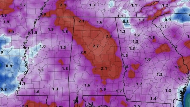
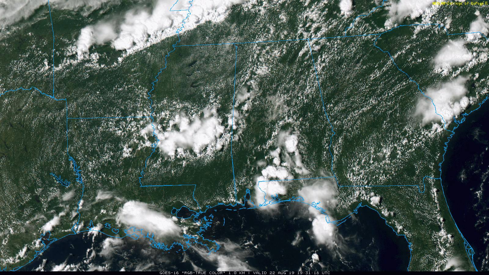
RADAR CHECK: Scattered showers and thunderstorms are most numerous over west and south Alabama at mid-afternoon. Otherwise the sky is partly sunny with temperatures generally in the 87- to 90-degree range. Additional showers and storms could form anywhere through midnight.
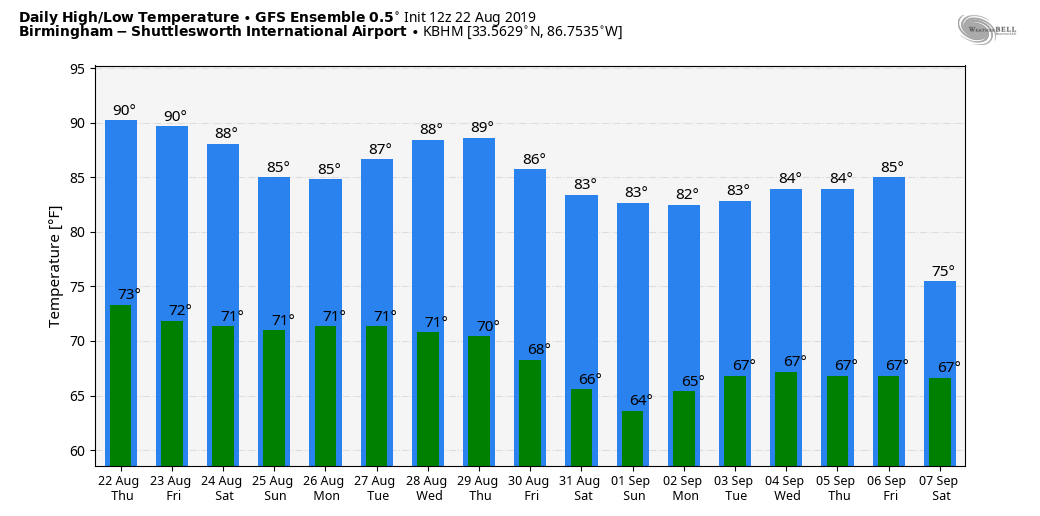
FRIDAY THROUGH THE WEEKEND: An increasingly moist, unstable air mass will be in place, setting the stage for occasional showers and thunderstorms all three days. It certainly won’t rain all day Friday or over the weekend, but there is a good chance of beneficial rain for a good part of Alabama. Most of the rain will come from noon until midnight, but late-night or morning showers can’t be ruled out. Heat levels will come down with the limited amount of sun; highs will be in the 84- to 88-degree range.
NEXT WEEK: Unsettled weather continues Monday and Tuesday with scattered to numerous showers and thunderstorms, but the latter half of the week will trend drier as a long-wave upper trough evolves over the eastern third of the U.S. There is a chance we see drier, continental air late in the week with lower humidity and cooler nights.
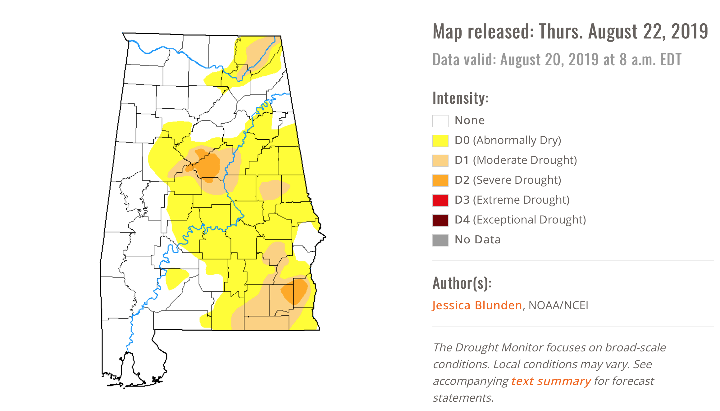
DROUGHT MONITOR: The Drought Monitor released this morning shows drought conditions expanding slightly across Alabama; concentrated over the northeast corner of the state, just south of Birmingham and over the southeast counties.
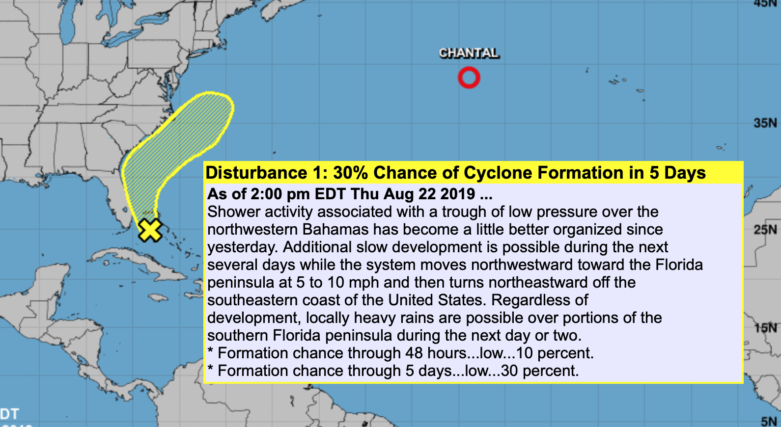
TROPICS: Tropical Depression Chantal is expected to dissipate over the North Atlantic, far from land, within 36 hours. A tropical wave over the Bahamas now has a 30 percent chance of becoming a tropical depression or storm over the next five days; it will move north, then northeast just off the southeastern U.S. coast, and is no threat to the Gulf of Mexico.
ON THIS DATE IN 1994: Hurricane John, about 345 miles south of Hilo, Hawaii, had winds of 175 mph and pressure at 920 millibars or 27.17 inches of mercury, making it one of the strongest hurricanes ever in the Central Pacific. The 31-day existence made John the longest-lasting tropical cyclone recorded in both the Pacific Ocean and worldwide, surpassing both Hurricane Tina’s previous record in the Pacific of 24 days in the 1992 season and the 1899 San Ciriaco hurricane’s previous world record of 28 days in the Atlantic. John was also the farthest-traveling tropical cyclone in both the Pacific Ocean and worldwide, with distance traveled of 7,165 miles, outdistancing previous record holders Hurricane Fico in the Pacific of 4,700 miles in the 1978 season and Hurricane Faith worldwide of 6,850 miles in the 1966 Atlantic season.
BEACH FORECAST: Click here to see the AlabamaWx Beach Forecast Center page.
WEATHER BRAINS: You can listen to our weekly 90-minute show any time on your favorite podcast app. This is the show all about weather featuring many familiar voices, including the meteorologists at ABC 33/40.
CONNECT: You can find me on all of the major social networks:
Facebook
Twitter
Instagram
Pinterest
Snapchat: spannwx
For more weather news and information from James Spann and his team, visit AlabamaWx.


