Scott Martin: Potential for strong to severe storms in Alabama today
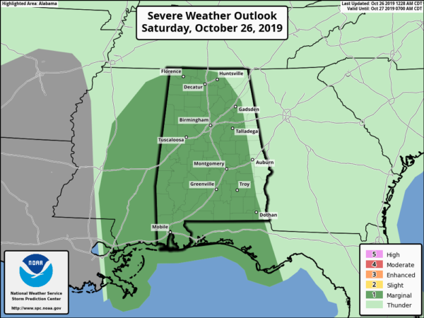
TODAY: The Storm Prediction Center has Alabama in a marginal risk for severe storms throughout the day today, with the exception of the easternmost counties along the Alabama-Georgia state line.
A Wind Advisory goes into effect today from 10 a.m. until 5 p.m. for central Alabama with the exception of Montgomery, Macon, Bullock, Lee, Russell, Pike and Barbour counties.
We could see winds averaging 10-20 mph throughout the advisory area with gusts up to 40 mph possible.
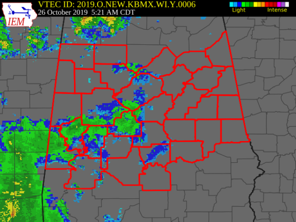 A Flash Flood Watch continues until 10 a.m. for Fayette, Greene, Hale, Lamar, Marengo, Marion, Pickens, Sumter, Tuscaloosa, Walker and Winston counties in central Alabama and for Colbert, Franklin, Lauderdale and Lawrence counties in north Alabama.
Today a strong cold front will begin to work its way through Alabama. Winds will start to pick up from west to east later this morning as the cold front approaches and moves into western Alabama in the 10-11 a.m. time frame. The front will move through and will be in central Alabama by 4-6 p.m. It will exit the state right at or just after 10 p.m.
Along and just ahead of the front is where we could see some stronger to marginally severe storms with isolated damaging wind gusts up to 60 mph and the potential for a brief tornado or two. Timing on the potential for strong to severe storms will be from 10 a.m. to 3 p.m. for the western third of the state, 1-6 p.m. for the central third and 4-10 p.m. for the eastern third.
The good news is that instability will be very limited and mid-level lapse rates will be very low. The bad news is that we’ll have plenty of shear that could get these storms along the front to start spinning that could lead to the gusty winds and a brief tornado.
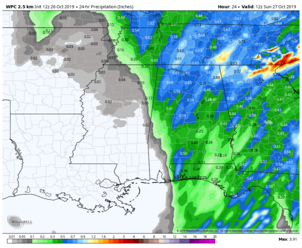
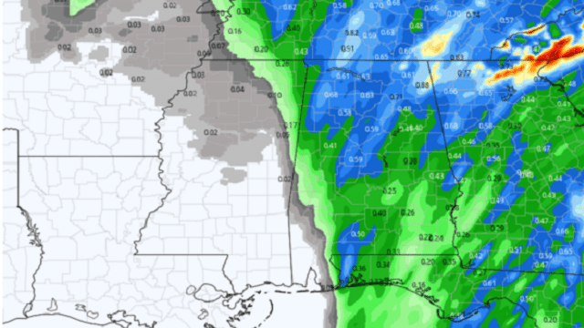
Rainfall amounts today look to be well less than what we saw on Friday. Forecast amounts from the Weather Prediction Center are mostly one-half to three-quarters of an inch. Amounts will be less in the southeastern corner of the state, around or just over one-quarter inch.
Rain will be out of the state before midnight and the overnight hours should be dry. Today’s highs will be in the lower 70s to 80 degrees from northwest to southeast.
SUNDAY: Sunday will start off mainly cloudy, but some of those clouds will dissipate, leaving us partly cloudy by the end of the afternoon. We’ll be dry with highs in the upper 60s to the mid-70s.
MONDAY: Look for nice weather as we’ll have partly to mostly clear skies. Highs will top out in the mid to upper 70s for most.
TUESDAY: The cold front that works through Alabama today will start to retrograde back in our general direction on Tuesday. As of now, we’ll go with the possibility of a few showers south of the I-59 corridor, while it will be dry north of that. Highs will be in the mid to upper 70s.
WEDNESDAY: Another cold front will approach from the west that will advect Gulf moisture out ahead of it. This will bring another good shot of beneficial rain; we could see totals in the 1- to 2-inch range. We could have some thunder, but instability looks too weak for severe storms at this point. Highs will be in the upper 60s to the upper 70s.
THURSDAY: The cold front will finally work through the area on Halloween. The bad news is that rain continues to look likely during a good part of the daytime. The good news is that rain should begin tapering off from west to east during the late afternoon through the evening. There may be some lingering raindrops for Trick-or-Treat time, but they should be light. Highs will be in the lower 60s to the lower 70s. Temperatures at 7 p.m. will be in the mid-50s to the lower 60s. Rainfall amounts look to be in the one-half-inch to 1-inch range.
FRIDAY: Great weather returns for Friday and the first day of November. We’ll have plenty of sunshine with highs topping out in the upper 50s to the mid-60s. Now that is more like fall weather in Alabama.
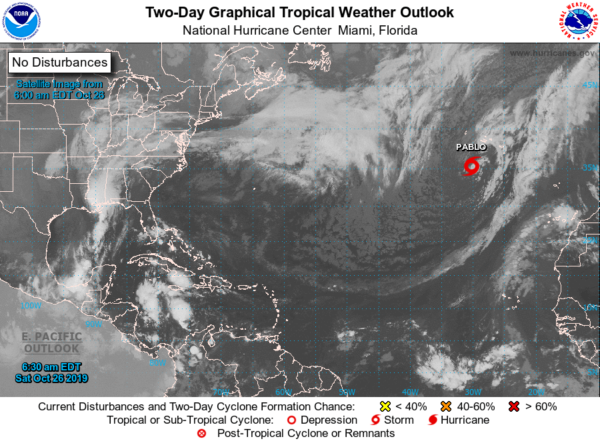
TROPICS: We have only one system on the board and that is Tropical Storm Pablo, which is well out in the eastern Atlantic. It will cross over the Azores today as it starts to take a turn to the north. It should become post-tropical by Sunday evening. The rest of the Atlantic Basin is quiet for now.
For more weather news and information from James Spann, Scott Martin and other members of the James Spann team, visit AlabamaWx.


