James Spann: Coldest air so far this season arrives in Alabama next week
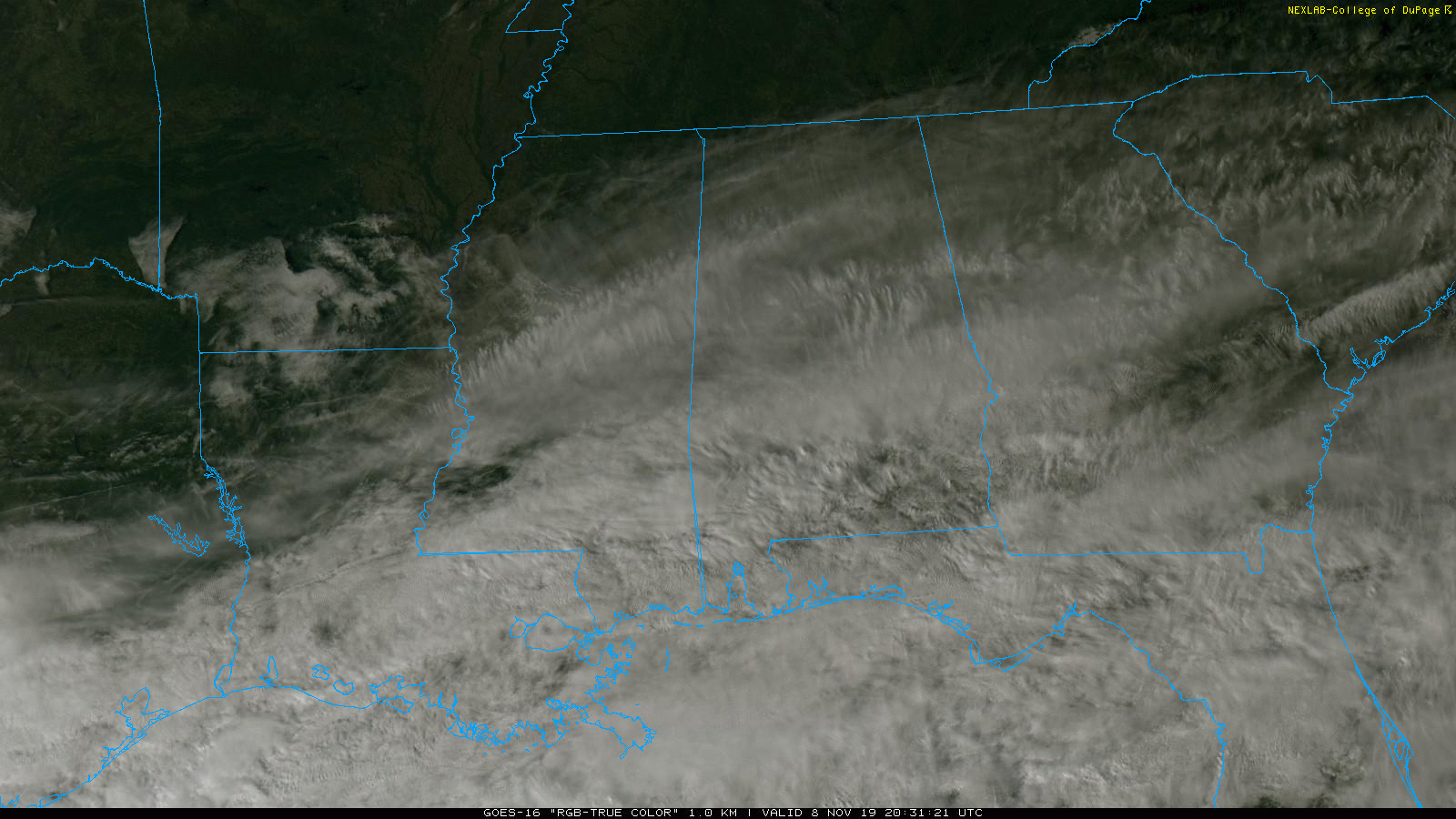
COOL NOVEMBER DAY: Temperatures are generally in the 45- to 52-degree range across Alabama this afternoon; the average high at Birmingham on Nov. 8 is 68. A band of mid- to high-level clouds persist over the state; those should move out tonight.
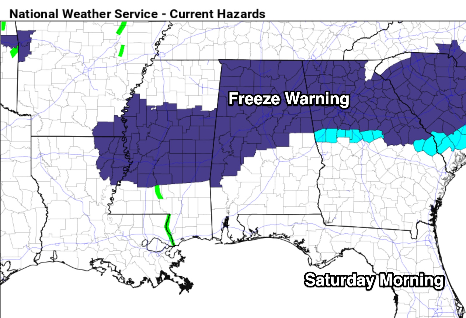
A freeze warning is in effect for most of north and central Alabama tonight; we project lows in the 28- to 32-degree range early Saturday morning.
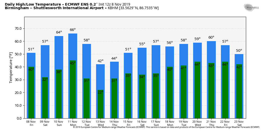
THE ALABAMA WEEKEND: Saturday will be a sun-filled day with a high around 60; on Sunday we reach the mid 60s with a good supply of sunshine.
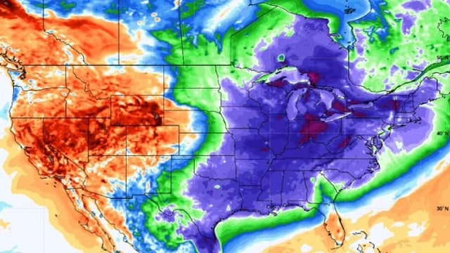
NEXT WEEK: Clouds will increase Monday ahead of a cold front that marks the leading edge of the coldest air so far this season. Periods of rain are likely Monday night into Tuesday morning; amounts should be less than one-half inch. The high Tuesday will most likely be reached between midnight and 3 a.m.; temperatures will drop into the 37- to 42-degree range during the morning and stay there through the afternoon with a brisk north wind. It will be a very raw, cold day.
There is a chance we could see a snow flake or two, or maybe a few ice pellets, on the back edge of the precipitation shield Tuesday morning over the northern quarter of Alabama as cold air rushes into the state, but there will be no impact. The cold air is the big deal.
The sky will clear Tuesday night, and by daybreak Wednesday temperatures will drop into the 18- to 22-degree range over north Alabama, right at record levels. Birmingham’s record low for Nov. 13 is 22, set way back in 1911, and that record is in danger. It rarely gets this cold before Thanksgiving in Alabama.
Both global models are now showing a wave of low pressure moving through the northern Gulf of Mexico Thursday. This will bring a cold rain into Alabama at some point toward the end of the week; there’s still much uncertainty. If this were January or February, this would be a good setup for snow, but in mid-November it should be a cold rain.
FOOTBALL WEATHER: It will be clear and cold for the high school games tonight, with temperatures falling through the 40s.
Alabama hosts LSU Saturday in Tuscaloosa at Bryant-Denny Stadium (2:30 p.m. kickoff). The weather could not be any better for the biggest college game of the year — a sunny sky, with temperatures falling from near 61 at kickoff into the mid 50s by the final whistle. Sunset Saturday in Tuscaloosa comes at 4:52 p.m., so the fourth quarter will be played under the lights.
UAB will take on Southern Miss in Hattiesburg Saturday (2:30 p.m. kickoff). Expect clear weather for the game with temperatures falling from near 65 at kickoff to near 60 by the fourth quarter.
Jacksonville State will take on Tennessee Tech Saturday (kickoff at 1:30 p.m. Central) in Cookeville; the sky will be sunny with temperatures in the 55- to 60-degree range during the game.
ON THIS DATE IN 1913: The Great Lakes Storm of Nov. 7-13, 1913, was a blizzard with hurricane-force winds that devastated the Great Lakes Region, sinking as many as 19 ships and stranding 19 others. This storm would be the deadliest and most destructive natural disaster ever to hit the Great Lakes.
BEACH FORECAST: Click here to see the AlabamaWx Beach Forecast Center page.
WEATHER BRAINS: You can listen to our weekly 90-minute show any time on your favorite podcast app. This is the show all about weather featuring many familiar voices, including the meteorologists at ABC 33/40.
CONNECT: You can find me on the major social networks:
Facebook
Twitter
Instagram
Pinterest
Snapchat: spannwx
For more weather news and information from James Spann and his team, visit AlabamaWx.


