James Spann: Rain returns to Alabama Friday
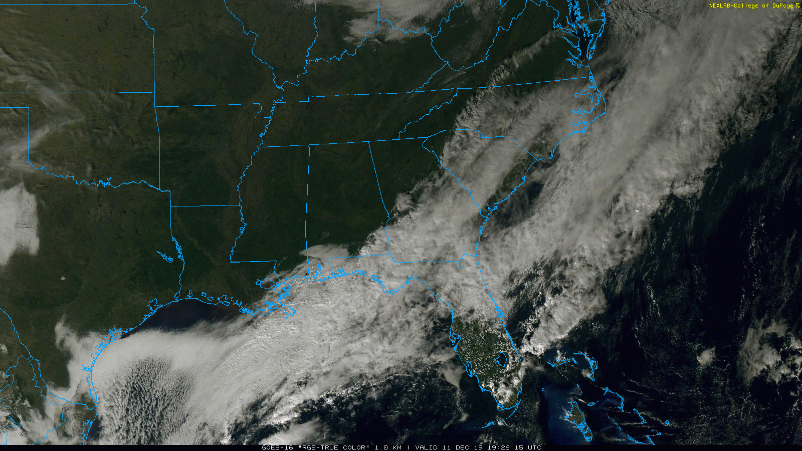
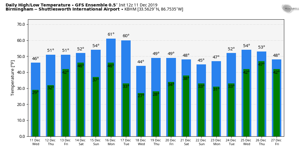
SUNNY DECEMBER DAY: Sunshine is out in full force over the northern two-thirds of Alabama this afternoon; clouds linger near the Gulf Coast with some scattered light rain there. Temperatures are only in the 40s over north Alabama, about 10 degrees below average for mid-December. Tonight will be fair and cold; most places will see a low in the 28- to 32-degree range early Thursday.
Thursday will be another dry day; we start with a sunny sky, but clouds will increase Thursday afternoon ahead of the next weather system to the west. The high will be in the low to mid 50s.
RAIN RETURNS: Friday will be a cloudy, cool day with periods of rain as a wave of low pressure moves out of the Gulf of Mexico. There will be no risk of severe storms and probably very little thunder. Amounts of around one-half inch are likely and rain will linger into Friday night.
THE ALABAMA WEEKEND: Clouds, and maybe a bit of light rain, will linger Saturday morning, but we could see some sun by Saturday afternoon as dry air returns; the high will be between 55 and 60 degrees. Then, on Sunday, expect a partly sunny sky with a high in the low 60s.
NEXT WEEK: Clouds increase Monday and more rain is likely late Monday, Monday night and early Tuesday. Amounts of one-half inch are likely, and while a few thunderstorms could be involved, we aren’t expecting them to be severe. Much colder air settles into the state Tuesday; temperatures will hold in the 40s over north Alabama, and we drop down into the 20s by early Wednesday morning. Global models hint the next chance of rain comes around Saturday, Dec. 21.
TUESDAY’S SOAKER: Rain totals Tuesday included:
- Remlap — 2.8 inches
- Black Creek — 2.34
- Morris — 2.04
- Arley — 1.96
- Coker — 1.1
- Concord — 1.05
- Bibbville — 1.01
- Crestwood — 0.85
- Northport — 0.74
- Heflin — 0.52
- Weaver — 0.38
Snow amounts over the northern quarter of the state were mostly between one-half inch and 1 inch on grassy areas.
ON THIS DATE IN 1961: An EF3 tornado moved through Jacksonville, producing damage on the campus of Jacksonville State University.
ON THIS DATE IN 1992: A complex storm system moved eastward from the Gulf Coast of Texas to eastern Georgia on Dec. 9-10. In the next 24 hours, the low-pressure system moved to the Chesapeake Bay and rapidly intensified. This system produced gale-force winds with gusts exceeding hurricane force and affected not only the Mid-Atlantic coastline but also as far southwest as the southern Appalachians, where trees were downed and roofs damaged. This storm also produced 20- to 30-foot waves in Massachusetts on Dec. 12-13. Precipitation amounts varied considerably. Rainfall amounts of 8 inches occurred in southeastern Massachusetts, while several areas in New York, Massachusetts, Pennsylvania and Maryland recorded more than 30 inches.
BEACH FORECAST: Click here to see the AlabamaWx Beach Forecast Center page.
WEATHER BRAINS: You can listen to our weekly 90-minute show any time on your favorite podcast app. This is the show all about weather featuring many familiar voices, including the meteorologists at ABC 33/40.
CONNECT: You can find me on the major social networks:
Facebook
Twitter
Instagram
Pinterest
Snapchat: spannwx
For more weather news and information from James Spann and his team, visit AlabamaWx.


