James Spann: Brighter days ahead for Alabama
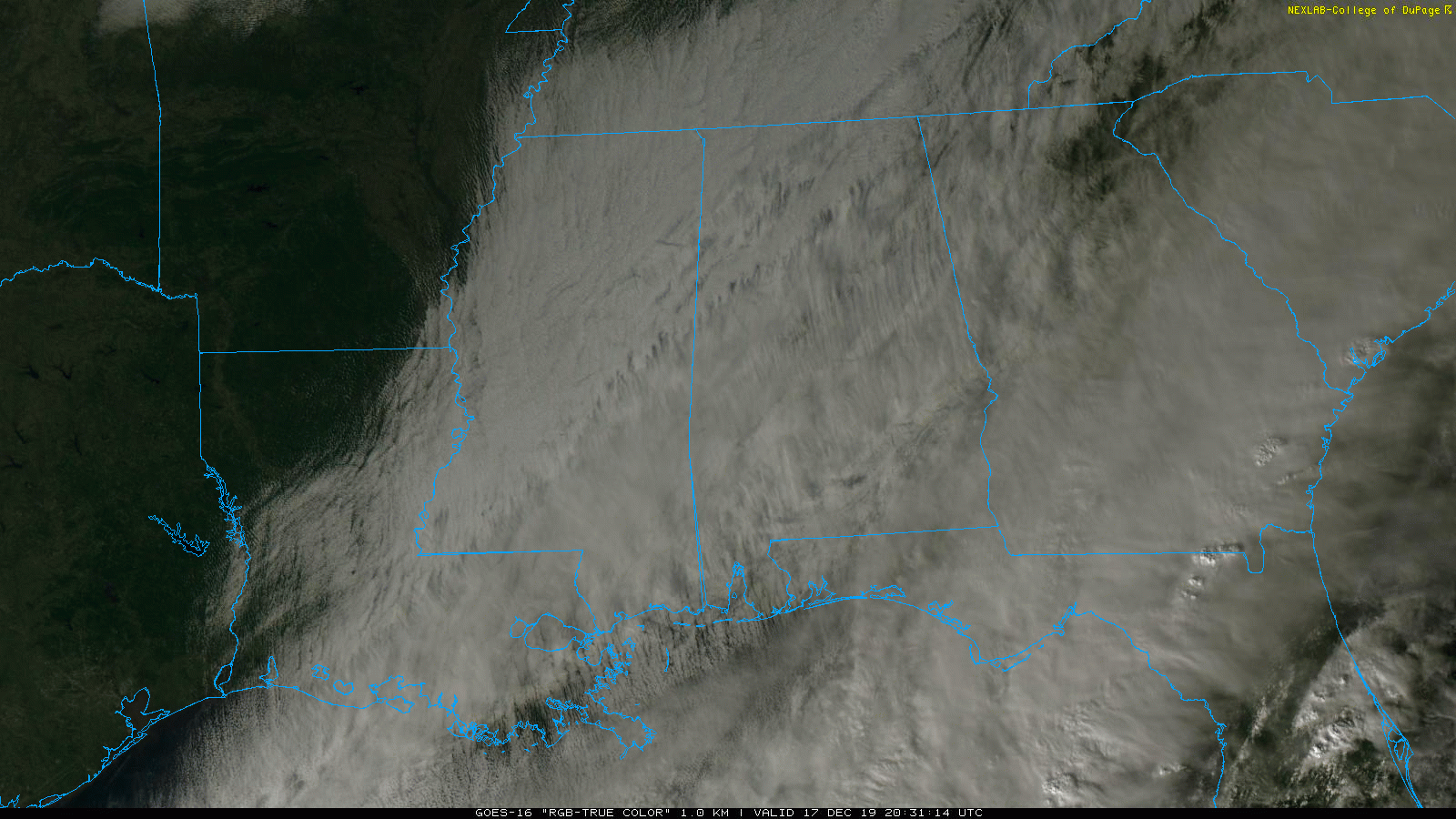
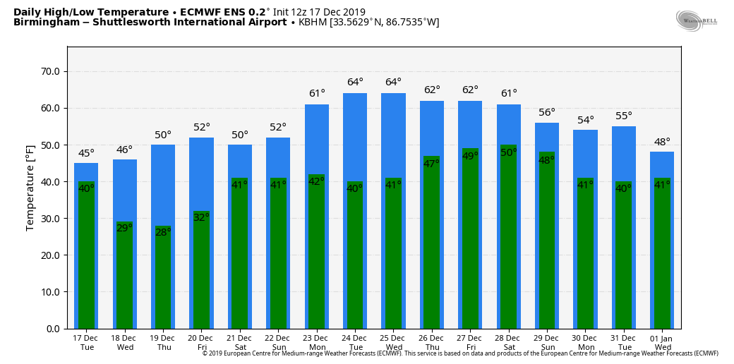
CLOUDY, COLD DECEMBER DAY: Temperatures are only in the 30s and 40s across Alabama this afternoon with a cloudy sky. The average high for Dec. 17 at Birmingham is 55. The sky will clear tonight, and we drop into the 20s early Wednesday morning.
The rest of the week will be dry; look for a sunny sky Wednesday and Thursday; Friday will be partly sunny. Highs will be close to 50 Wednesday and in the mid 50s Thursday and Friday.
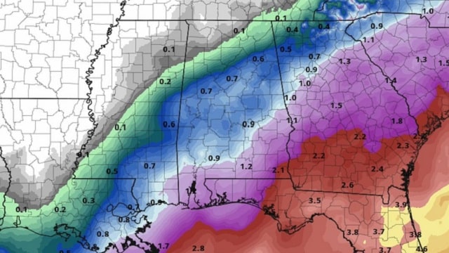
THE ALABAMA WEEKEND: A wave of low pressure moving along the Gulf Coast will bring rain back to Alabama over the weekend. The rain could begin as early as Saturday morning over the southern counties. We expect periods of rain Saturday and Sunday; heavier rain totals will be over south Alabama, where more than 1 inch is likely. Totals for the central counties will be closer to one-half inch, with lighter amounts over the northern third of the state. There will be no risk of severe storms and probably very little thunder. Highs over the weekend will be in the 50s.
CHRISTMAS WEEK: For now the weather looks dry and very comfortable in Alabama Monday through Friday, with mostly sunny days, fair nights and highs in the 60s. You won’t be waking up to snow on the ground here Christmas morning, but odds of a “White Christmas” here are always less than 1 percent, based on climatology.
TORNADO SURVEYS: At least six tornadoes touched down in Alabama late yesterday and last night. Details:
- Marengo County: EF-2 at Salt Wall on U.S. 80 west of Demopolis. Two mobile homes were destroyed and three injuries reported.
- Colbert County: EF-2 damage at Colbert Heights.
- Bibb County: EF-1 at Brierfield. Only tree damage has been found so far, with no structures affected.
- Madison County: EF-1 at Monrovia.
- Shelby County: EF-0 just east of Montevallo along Alabama Highway 25.
The North Lawrence County tornado, responsible for two fatalities near Town Creek, has not been rated by National Weather Service Huntsville as of the time I am writing this post.
ON THIS DATE IN 1924: From the Monthly Weather Review, “a severe glaze storm occurred in west-central Illinois on December 17 and 18, the area of great destruction embracing a territory about 75 miles in width and 170 miles in length. In the affected area, trees were badly damaged, wires broken and thousands of electric poles went down. Electric services were paralyzed, and it required weeks to restore operation and months to permanently rebuild the lines.”
BEACH FORECAST: Click here to see the AlabamaWx Beach Forecast Center page.
WEATHER BRAINS: You can listen to our weekly 90-minute show any time on your favorite podcast app. This is the show all about weather featuring many familiar voices, including the meteorologists at ABC 33/40.
CONNECT: You can find me on the major social networks:
Facebook
Twitter
Instagram
Pinterest
Snapchat: spannwx
For more weather news and information from James Spann and his team, visit AlabamaWx.


