James Spann: Scattered light rain for Alabama today
James Spann has the Alabama forecast and a heads up on a weekend weather change from Alabama NewsCenter on Vimeo.
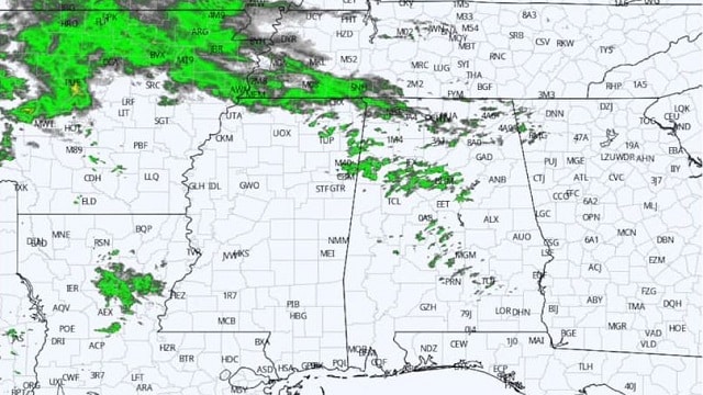
CLOUDY DAY: Clouds will hang tough over Alabama today, and we note some patchy light rain over the northern half of the state at daybreak. While most of the day will be dry, a bit of light rain is possible in scattered spots; temperatures will hold in the 50s. The average high for Birmingham on Jan. 17 is 54.
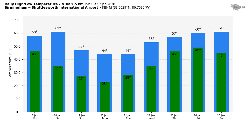
THE ALABAMA WEEKEND: A cold front will pass through Alabama Saturday; looks like the main window for showers will come from 11 a.m. until 6 p.m. Unlike last Saturday, this time we won’t have any risk of severe thunderstorms and probably very little thunder. Rain amounts will be less than one-half inch, so no flooding problems. The afternoon high will be in the 55- to 60-degree range for the northern half of the state.
The sky will clear Saturday night, and Sunday will be a bright, sunny day but considerably colder, with a high in the mid to upper 40s along with a stiff northwest breeze.
NEXT WEEK: The weather will be dry and cold with a good supply of sunshine each day Monday through Wednesday. Morning lows will be well below freezing; the coldest morning will come early Tuesday, when temperatures will drop into the 20- to 25-degree range; teens are likely for colder spots. The high will be between 40 and 45 degrees Monday and Tuesday; then we warm into the low 50s Wednesday as a warming trend begins. Clouds increase Thursday, and rain returns to the state Thursday night and Friday.
MESSY WEATHER NORTHWEST OF ALABAMA: Winter weather advisories and winter storms warnings cover much of the nation from west Texas to the Great Lakes as a storm system impacts that region; blizzard warnings are in effect for parts of the Dakotas and Minnesota. We should note there are no signs of winter weather mischief (snow, ice, etc.) for Alabama through the rest of January, based on current global model output.
ON THIS DATE IN 2013: One to 3 inches of snow fell across the northern half of Alabama, with locally higher amounts of 4 to 5 inches also reported. Thundersnow, a very rare occurrence here in the South, was observed with the heaviest snow band as it moved across Tuscaloosa, Walker, Jefferson and St Clair counties. Road conditions became hazardous in areas where snow fell quickly and heavily. Icy roadways led to numerous traffic accidents in some counties, and travel came to a halt in a few locations.
BEACH FORECAST: Click here to see the AlabamaWx Beach Forecast Center page.
WEATHER BRAINS: You can listen to our weekly 90-minute show any time on your favorite podcast app. This is the show all about weather featuring many familiar voices, including the meteorologists at ABC 33/40.
CONNECT: You can find me on the major social networks:
Facebook
Twitter
Instagram
Pinterest
Snapchat: spannwx
For more weather news and information from James Spann and his team, visit AlabamaWx.


