Scott Martin: Showers, wintry mix for Alabama this morning; major rains start Monday
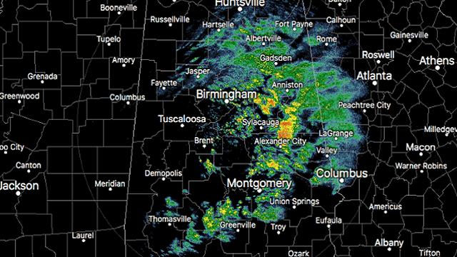
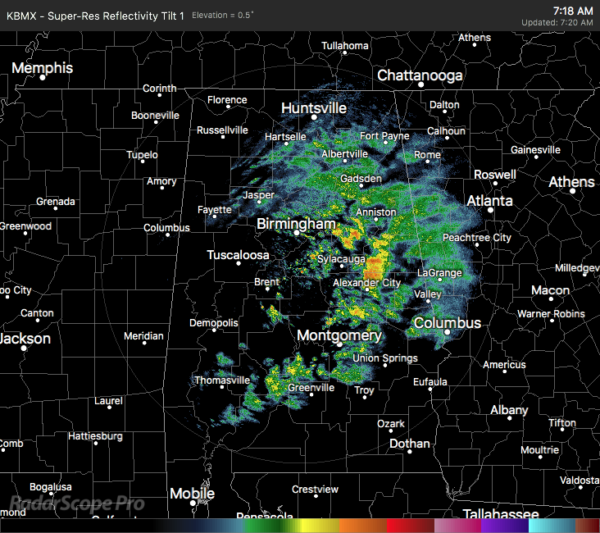
TODAY: At 7:23 a.m., radar showed a good bit of shower activity on the eastern half of Alabama. Some snow showers or a mix may be occurring. There are no reports of any travel issues, but a Winter Weather Advisory is in effect for Calhoun, Cleburne, Etowah and Cherokee counties until 11 a.m. We have reports of some minor accumulations on grassy and elevated surfaces.
Temperatures are in the mid-30s to the lower 40s. Troy was the cold spot at 34 degrees, while several locations were tied as the warm spots at 43 degrees, including Birmingham.
The latest run of the High-Resolution Rapid Refresh shows showers moving across the area mainly north of I-20 and east of I-65 through much of the morning, with a mix of snow or sleet over the extreme northeastern parts of the state in the higher terrains. Much of that activity will be out of the area before midday, leaving only a small tail of scattered showers across the southern portions of the area. Those showers should be out of here before 6 p.m. tonight. Temperatures make a nice rebound, topping out in the lower 50s to the lower 60s from north to south. We’ll have sunny skies by mid-afternoon.
SUNDAY: We’ll have mostly sunny skies through much of the daylight hours, but clouds will begin to move in ahead of an approaching cold front. Rain chances will start to increase after midnight over western Alabama, so go out and enjoy the day while it is dry. Highs will be nice, reaching the lower to mid-60s for most, with upper 60s for southwest Alabama.
MONDAY: A cold front will continue to make a very slow approach, setting the stage for rain and thunderstorms. Those will be likely over the western and northwestern parts of the state for the first half of the day and will eventually move into the rest of the state during the late afternoon. Rain could be heavy at times and some flash flooding is possible, especially with the already well-saturated soils. One to 2 inches of rainfall is possible through midnight. Highs will be in the lower 60s to the lower 70s.
TUESDAY: The front stalls out over Alabama, and that will keep rain and a few thunderstorms likely through much of the day. Another surface low will form to the west that may allow some of the moisture to be pulled northward, which may allow some locations south of I-20 to be rain-free for a few hours during the late-night and overnight hours. Rainfall totals through midnight look to be around 1-1.5 inches. Highs will be in the lower 60s to the lower 70s.
WEDNESDAY: The surface low will be on the Gulf Coast near the Texas/Mexico border to start the day and will move northeastward along the front. The front will also start to move slowly, and rain and thunderstorms will become likely during the evening and late-night hours. We could see another one-quarter to three-quarters of an inch of rainfall through midnight. Highs will be in the upper 50s to the lower 70s from northwest to southeast.
THURSDAY: The system will finally catch high gear and will start to accelerate out of the area by or just after midday, but another 1-2 inches of rainfall may occur before it exits, stage right. Skies will remain mostly cloudy and afternoon highs will reach the upper 50s to the lower 70s.
FRIDAY: We’ll finally have a chance to dry out a little as skies slowly start to clear. Temperatures will be close to seasonal as highs reach the mid-50s to the lower 60s. Unfortunately, it looks like showers return on Saturday.
For more weather news and information from James Spann, Scott Martin and other members of the James Spann team, visit AlabamaWx.


