James Spann: Blue sky, sunshine and cool temperatures for Alabama
James Spann forecasts dry weather, below-average temperatures for Alabama from Alabama NewsCenter on Vimeo.
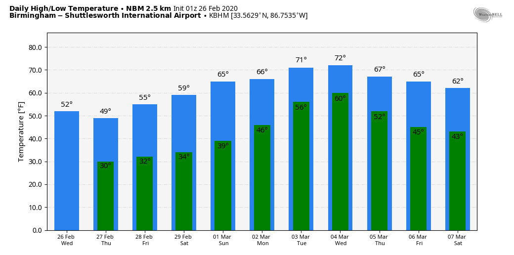
VERY DRY AIR: Temperatures were near the freezing mark across much of north and central Alabama early this morning. We are forecasting a high today close to 50 degrees with sunshine in full supply. The average high for Birmingham on Feb. 27 is 62. Tonight will be clear and cold again; we drop into the 30- to 35-degree range early Friday morning.
The day Friday will feature a partly sunny sky with a high in the mid 50s. Clouds will increase late in the day ahead of a clipper-type system, and that will bring the risk of a few scattered showers to north Alabama Friday evening. Moisture will be limited, and rain amounts will be light and spotty. We will also mention the risk of a few snow flurries or showers late Friday night over the northeast corner of the state, but no impact is expected.
THE ALABAMA WEEKEND: The weekend will be dry with a good supply of sunshine Saturday and Sunday. The high will be in the upper 50s Saturday, followed by upper 60s Sunday. Early morning lows will be in the 30s.
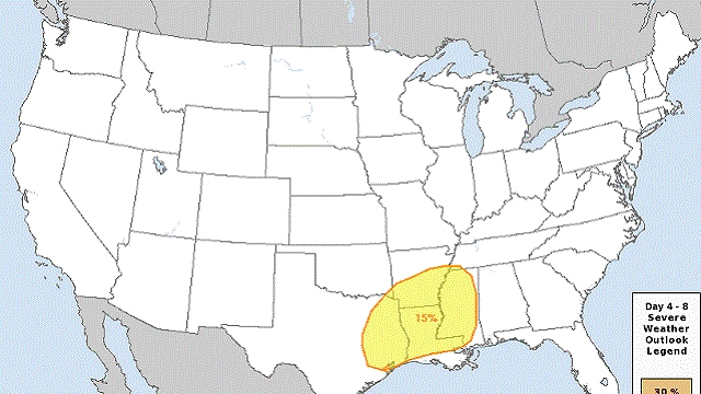
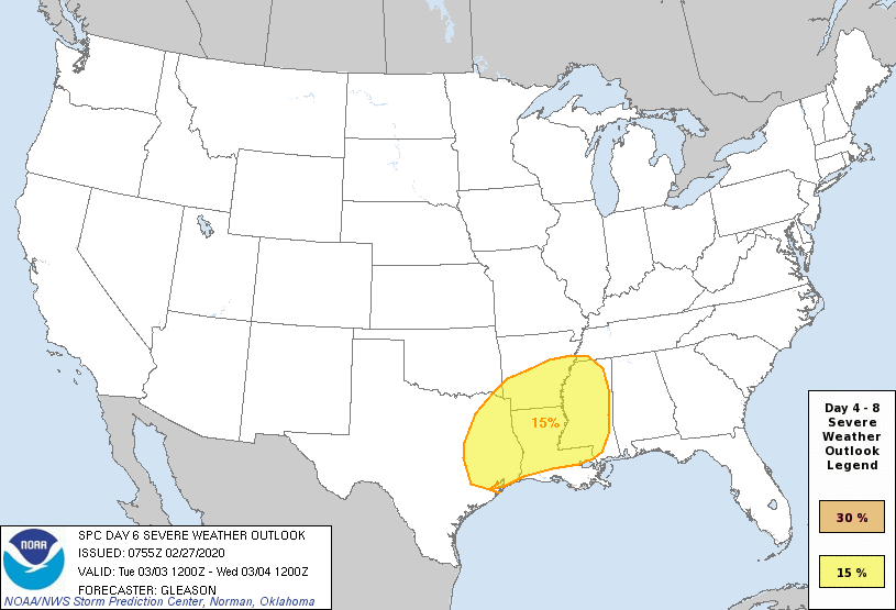
NEXT WEEK: Moisture levels will rise, and we will mention a chance of scattered showers Monday and Tuesday. The sky will be mostly cloudy and Monday’s high will be in the 67- to 70-degree range, followed by low 70s Tuesday. A rather robust weather system will bring rain and storms to the state late Tuesday night into Wednesday; no doubt strong storms will be possible with this feature, but it is still too early to determine whether this will pose a significant risk of severe thunderstorms.
The Storm Prediction Center has areas west of Alabama in severe weather risk in its outlook for Tuesday, but for now no risk has been defined for Alabama on Wednesday.
Dry, pleasant weather is likely for Thursday and Friday of next week.
RAIN UPDATE: Birmingham’s rain total for the month is up to 13.26 inches. This will be the third-wettest February on record, behind February 1961 (17.67 inches) and February 1903 (15.86 inches).
ON THIS DATE IN 1999: A brief tornado, rated EF-2, occurred just northwest of Locust Fork in Blount County. The tornado crossed County Road 13 moving north. Other wind damage was reported in more than eight counties as a strong line of storms rolled through the state. Most of the damage was caused by straight-line winds.
BEACH FORECAST: Click here to see the AlabamaWx Beach Forecast Center page.
WEATHER BRAINS: You can listen to our weekly 90-minute show any time on your favorite podcast app. This is the show all about weather featuring many familiar voices, including the meteorologists at ABC 33/40.
CONNECT: You can find me on the major social networks:
Facebook
Twitter
Instagram
Pinterest
Snapchat: spannwx
For more weather news and information from James Spann and his team, visit AlabamaWx.com.


