James Spann: Warmer days ahead for Alabama, with spotty showers
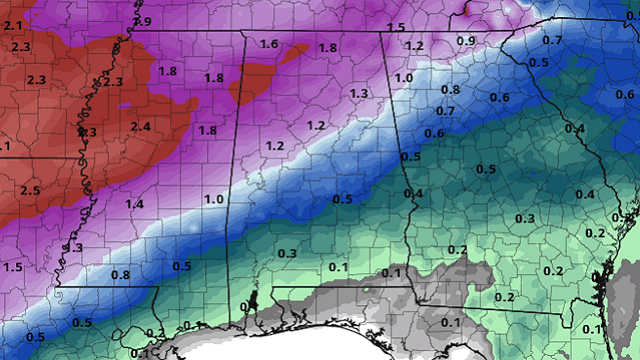
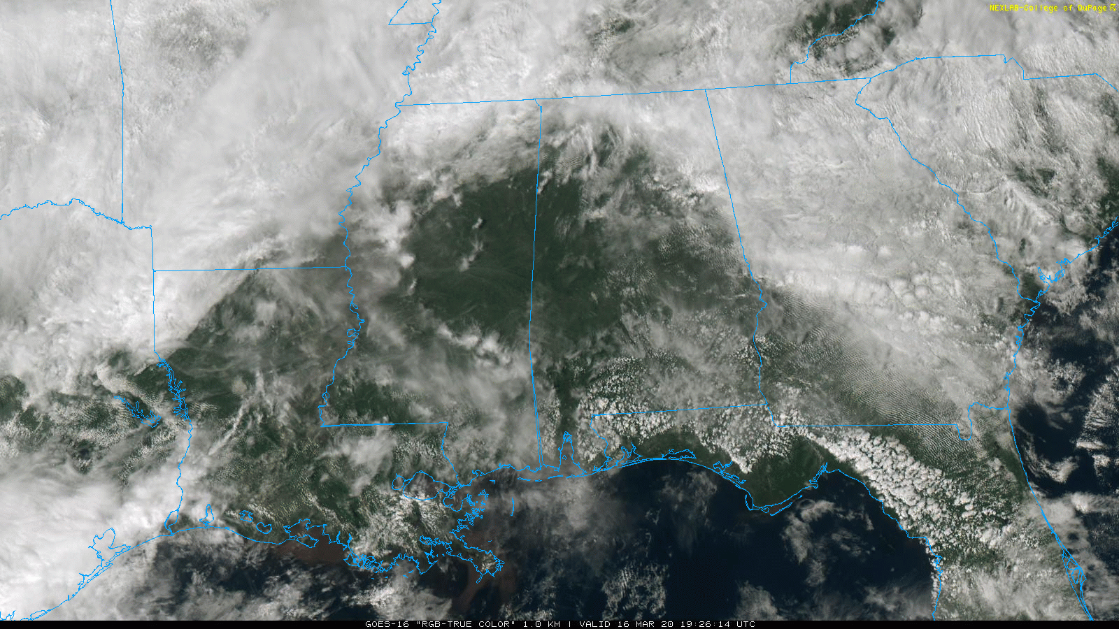
BIG CONTRAST: A stalled front is bringing another big thermal contrast to Alabama this afternoon. North of the front at 2 p.m. Huntsville and Muscle Shoals reported 54 degrees, while to the south Montgomery had soared to 81. The sky is partly sunny over most of the state, although clouds are hanging tough over the northern third. There are a few patches of light rain on radar across the Tennessee Valley, but most of the state is dry.
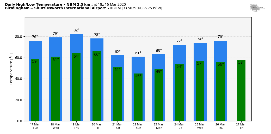
MIDWEEK: Look for a warming trend through midweek. The high will be in the mid 70s Tuesday, followed by upper 70s Wednesday and low to mid 80s Thursday. A few scattered showers are possible Tuesday and Wednesday, and maybe a thunderstorm in spots, but nothing really widespread or heavy. Thursday looks mostly dry. It should be the warmest day so far this year for most of Alabama.
FRIDAY AND THE WEEKEND: A cold front will bring an organized band of rain into the state, along with potential for a few thunderstorms. No severe storms are expected, and rain amounts should be around one-half inch. The weekend will be noticeably cooler over the northern half of the state. Some places north of Birmingham won’t get out of the 50s Saturday and Sunday, but south Alabama will stay mild, with highs at or over 70 degrees. The sky will be mostly cloudy with some patchy, light rain both days for north and central Alabama.
NEXT WEEK: The pattern continues to favor an upper trough over the western U.S. and a ridge over the eastern states. This should lead to temperatures above average here in Alabama; highs most of next week will be in the 70s. Like this week, there will be some risk of showers on most days, but there is still no sign of any issues with really heavy rain, flooding or severe thunderstorms.
ON THIS DATE IN 1942: A total of 26 significant tornadoes, including five violent ones and 18 killers, would cause 148 fatalities from Illinois and Indiana through Kentucky and Tennessee, into Mississippi and Alabama. The Delta towns of Itta Bena and Greenwood were hit around 3 p.m. by a family of twisters that killed 63 people. Five automobiles were hurled into the Tallahatchie River near Greenwood, killing six. Two school buses were hit. The hospital at Grenada was missed by just 20 yards, even as doctors and nurses worked on patients from the first big tornado.
Just after 5 p.m., a powerful tornado struck the northern part of Baldwyn, Mississippi, north of Tupelo. The F4 tornado killed five people. Even as rescuers were digging through the rubble of more than 50 destroyed homes, a second tornado roared into the town a scant one-half hour later. No one died in the second tornado, although it destroyed 25% of the business district. The twin tornadoes that struck Baldwyn were the subject of tornado legend for many years.
In Alabama, a tornado killed a couple at Waterloo in Lauderdale County around 6 p.m. Their bodies were blown more than 200 yards.
BEACH FORECAST: Click here to see the AlabamaWx Beach Forecast Center page.
WEATHER BRAINS: You can listen to our weekly 90-minute show any time on your favorite podcast app. This is the show all about weather featuring many familiar voices, including the meteorologists at ABC 33/40.
CONNECT: You can find me on all of the major social networks:
Facebook
Twitter
Instagram
Pinterest
Snapchat: spannwx
For more weather news and information from James Spann and his team, visit AlabamaWx.


