James Spann: Another warm day for Alabama, with a few isolated afternoon showers, storms
James Spann forecasts a warm start for the Alabama work week from Alabama NewsCenter on Vimeo.
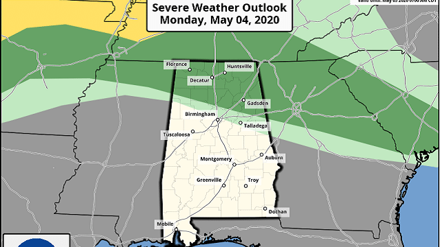
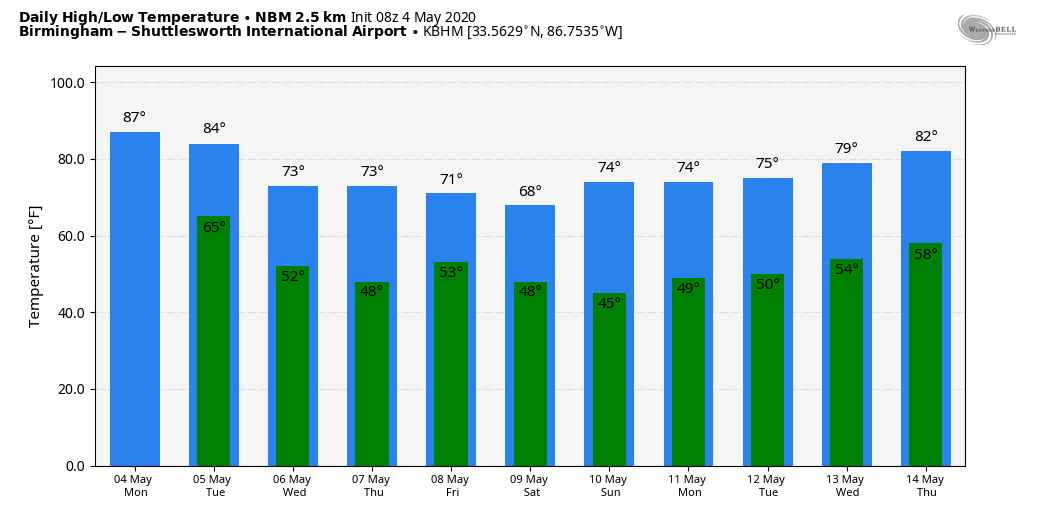
WARM MAY DAY: We project a high in the mid to upper 80s today; for many communities, today will be the warmest day so far in 2020. The average high for Birmingham on May 4 is 79. The sky will feature a mix of sun and clouds with no rain this morning. Later today, we will watch radar trends as thunderstorms could form northwest of the state and possibly move into north Alabama by late afternoon. If these storms do develop, they could produce strong winds, somewhat similar to the event yesterday that was mainly over Tennessee and far north Alabama. The Storm Prediction Center has a marginal risk of severe storms defined for this possibility, north of a line from Hamilton to Springville to Heflin.
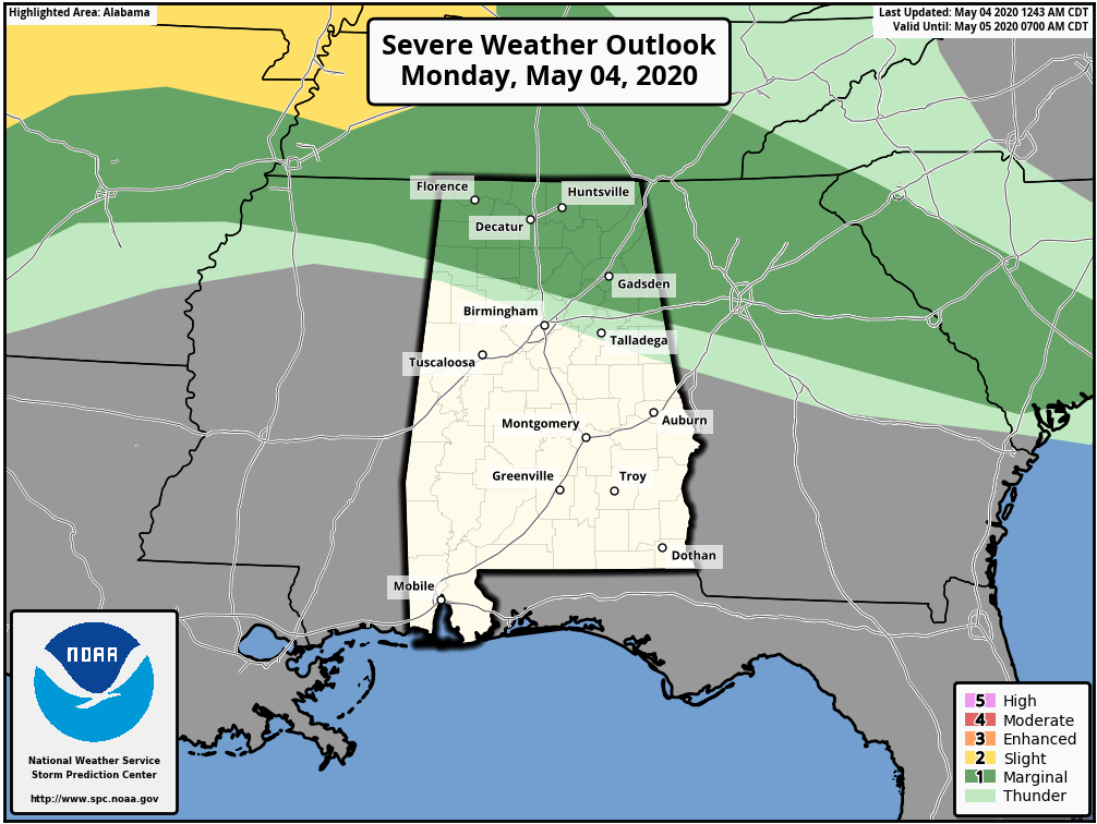
The window for these storms, if they develop, will be from 3 until 8 p.m. But for most places in Alabama, today will be rain-free.
Tuesday will be another warm day with a high in the 80s, but a cold front will bring a chance of showers, and possibly a few thunderstorms, late Tuesday and Tuesday night. Rain amounts should be fairly light, generally less than one-half inch.
COOLER AIR RETURNS: Wednesday will be a sunny day but noticeably cooler, with a high in the low 70s and a stiff north breeze of 10-20 mph. Temperatures will drop into the 40s by early Thursday morning. Then, Thursday will be another sunny day with a high in the low 70s again. Another cold front will bring a chance of showers Friday afternoon; rain amounts should remain light.
THE ALABAMA WEEKEND: The weekend will be dry, but unseasonably cool. Temperatures will drop into the 40s early Saturday morning, and the afternoon high will be in the 65- to 70-degree range, about 15 degrees below average for mid-May. The low early Sunday will be somewhere between 40 and 46 degrees for most places, but some of the colder pockets over northeast Alabama (Valley Head, Black Creek, etc.) could reach the 30s. Expect a good supply of sunshine both days.
NEXT WEEK: Temperatures will likely remain below average, and there will be some risk of rain around midweek.
There’s no sign of any excessively heavy rain events for Alabama for the next 10-15 days as a drier pattern continues to evolve.
ON THIS DATE IN 2007: A devastating EF5 twister demolishes nearly every structure in Greensburg, Kansas, around 9:30 p.m. and kills 10. The mammoth wedge tornado cuts a swath 1.7 miles wide and 22 miles long across the Kansas landscape. It is the worst single tornado to touch down in the U.S. in eight years.
BEACH FORECAST: Click here to see the AlabamaWx Beach Forecast Center page.
WEATHER BRAINS: You can listen to our weekly 90-minute show any time on your favorite podcast app. This is the show all about weather featuring many familiar voices, including the meteorologists at ABC 33/40.
CONNECT: You can find me on the major social networks:
Facebook
Twitter
Instagram
Pinterest
Snapchat: spannwx
For more weather news and information from James Spann and his team, visit AlabamaWx.


