James Spann: Unsettled weather for Alabama through Friday
James Spann forecasts occasional rain for Alabama this week from Alabama NewsCenter on Vimeo.
WET PATTERN DEVELOPS: On the maps this morning, there is a large-scale upper trough west of the state, moving in our direction. The upward motion associated with the trough, along with increased tropical moisture, will set the stage for unsettled weather for Alabama today and through the rest of the week. The sky will be generally cloudy each day, and we will forecast occasional showers and thunderstorms. The rain won’t be continuous, of course, but the pattern suggests the potential for beneficial rain through Friday.
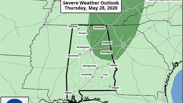
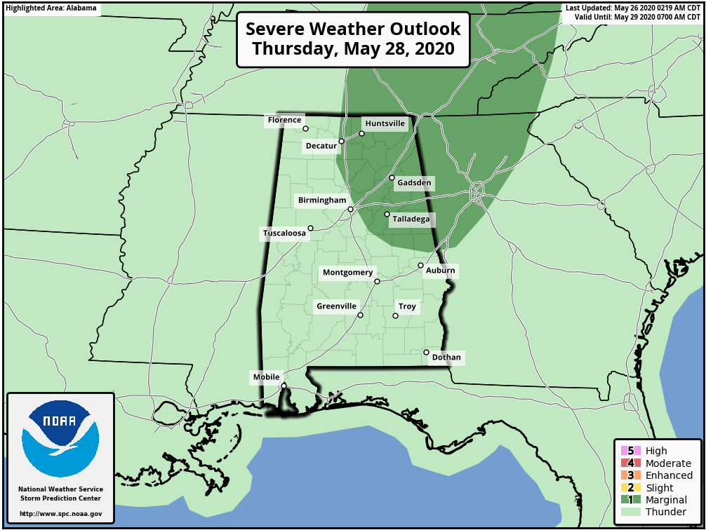
Rain distribution won’t be very even, but most communities should see at least 1 inch; a few spots could see 2 inches. Organized severe storms are not expected, although the Storm Prediction Center has parts of north and east Alabama in a low-end marginal risk (level 1 out of 5) of severe thunderstorms Thursday.
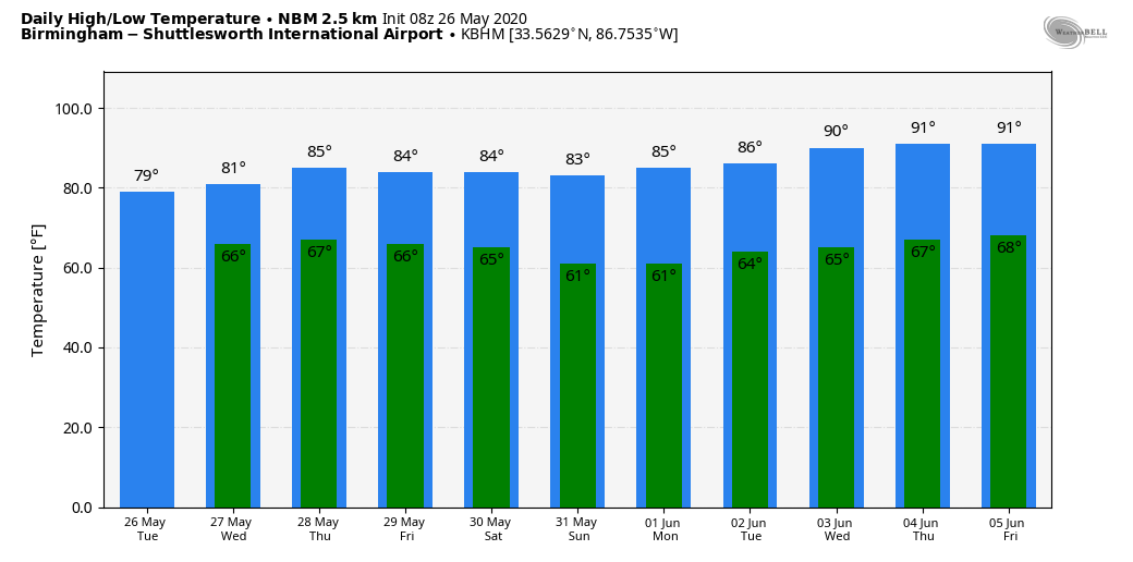
Small hail and gusty winds are likely with the heavier thunderstorms, and of course all storms in late May can produce a large amount of lightning. Heat levels will be down because of the clouds and rain. Many places across north and central Alabama will hold in the 70s today and Wednesday; then we project highs in the low 80s Thursday and Friday.
THE ALABAMA WEEKEND: The best chance of showers will shift into the southern half of the state Saturday as an unusually dry air mass for the end of May creeps into the northern counties. Then, a refreshing air mass arrives Sunday with sunshine in full supply, lower humidity and pleasant temperatures. Cooler spots will drop into the 50s early Sunday morning, followed by a high close to 80 degrees.
NEXT WEEK: Dry weather continues through much of the week with slowly rising heat and humidity levels. A few showers could return Friday.
TROPICS: A disturbance over the Florida Peninsula continues to produce heavy rain over the eastern coast of the state; the National Hurricane Center gives it only a 20% chance of tropical development in the coming days because of strong winds aloft. Regardless of development, heavy rainfall could cause flash flooding over portions of southern and central Florida tonight, spreading northward to coastal sections of northeastern Florida, Georgia and the Carolinas on Wednesday. Gusty winds could also produce rough marine conditions and life-threatening surf and rip currents along the coasts of eastern Florida, Georgia and the Carolinas through Wednesday.
ON THIS DATE IN 1917: A major tornadic thunderstorm took a 293-mile track across parts of central Illinois and Indiana. It was once believed to be a single tornado, but a later study indicated it was likely at least eight separate tornadoes. Overall, 101 people in Illinois were killed during the tornado outbreak, with 638 injured.
BEACH FORECAST: Click here to see the AlabamaWx Beach Forecast Center page.
WEATHER BRAINS: You can listen to our weekly 90-minute show anytime on your favorite podcast app. This is the show all about weather featuring many familiar voices, including the meteorologists at ABC 33/40.
CONNECT: You can find me on the major social networks:
Facebook
Twitter
Instagram
Pinterest
Snapchat: spannwx
For more weather news and information from James Spann and his team, visit AlabamaWx.