James Spann: Much drier air arrives in Alabama Wednesday night
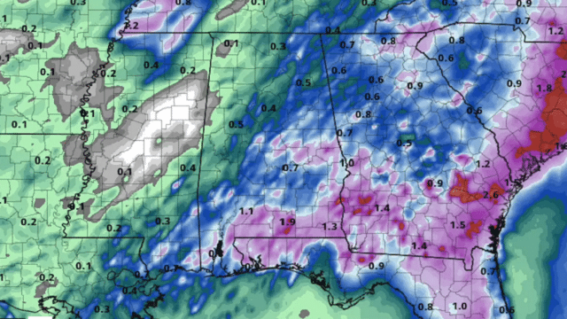
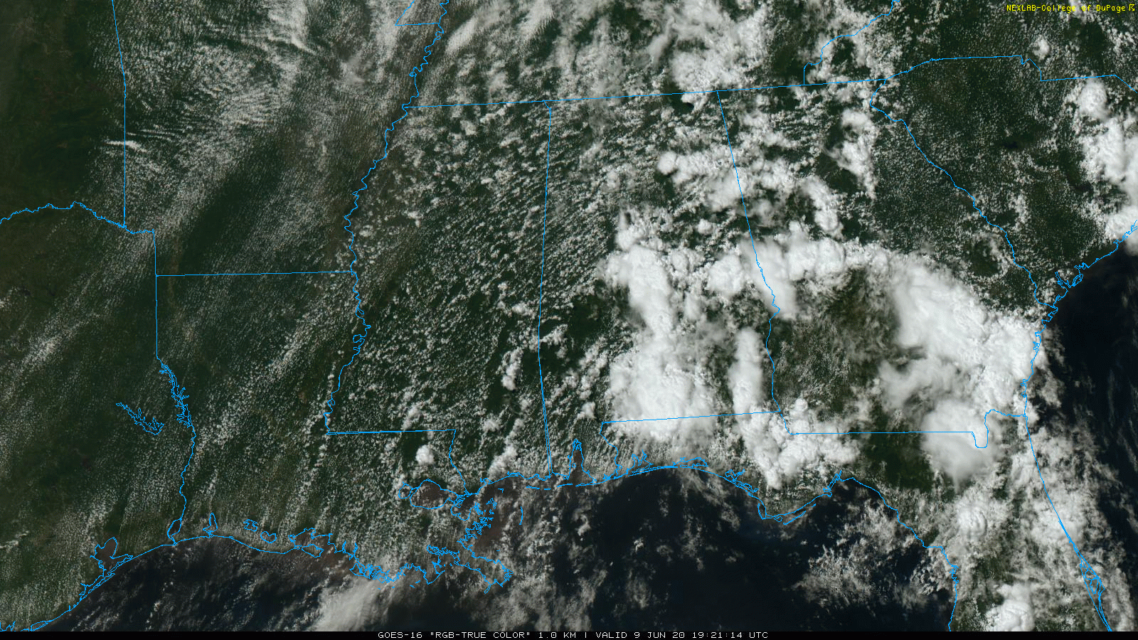
RADAR CHECK: A number of showers and thunderstorms have developed in the moist, tropical environment across Alabama this afternoon. There are no severe storms, but the showers are very efficient rain producers, and some temporary flooding is possible over the next few hours. Showers will fade late tonight as the air cools and becomes more stable.
WEDNESDAY: A rather rare June front will push into Alabama and will bring an organized line of thunderstorms. The storms during the afternoon could be strong to severe, and the Storm Prediction Center maintains a low-end, marginal risk (level 1 of 5) for a decent part of the state.
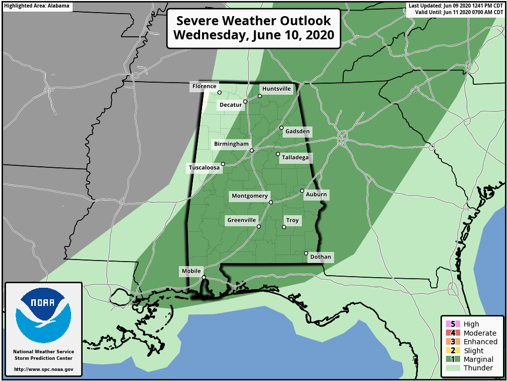
The higher severe weather probabilities will most likely come over the eastern half of the state Wednesday afternoon, and the main threat will come from strong straight-line winds. Then, much drier air will roll into the state Wednesday night.
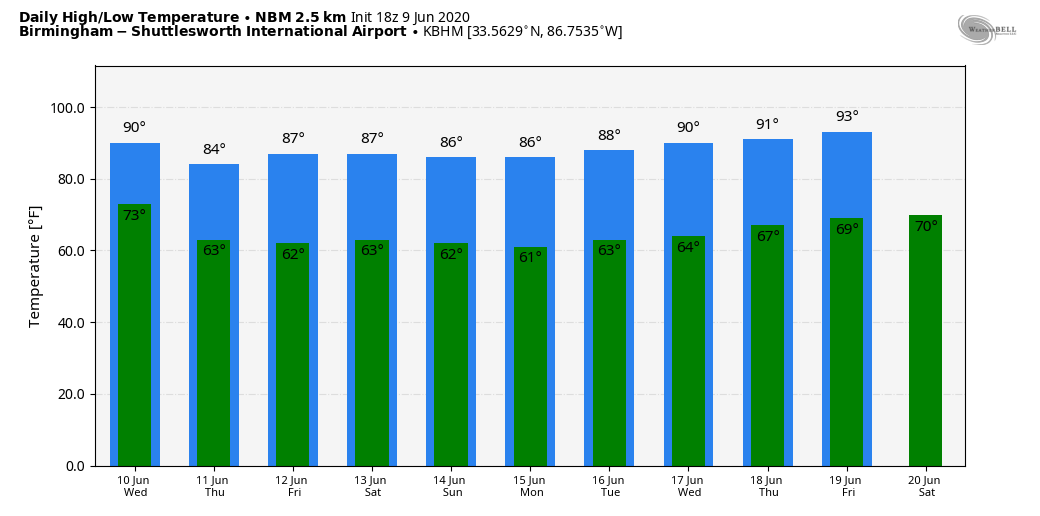
THURSDAY THROUGH THE WEEKEND: Thursday will be a different kind of day. Today, we experienced dewpoints in the 75- to 80-degree range, but by Thursday they drop into the 50s as much drier air takes over. The day will be sunny with noticeably lower humidity levels. Dry weather will continue Friday through the weekend with sunny, warm days and clear, pleasant nights. Cooler spots will drop into the 50s each morning, with low 60s elsewhere. The chance of showers over the weekend will be confined to the far southeast corner of Alabama, around Dothan.
NEXT WEEK: The weather pattern continues to look quiet. Moisture levels slowly rise, and a few isolated showers could show up over the latter half of the week, but no sign of any widespread rain.
TROPICS: A non-tropical area of low pressure is over the central Atlantic Ocean a few hundred miles east of Bermuda. Development of this system as a subtropical cyclone appears unlikely because of unfavorable environmental conditions, and the low is expected to dissipate in a few days. The rest of the Atlantic basin is quiet.
ON THIS DATE IN 1966: Hurricane Alma made landfall over the eastern Florida panhandle near Apalachee Bay with winds of 90 mph. This marked the earliest United States hurricane landfall since a hurricane in May and June of 1825. Damage in the lower Florida Keys was estimated at around $300,000. In southwestern Florida, the hurricane heavily damaged the mango crop. High rainfall totals occurred across the state, peaking at 9.94 inches in Dania Beach near Miami. There were eight tornadoes or funnel clouds in the state, including one in Dade County that damaged a home. Along the west coast of Pinellas County, the storm damaged the grapefruit crop. High winds, including a gust of 93 mph, caused power outages in the Tampa Bay area.
BEACH FORECAST: Click here to see the AlabamaWx Beach Forecast Center page.
WEATHER BRAINS: You can listen to our weekly 90-minute show anytime on your favorite podcast app. This is the show all about weather featuring many familiar voices, including the meteorologists at ABC 33/40.
CONNECT: You can find me on the major social networks:
Facebook
Twitter
Instagram
Pinterest
Snapchat: spannwx
For more weather news and information from James Spann and his team, visit AlabamaWx.


