James Spann: Scattered showers, storms remain in the forecast for Alabama
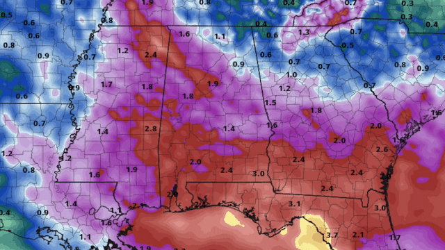
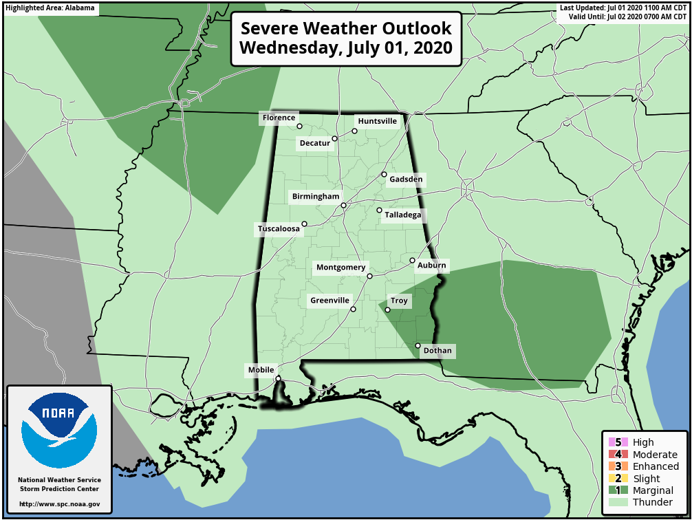
MUGGY AFTERNOON: A mesoscale convective system rolled through Alabama this morning in a northwest flow aloft, producing heavy rain and gusty winds. Radar suggests parts of northwest Alabama received more than 5 inches of rain earlier today, and a few flash flood warnings were required. The radar is fairly quiet over north and central Alabama at mid-afternoon with heavier storms over the southern third of the state. The Storm Prediction Center has removed the severe weather threat for most of the state thanks to stabilization after the morning rain.
We are watching another mass of storms over west Tennessee and east Arkansas; those will likely push through north Alabama tonight with potential for more heavy rain and strong wind gusts.
REST OF THE WEEK AND THE HOLIDAY WEEKEND: An ocean of humidity will remain parked over the Deep South Thursday through Sunday. That means we will deal with scattered showers and thunderstorms daily; with high precipitable water values where storms form, they will be efficient rain producers. But it certainly won’t rain all day, and the sun will be out at times. Most, but not all, of the thunderstorms will come from about 1 until 9 p.m. Afternoon highs will be generally between 87 and 92, very close to seasonal averages for early July in Alabama.
As is the case with most summer thunderstorms, the most dangerous element is lightning. When thunder roars, be sure and go indoors.
NEXT WEEK: Look for partly sunny days with random, scattered, mostly afternoon and evening showers and thunderstorms through the week. Afternoon highs will remain pretty close to 90 degrees. There will be, of course, variations in the daily coverage and placement of showers and storms, but no way of knowing this far out about the small-scale features that are the determining factors.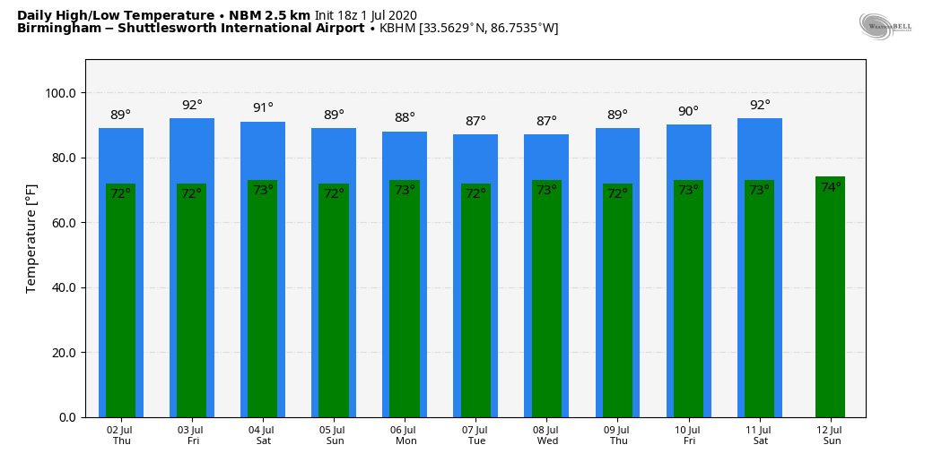
TROPICS: All remains quiet and tropical storm formation is not expected across the Atlantic basin through the weekend. The peak of the season typically comes in August and September.
LOOKING BACK AT JUNE: The average high for Birmingham during June was 87.7 degrees, which is exactly average for the month. The rain total was 4.04 inches, a little below the average of 4.38 inches.
ON THIS DATE IN 2002: San Antonio, Texas, recorded 9.52 inches of rain to set a new record for its greatest rainfall for the entire month of July.
BEACH FORECAST: Click here to see the AlabamaWx Beach Forecast Center page.
WEATHER BRAINS: You can listen to our weekly 90-minute show any time on your favorite podcast app. This is the show all about weather featuring many familiar voices, including the meteorologists at ABC 33/40.
CONNECT: You can find me on the major social networks:
Facebook
Twitter
Instagram
Pinterest
Snapchat: spannwx
For more weather news and information from James Spann and his team, visit AlabamaWx.


