Scott Martin: Strong storms possible for Alabama Sunday
THE ALABAMA WEEKEND: We’ll have a northwesterly flow across Alabama today, which will allow the humidity to drop slightly due to drier continental air. We’ll have plenty of sunshine, and no measurable rain is expected throughout the day. Afternoon highs will max out in the lower to mid-90s, but the index values will stay below advisory criteria.
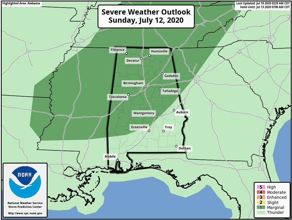
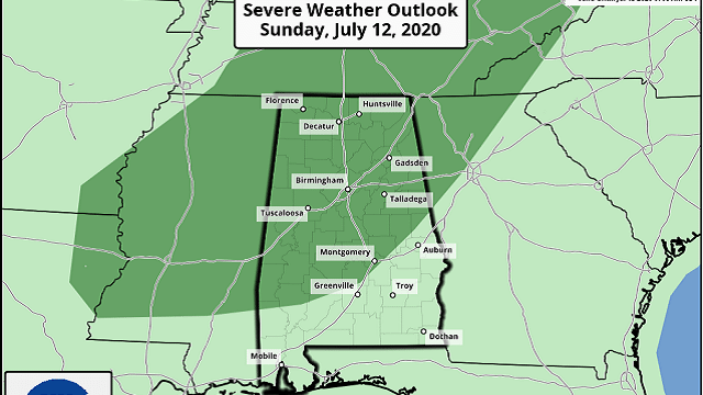
Nearly all of central Alabama is under a level 1 marginal risk for severe storms on Sunday, as that helpful northwest flow will send a shortwave trough in our direction. Moisture-rich and unstable air will be brought into the area by a southwesterly flow at the lower levels, providing the ingredients for thunderstorm development, especially during the afternoon and evening. The main threats from the stronger to possibly severe storms will be from damaging wind gusts up to 60 mph. Timing looks to be from noon to 9 p.m. Not everyone will see rain; chances will be 40% to 60% from northwest to southeast. Highs will be in the lower to mid-90s.
THE WORK WEEK: The trough will get hung up to the south, allowing the potential for scattered showers and storms for southern Alabama on Monday, but the northern two-thirds of the state will remain dry. Highs will be in the lower 90s.
Tuesday will be nearly the same as southern Alabama remains in a little more unstable air, but rain chances will be slim at best. The rest of Alabama will remain dry and hot. Highs will reach the lower to mid-90s.
Wednesday and Thursday will be even hotter as a ridge builds from the Southern Plains. There will be just enough deep moisture that an isolated shower or two will be possible during the afternoon, but nearly everyone will stay dry both days. Temperatures and humidity levels may be high enough that heat advisories may be needed. Highs on both days will be in the mid to upper 90s.
Just a little more moisture is allowed to move into Alabama on Friday. It will help bring the temperatures down by a couple of degrees and will give us a small increase in the scattered afternoon shower and storm chances. Highs will be in the lower to mid-90s.
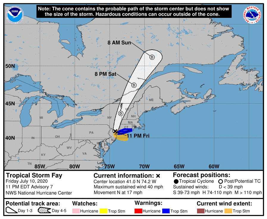
TROPICS: At 11 p.m. Friday night, Tropical Storm Fay was continuing her northward trek across New Jersey while weakening. Winds were at 40 mph and the minimum central pressure had risen to 1,001 millibars. Fay is expected to either weaken into a depression or become post-tropical at some point this morning. Other than some gusty winds and a few minor flooding issues in poor drainage areas, no major impacts are expected across New England. The rest of the Atlantic Ocean, Caribbean Sea and the Gulf of Mexico remain rather quiet.
ON THIS DATE IN 1987: Early-morning thunderstorms produced wind gusts to 90 mph at Parkston, South Dakota, and wind gusts to 87 mph at Buffalo, Minnesota. Later in the day, strong thunderstorm winds at Howard, Wisconsin, collapsed a circus tent, injuring 44 people.
BEACH FORECAST CENTER: Get the latest weather and rip current forecasts for the beaches from Bay St. Louis, Mississippi, to Panama City Beach, Florida, on our Beach Forecast Center page. There, you can select the forecast of the region you are interested in.
For more weather news and information from James Spann, Scott Martin and other members of the James Spann team, visit AlabamaWx.