James Spann: Hottest week so far this year for Alabama
James Spann forecasts a hot, mostly dry start for the Alabama work week from Alabama NewsCenter on Vimeo.
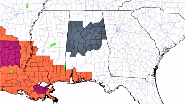
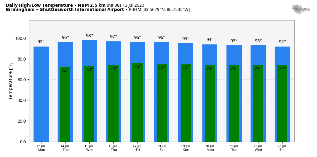
FOGGY START: A dense fog advisory is in effect for much of central Alabama this morning; visibilities are quite restricted in some areas. The fog will dissipate by mid-morning. We note some rain over Mobile and Baldwin counties at daybreak, but most of the state is dry and we expect much calmer weather today with a good supply of sunshine. Odds of an afternoon shower are very small (10% or less over the northern half of the state for any given point), and the high will be in the low 90s, right at seasonal averages. The average high for July 13 at Birmingham is 91.
TUESDAY/WEDNESDAY: Rising heat levels are the big story; look for a high in the mid 90s both days, maybe even upper 90s in spots. The sky will remain mostly sunny, and afternoon showers and storms will remain isolated and mostly over the southern counties of the state. Birmingham’s hottest temperature so far this summer is 94, recorded on June 20, June 29 and July 3. There’s a good chance we exceed that, if not Tuesday, on Wednesday.
THURSDAY THROUGH THE WEEKEND: Moisture levels rise Thursday and Friday, and we will bring back the chance of scattered, mostly afternoon and evening showers and thunderstorms both days. Otherwise, the sky will be partly sunny with a high in the low to mid 90s. The weekend will be pretty much the same. We will have the usual risk of random, scattered showers and storms Saturday and Sunday, generally from 1 until 9 p.m. Otherwise, look for partly sunny days with highs between 90 and 94.
NEXT WEEK: The classic summer pattern rolls along through the week — hot, humid days with a few scattered showers or storms possible each day, mostly during the afternoon and evening hours. Highs hold in the low to mid 90s.
TROPICS: The Atlantic basin remains very quiet, and tropical storm formation is not expected this week. The peak of the season will come in August and September.
SUNDAY’S STORMS: A line of strong to severe thunderstorms moved southward through all of Alabama Sunday, initially in the Tennessee Valley during the morning, ending up along the Gulf Coast by evening. A number of trees and power lines were taken down, and rain amounts exceeded 1 inch in some spots. A few totals:
- Muscle Shoals — 2.06 inches
- Huntsville — 1.38
- Grayson Valley — 1.33
- Moody — 1.23
- Birmingham Airport — 1.12
- Mobile — 0.67
- Montgomery — 0.4
ON THIS DATE IN 1951: Rivers across eastern Kansas crested well above flood stage, causing the most significant destruction from flooding in the Midwestern United States at that time. In all, 500,000 people were left homeless and 24 people died in the disaster.
BEACH FORECAST: Click here to see the AlabamaWx Beach Forecast Center page.
WEATHER BRAINS: You can listen to our weekly 90-minute show anytime on your favorite podcast app. This is the show all about weather featuring many familiar voices, including the meteorologists at ABC 33/40.
CONNECT: You can find me on all of the major social networks:
Facebook
Twitter
Instagram
Pinterest
Snapchat: spannwx
For more weather news and information from James Spann and his team, visit AlabamaWx.


