James Spann: Most Alabama communities stay dry
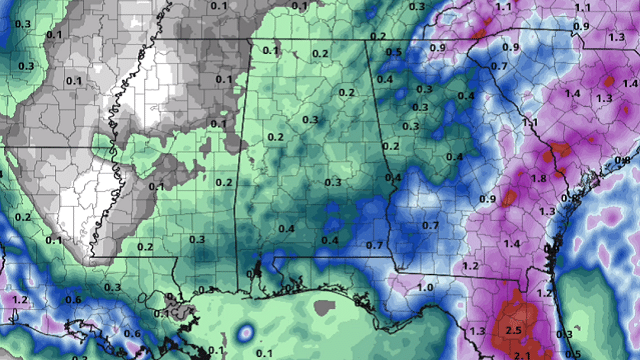
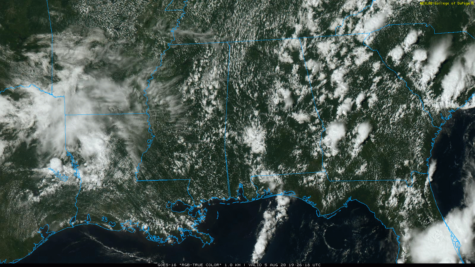
RADAR CHECK: We have a few isolated showers across the eastern half of Alabama this afternoon; they are small and moving quickly to the northeast. Otherwise, most communities are dry with a partly to mostly sunny sky; temperatures are mostly in the 87- to 92-degree range at mid-afternoon. The small showers will fade away after sunset as the air cools and becomes more stable.
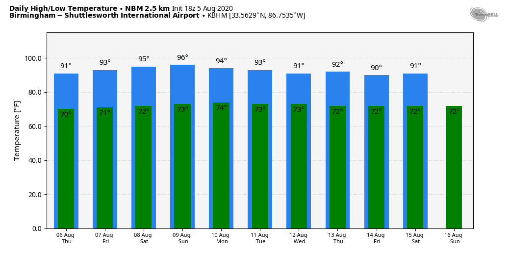
THURSDAY THROUGH THE WEEKEND: A very quiet weather pattern will persist. Look for partly to mostly sunny days, fair nights and only isolated afternoon showers. Odds of any one particular spot getting wet is 15-20% Thursday and 5-10% for Friday and the weekend. Afternoon highs will be in the low 90s Thursday and Friday; some places could reach the mid 90s over the weekend as the heat begins to build.
NEXT WEEK: Moisture levels will rise, and we will bring back the usual threat of random, scattered, mostly afternoon and evening showers and thunderstorms each day. Otherwise, we’ll see partly sunny days, fair nights and highs mostly in the low 90s.
TROPICS: The small disturbance southwest of Bermuda is not expected to develop due to dry and harsh upper-air winds, and the rest of the Atlantic basin is quiet.
The 2020 hurricane season outlook was updated today by the team at Colorado State University. The Atlantic has already had nine named storms and two hurricanes through Aug. 4. They estimate that 2020 will have an additional 10 hurricanes, 15 named storms (the average is 10.2), 76.25 named storm days (the average is 53.2), 42 hurricane days (the average is 22.9), five major Category 3-5 hurricanes (the average is 2.6) and 11 major hurricane days (the average is 5.9). The probability of U.S. major hurricane landfall is estimated to be about 140% of the long-period full-season average.
The tropical Atlantic is much warmer than normal, and vertical wind shear across the tropical Atlantic and Caribbean has been much weaker than normal. Warmer-than-normal water across the tropical Atlantic provides more fuel for tropical cyclones and also is associated with lower-than-normal pressure (as was observed in July) and increased instability – all of which favor more hurricane activity.
The next storm names are Josephine, Kyle, Laura, Marco, Nana, Omar, Paulette, Rene, Sally, Teddy, Vicky and Wilfred.
ON THIS DATE IN 1980: Allen intensified into a Category 5 hurricane south of Puerto Rico. This made Allen the earliest Category 5 hurricane in the Atlantic on record, but it was later surpassed by Hurricane Emily, which reached that intensity on July 16, 2005. it was the fifth-most-intense Atlantic Hurricane on record in terms of barometric pressure, behind Hurricane Rita, the 1935 Labor Day hurricane, Hurricane Gilbert and Hurricane Wilma. Allen was one of the few hurricanes to reach Category 5 status on the Saffir–Simpson Hurricane Scale on three separate occasions, and it spent more time as a Category 5 than all but two other Atlantic hurricanes.
BEACH FORECAST: Click here to see the AlabamaWx Beach Forecast Center page.
WEATHER BRAINS: You can listen to our weekly 90-minute show anytime on your favorite podcast app. This is the show all about weather featuring many familiar voices, including the meteorologists at ABC 33/40.
CONNECT: You can find me on the major social networks:
Facebook
Twitter
Instagram
Pinterest
Snapchat: spannwx
For more weather news and information from James Spann and his team, visit AlabamaWx.


