James Spann: Alabama showers, storms to slowly increase
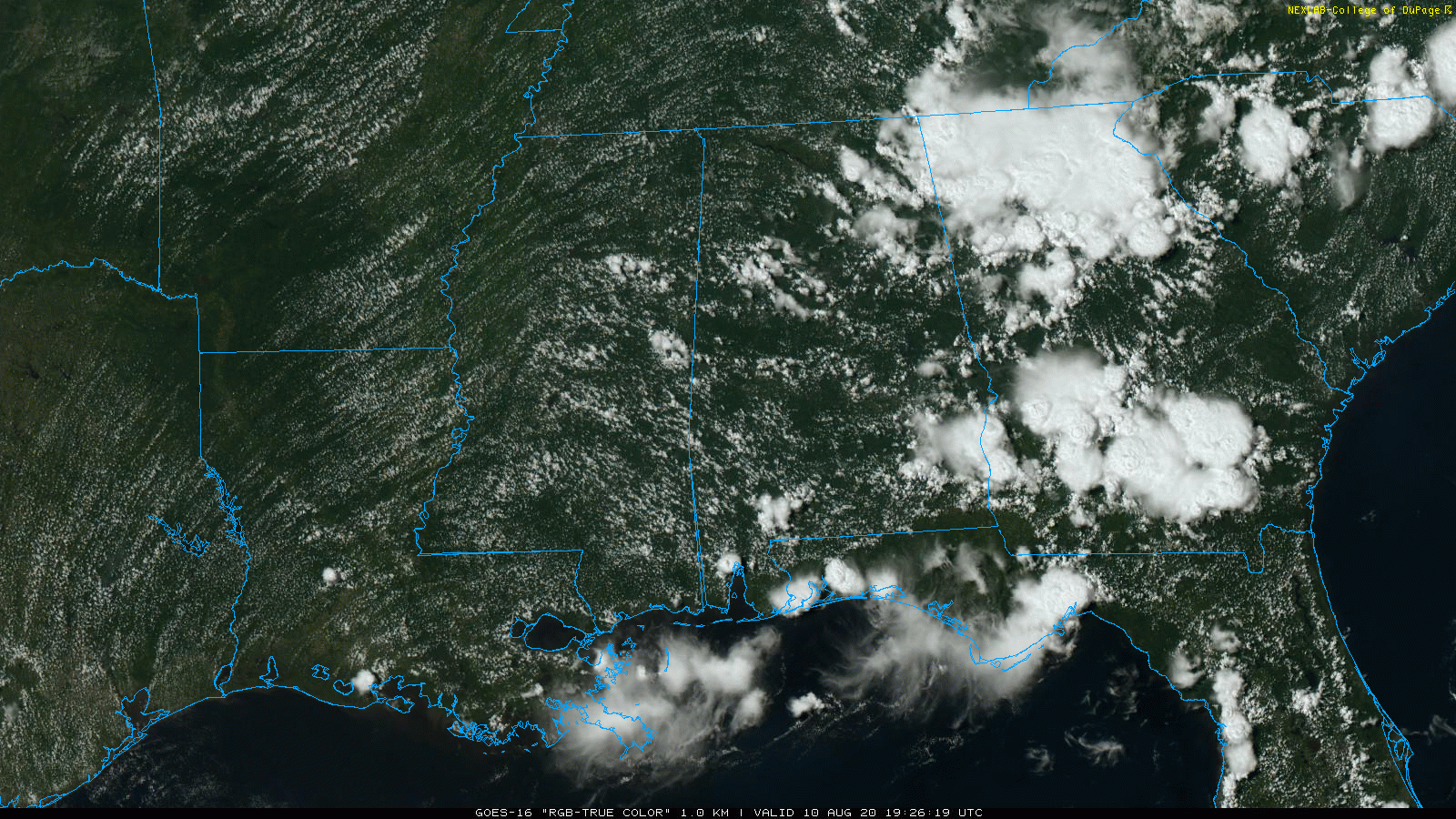
RADAR CHECK: Scattered showers and thunderstorms continue to develop across Alabama this afternoon; they are moving southeast and producing heavy rain and frequent lightning in some spots. We have a mix of sun and clouds with temperatures in the low to mid 90s away from the summer showers. Showers and storms will fade away late tonight.
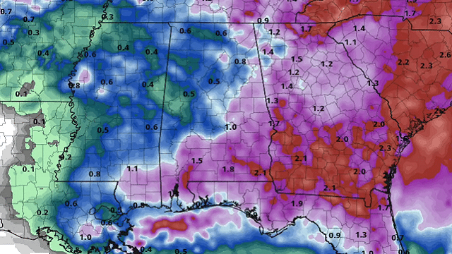
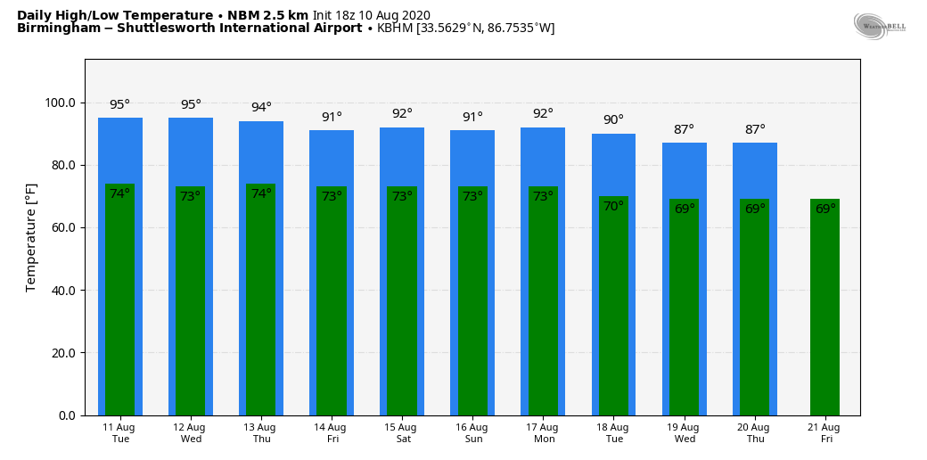
REST OF THE WEEK: We expect a slow increase in the number of scattered showers and storms daily through the rest of the week; the highest coverage will likely come on Thursday and Friday. Most of the storms, but not necessarily all, will come from about 1 until 11 p.m. Heat levels slowly back down; look for low to mid 90s Tuesday, low 90s Wednesday and highs in the 88- to 92-degree range Thursday and Friday. As always with summer storms, rain distribution will be very uneven, but some spots could easily see 1 inch of rain or more between now and Friday.
THE ALABAMA WEEKEND: Look for scattered to numerous showers and storms Saturday, but not an all-day kind of rain. The sky will be occasionally cloudy with a high between 88 and 92. Showers become fewer in number Sunday as drier air slips into the state; the sky will be partly sunny with a high around 90 degrees.
NEXT WEEK: For now it looks like a rather routine week for summer with partly sunny days and the usual risk of random, scattered, mostly afternoon and evening showers and storms daily. Highs will be in the upper 80s and low 90s.
MIDWEST DERECHO: A long-lasting line of severe storms blasted through Iowa this afternoon with winds of 60-100 mph; those storms are moving into the Chicago area at 3:15 this afternoon.
TROPICS: A broad area of low pressure almost 700 miles west-southwest of the Cabo Verde Islands is not showing signs of additional organization, with satellite-derived wind data from this morning still showing the system having an elongated surface circulation. However, environmental conditions are expected to be somewhat conducive for development to occur, and a tropical depression could form during the next couple of days while the disturbance moves generally westward to west-northwestward at 10 to 15 mph across the tropical Atlantic. Conditions are forecast to become less conducive for development by the end of the week.
The rest of the Atlantic basin, including the Gulf of Mexico, is quiet for now.
ON THIS DATE IN 1856: A hurricane destroyed Isle Dernieres or Last Island, a pleasure resort south-southwest of New Orleans. The highest points of the island were under five feet of water. The resort hotel was destroyed, along with the island’s gambling establishments. More than 200 people perished, and the island lost all its vegetation and split in half. Only one cow remained on the island after the catastrophe. The Last Island is now just a haven for pelicans and other seabirds. The steamer Nautilus foundered during the storm. The lone survivor clung to a bale of cotton and washed ashore sometime later.
BEACH FORECAST: Click here to see the AlabamaWx Beach Forecast Center page.
WEATHER BRAINS: You can listen to our weekly 90-minute show anytime on your favorite podcast app. This is the show all about weather featuring many familiar voices, including the meteorologists at ABC 33/40.
CONNECT: You can find me on the major social networks:
Facebook
Twitter
Instagram
Pinterest
Snapchat: spannwx
For more weather news and information from James Spann and his team, visit AlabamaWx.


