James Spann: A few strong storms possible in Alabama through tonight
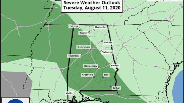
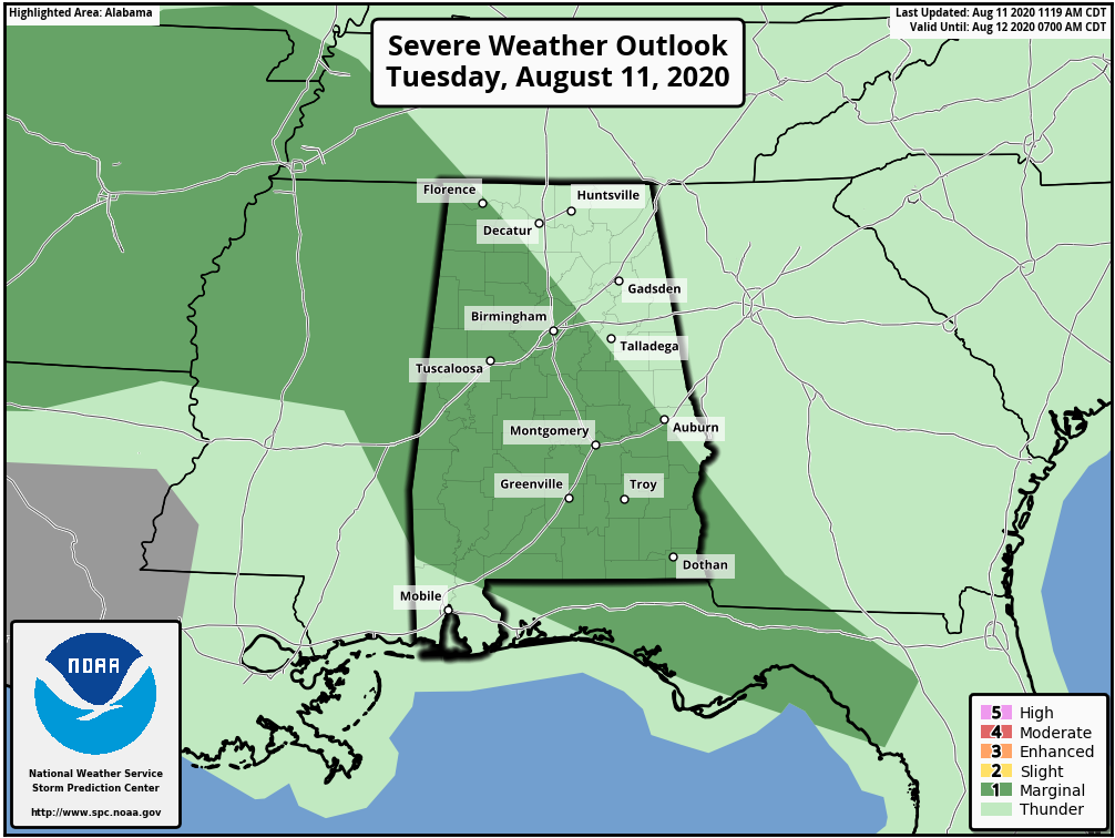
RADAR CHECK: A number of showers and strong thunderstorms are in place across Alabama this afternoon; the heaviest cluster of storms at 3 p.m. was near Montgomery, where a severe thunderstorm warning was in effect. We are also watching other storms over Tennessee and Arkansas; those will likely move into Alabama tonight, and they could be strong to severe. The Storm Prediction Center has a marginal risk (level 1 of 5) in place for much of Alabama through tonight.
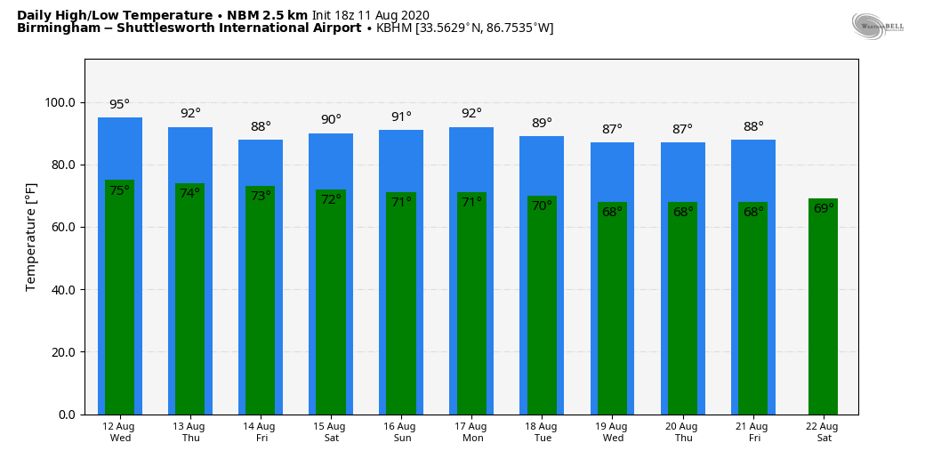
Away from the storms, the sky is partly sunny with temperatures mostly in the low 90s across Alabama this afternoon.
REST OF THE WEEK: We expect scattered to numerous showers and storms Wednesday and Thursday as a rather unstable air mass remains in place. Most (but not all) of the thunderstorms will come from 1 until 11 p.m., and rain could be heavy in spots. Scattered showers are still possible Friday, but they should be a little fewer in number. The high will be in the low 90s Wednesday and in the 88- to 91-degree range Thursday and Friday.
THE ALABAMA WEEKEND: The trend toward drier weather continues, with just a few isolated showers Saturday and mostly dry Sunday. Look for a good supply of sunshine both days with highs remaining between 88 and 91 degrees.
NEXT WEEK: A few showers are possible Monday and Tuesday; then rain chances look fairly low over the latter half of the week with temperatures below average, highs in the 80s and lows in the 60s.
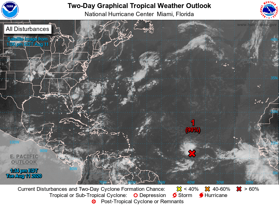
TROPICS: A low-pressure system is over the eastern tropical Atlantic, more than a thousand miles east of the Lesser Antilles. Shower and thunderstorm activity decreased somewhat this morning, but new activity is forming near the system’s center of circulation. If these storms persist, advisories will likely be initiated on a tropical depression later today or tonight. Even if a depression does not form by tonight, environmental conditions are expected to become more conducive for development while the system moves west-northwestward around 15 mph during the next couple of days. Conditions are expected to become less conducive for development by the end of the week.
If a tropical depression or storm forms, it will likely gain latitude and pass just north of the Leeward Islands in four to five days. Then it should recurve into the open Atlantic well east of the U.S. The rest of the Atlantic basin is quiet, including the Gulf of Mexico.
ON THIS DATE IN 1999: An F2 tornado touched down in the metropolitan area of Salt Lake City. The tornado lasted 10 minutes, killed one person, injured more than 80 people and caused more than $170 million in damages. It was the most destructive tornado in Utah’s history and awakened the entire state’s population to the fact that the Beehive State does experience tornadoes.
BEACH FORECAST: Click here to see the AlabamaWx Beach Forecast Center page.
WEATHER BRAINS: You can listen to our weekly 90-minute show anytime on your favorite podcast app. This is the show all about weather featuring many familiar voices, including the meteorologists at ABC 33/40.
CONNECT: You can find me on the major social networks:
Facebook
Twitter
Instagram
Pinterest
Snapchat: spannwx
For more weather news and information from James Spann and his team, visit AlabamaWx.


