Scott Martin: Showers, storms for Alabama today, potential tropical moisture by midweek
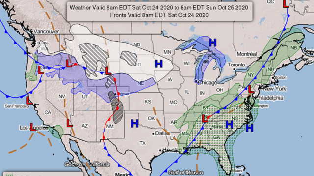
TODAY: A cold front will continue to move through Alabama through the daylight hours, bringing showers and thunderstorms along and ahead of it. The front will be out of the state tonight, but showers may not end for southeastern Alabama until around midnight. We could see a few strong storms with gusty winds and small hail, but severe weather is not expected. Highs will range from the upper 60s in the northwest to the lower 80s in the southeast.
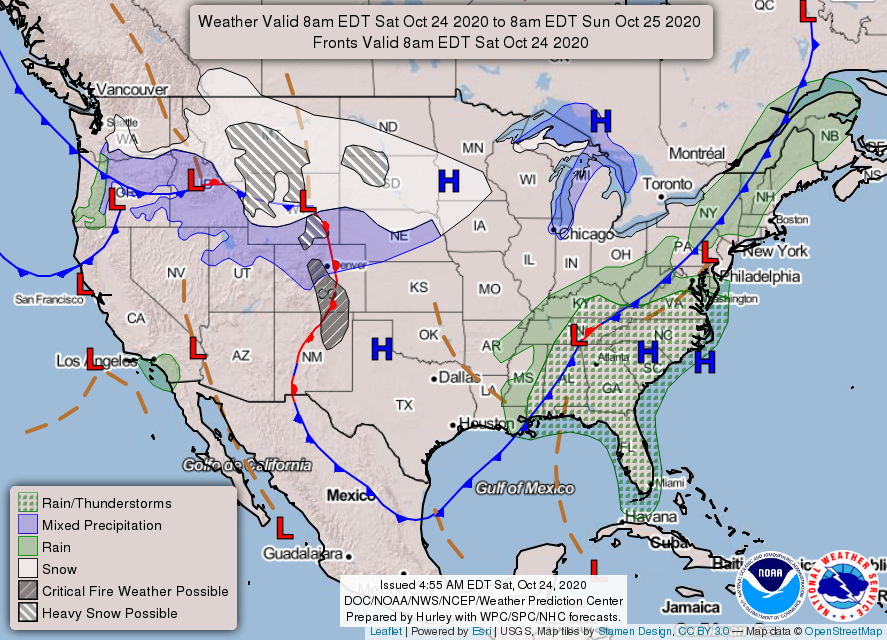
SUNDAY: While Sunday will be dry, we will have clouds blocking out a good bit of the sunshine to end the weekend. Afternoon highs will be in the mid-70s to the lower 80s from northwest to southeast.
MONDAY: The start to the work week will be dry and warm with a good bit of sunshine, but another system associated with a cold front will be approaching from the west. Highs will be in the upper 70s to the mid-80s.
TUESDAY: The cold front makes it into Alabama by Tuesday morning, and that will bring a chance of a few scattered showers and thunderstorms throughout the day. Afternoon highs will be in the mid-70s to the mid-80s.
WEDNESDAY: We start to see some moisture associated with a potential tropical depression moving into the southern half of the state on Wednesday, which will bring increased rain chances for a bit. This model run does not have the system making it to a tropical storm, but we’ll be watching it. Highs will be in the lower 70s to the lower 80s.
THURSDAY: The Global Forecast System has the tropical low moving through the northern parts of the state during the day Thursday, keeping us wet at times throughout the daylight hours, but most of the activity will be out of here by late night. The heaviest rainfall looks to occur over the extreme northern parts of central Alabama and all of north Alabama, where projected totals are 2 to 3 inches. If this pans out, we may have to watch for localized flash flooding. Since this is tropical in nature, this will probably change throughout the next few days, so stay tuned. Highs will be in the 70s.
FRIDAY: A cold front will help to push the tropical moisture out before the start of the day, and it will bring cooler temperatures to Alabama to end the work week. We look to have plenty of sunshine with highs reaching the mid-60s to the mid-70s.
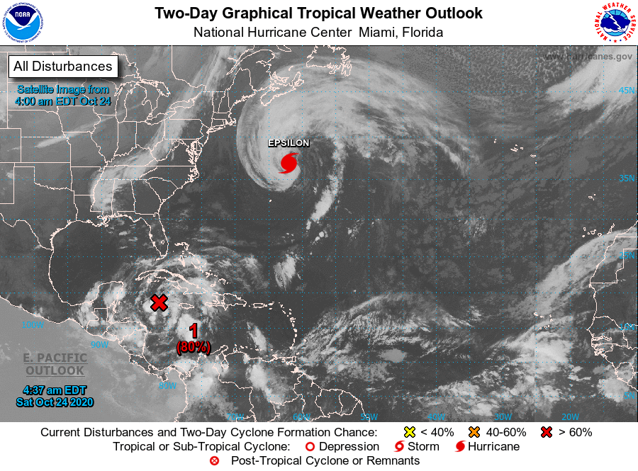
INVEST 95L: We are seeing an increase in organization over the Caribbean Sea just south of the Grand Cayman Island, and the environment will remain favorable for further development. We may have a tropical depression form within the next 24-48 hours while the system drifts northward to northwestward. For now, the National Hurricane Center has it moving into the southern Gulf of Mexico by the beginning of the work week. In the latest ensemble guidance, most members have the system moving across the Gulf of Mexico and potentially making landfall somewhere on the northern Gulf Coast within the next five days. Intensity guidance shows us that most members keep it as a tropical storm. It will be named Zeta if it does make it to tropical storm strength. We’ll have a much better idea once it gets better organized, so stay tuned.
HURRICANE EPSILON: Epsilon continues to move farther out to sea and away from any land. At 4 a.m., the center was around 355 miles north-northeast of Bermuda and was moving north-northeast at 12 mph. The maximum sustained winds were at 75 mph. It will experience gradual weakening over the weekend and will become post-tropical possibly by Sunday afternoon.
ON THIS DATE IN 2005: Hurricane Wilma reached the U.S. coastline near Everglades City in Florida with maximum sustained winds near 120 mph. The hurricane accelerated across south Florida and the Miami-Fort Lauderdale area, exiting the coast later the same day. There were 10 fatalities in Florida and nearly 6 million people lost power, the most widespread outage in Florida history. Preliminary estimates of insured losses in Florida were over $6 billion, while uninsured losses were over $12 billion.
BEACH FORECAST CENTER: Get the latest weather and rip current forecasts for the beaches from Dauphin Island to Panama City Beach, Florida, on our Beach Forecast Center page. There, you can select the forecast of the region you are interested in.
For more weather news and information from James Spann, Scott Martin and other members of the James Spann team, visit AlabamaWx.


