James Spann: Tropical rain returns to Alabama on Wednesday
James Spann has the Alabama forecast for Tropical Storm Zeta from Alabama NewsCenter on Vimeo.
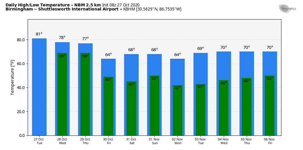
A FEW SHOWERS LATER TODAY: Alabama’s weather will remain generally quiet today, although a few scattered showers are possible this afternoon as moisture levels begins to rise. We expect a mix of sun and clouds with a high around 80 degrees for most communities.
ZETA ON THE WAY: Early this morning Tropical Storm Zeta is over the tip of the Yucatan Peninsula with winds of 70 mph. It will regain hurricane strength as it moves into the Gulf of Mexico later today, and the National Hurricane Center still expects landfall over southeast Louisiana Wednesday evening as either an upper-end tropical storm or minimal hurricane.
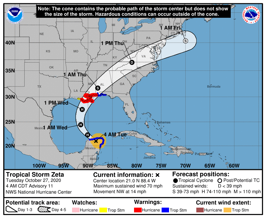
The remnant circulation will move quickly across Alabama Wednesday night.
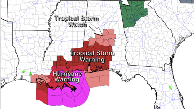
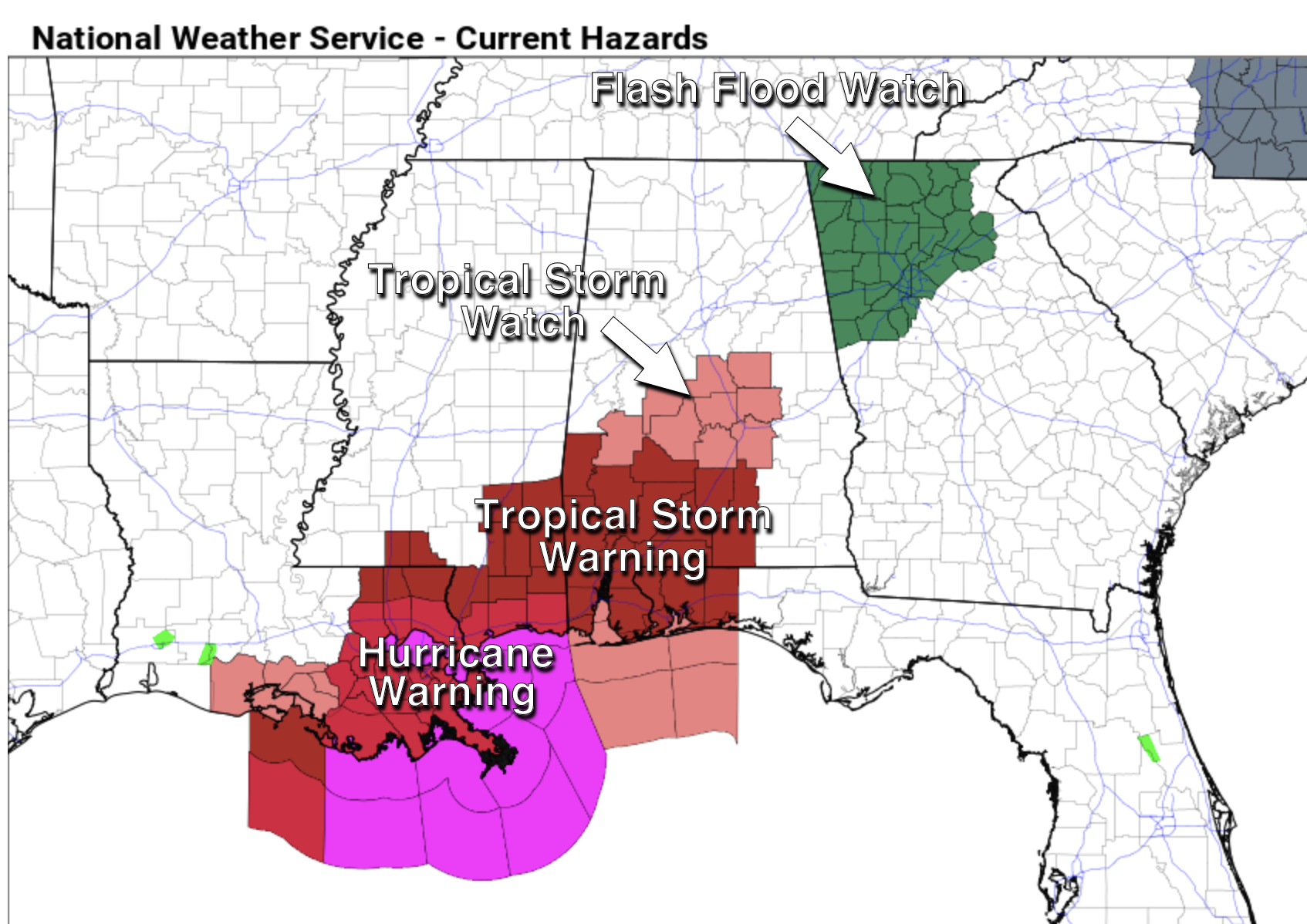
ON THE COAST: A Tropical Storm Warning is in effect for the Alabama Gulf Coast and the Florida Panhandle as far east as the Walton-Okaloosa county line. To the west, a Hurricane Warning is in effect for coastal Mississippi and southeast Louisiana.
A storm surge of 2-4 feet is forecast Wednesday night in the Tropical Storm Warning area, including Mobile Bay. Winds could gust as high as 50 mph over Mobile and Baldwin counties. Wind gusts to 40 mph are possible at places like Pensacola and Navarre Beach.
Dangerous rip currents are likely along the coast today and Wednesday, but the surf will improve Thursday. A few isolated waterspouts or brief tornadoes are possible Wednesday afternoon and night.
INLAND ALABAMA: A Tropical Storm Warning is in effect for parts of south and southwest Alabama, where winds could gust to 45 mph Wednesday night. A Tropical Storm Watch is in effect for parts of central Alabama for potential winds of 40-45 mph Wednesday night. While a few scattered trees could come down, we are not expecting widespread tree or power line damage.
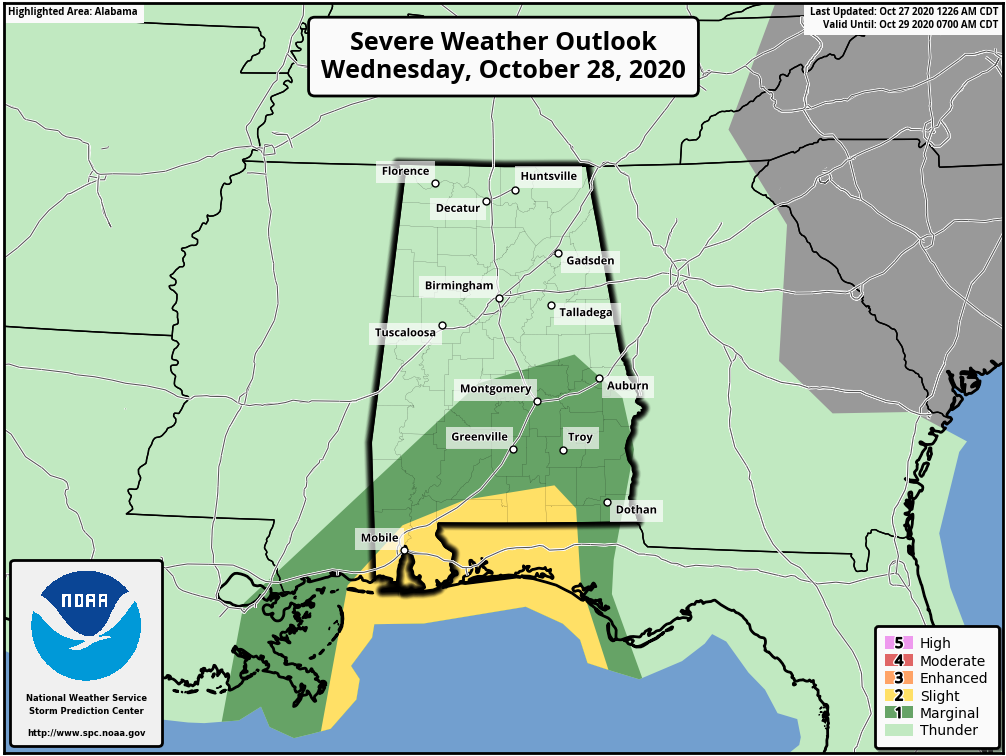
Rain amounts of 2-4 inches are likely for much of the state, with lighter amounts over the southeast tip of the state. While some isolated issues are possible, for now we are not expecting any serious flooding across the state due to the fast movement of Zeta. Most of the rain directly associated with the tropical system will come Wednesday and Wednesday night; the rain ends early in the day Thursday as the remnant circulation quickly moves east of the state.
Also, a few isolated, brief tornadoes are possible Wednesday night over the southern half of the state. The higher tornado probabilities are south of U.S. 84.
FRIDAY AND THE WEEKEND: The weather will be delightful Friday and Saturday — lots of sunshine both days with lows mostly in the 40s and highs between 66 and 72. Scattered clouds arrive Sunday, and a few isolated showers are possible as an upper trough passes overhead, but most places will remain dry. The high Sunday will be in the low 70s.
NEXT WEEK: For now much of the week looks dry with seasonal temperatures.
TIME CHANGE: We go back on Standard Time this weekend; set the clocks back one hour before going to bed Saturday night. Sunset time for Birmingham Sunday afternoon is 4:54 p.m.
ON THIS DATE IN 2006: A waterspout came ashore and produced EF1 tornado damage in Apalachicola. The tornado cut a path approximately 1 mile long and more than 100 yards wide, damaging a fast food restaurant, school, hospital, electric power substation and dozens of homes.
BEACH FORECAST: Click here to see the AlabamaWx Beach Forecast Center page.
WEATHER BRAINS: You can listen to our weekly 90-minute show anytime on your favorite podcast app. This is the show all about weather featuring many familiar voices, including the meteorologists at ABC 33/40.
CONNECT: You can find me on all of the major social networks:
Facebook
Twitter
Instagram
Pinterest
Snapchat: spannwx
For more weather news and information from James Spann and his team, visit AlabamaWx.


