James Spann: Showers for Alabama Tuesday, Wednesday
James Spann has the Alabama forecast to start the work week from Alabama NewsCenter on Vimeo.
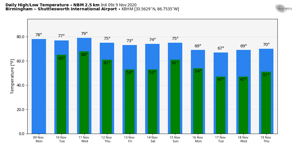
MILD NOVEMBER WEATHER: Most of Alabama will stay dry today; with a mix of sun and clouds we project a high between 75 and 78 degrees for most communities this afternoon. The average high for Birmingham on Nov. 9 is 68.
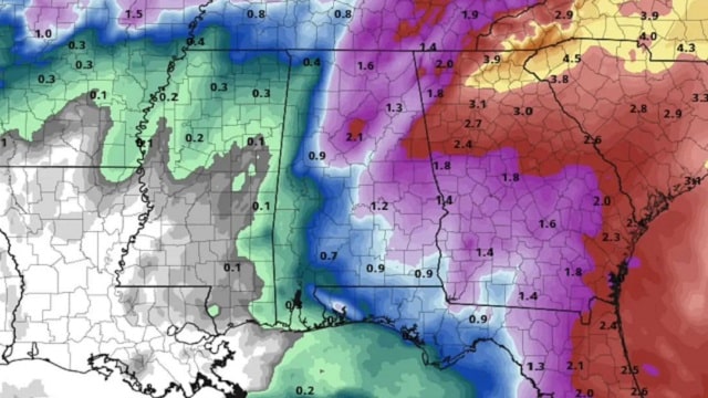
Moisture levels will increase over the next 48 hours, and we will bring in a chance of showers Tuesday afternoon. Showers will remain possible Tuesday night and Wednesday ahead of a cold front. A few isolated thunderstorms are possible as well, but no severe storms are expected. Rain amounts will be generally in the one-half-inch range before drier air returns Wednesday night. Highs hold in the mid to upper 70s Tuesday and Wednesday.
Thursday and Friday will feature a good supply of sunshine both days with lower humidity levels and cooler nights. While highs will remain in the 70s, morning lows will drop into the upper 40s and low 50s by Friday.
THE ALABAMA WEEKEND: There is great uncertainty in the forecast for the weekend as models diverge significantly with Tropical Storm Eta. For now we will leave the weekend generally dry, with just an outside risk of a shower Sunday, but the forecast could change dramatically in the days ahead. Highs will hold in the 70s.
NEXT WEEK: With the model struggles it will be hard to be specific about the weather situation next week, but the pattern favors some potential for highs to drop into the 60s by midweek, with lows in the 40s.
TROPICAL STORM ETA: Eta is in the southeast Gulf of Mexico this morning with sustained winds of 65 mph. It could become a minimal hurricane Tuesday and Wednesday before weakening again later in the week. Steering currents collapse, and the system will meander around the southern or eastern Gulf of Mexico for most of the week.
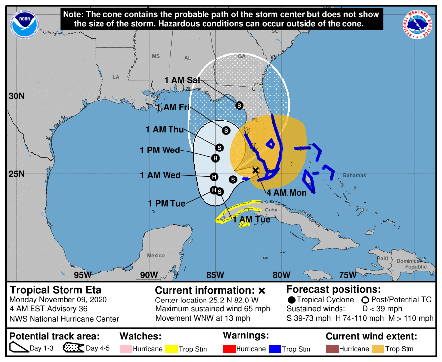
There is major model divergence on the future of Eta. The American global model (the GFS) ultimately pushes it to the west and the north, while the European model (ECMWF) moves the system toward north Florida, north of Tampa, late in the week. The National Hurricane Center track could change significantly as we get better clarity in coming days. It is still too early to know what, if any, impact Eta will have on Alabama and the central Gulf Coast. If there is a direct impact it will involve rain, and most likely not wind.
Elsewhere in the tropics, showers and thunderstorms associated with a non-tropical low-pressure system several hundred miles southwest of the Azores continue to get gradually better organized. Further development is expected, and a tropical or subtropical storm will likely form during the next few days while the system moves eastward or east-northeastward over the northeastern Atlantic Ocean. This one is no threat to the U.S.
A tropical wave is forecast to move over the central Caribbean Sea, where an area of low pressure could form in a couple of days. Environmental conditions are forecast to be conducive for development, and a tropical depression could form late this week or over the weekend while the system moves slowly westward. It’s too early to know whether this will affect the Gulf of Mexico or the U.S.
ON THIS DATE IN 1926: An estimated F3 to F4 tornado tore through La Plata, Maryland, killing 14 people at a small school. This storm killed 17 people and injured 65 others.
BEACH FORECAST: Click here to see the AlabamaWx Beach Forecast Center page.
WEATHER BRAINS: You can listen to our weekly 90-minute show anytime on your favorite podcast app. This is the show all about weather featuring many familiar voices, including the meteorologists at ABC 33/40.
CONNECT: You can find me on the major social networks:
For more weather news and information from James Spann and his team, visit AlabamaWx.


