James Spann: Alabama stays dry through Friday; Iota nearing Central American coast
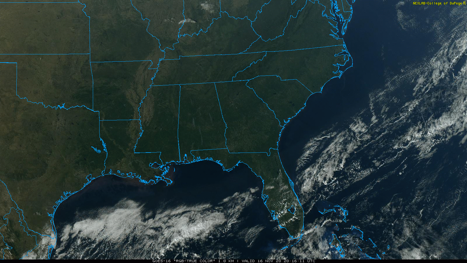
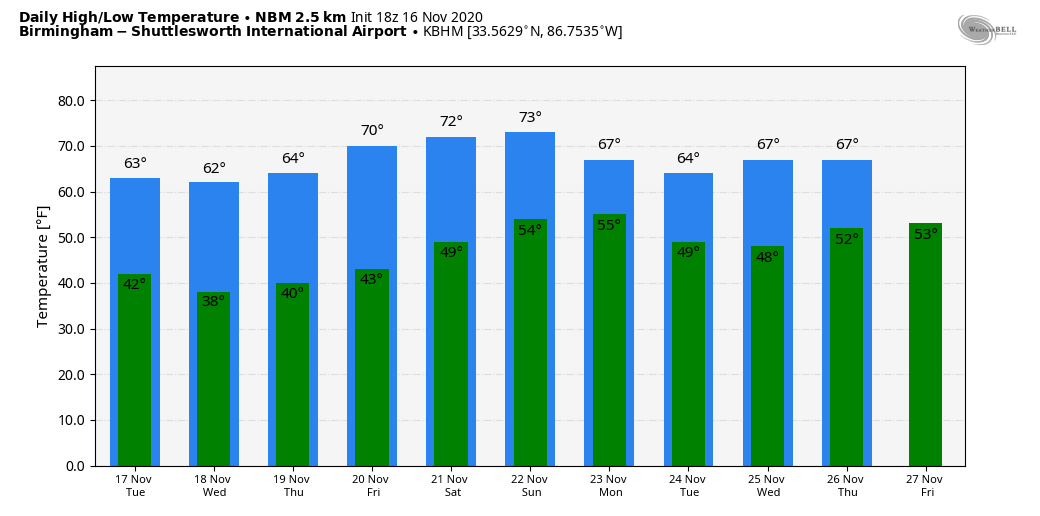
NOT A CLOUD IN THE SKY: A very dry air mass is in place across Alabama this afternoon; the sky is sunny statewide with temperatures in the 60s. Tonight will be clear and chilly again, with lows between 30 and 40 degrees for most communities over the northern half of the state.
Alabama’s weather won’t change much for the rest of the week. Look for sunny, cool days and clear, cold nights, with highs in the 60s and lows mostly in the 30s. Many places will see frost, and colder spots will see a freeze, much like what we experienced early today.
THE ALABAMA WEEKEND: Saturday will be mostly sunny and warmer, with a high in the low 70s. Moisture begins to increase Sunday, and we will introduce the chance of a few isolated showers, but nothing really widespread. The high Sunday will be between 72 and 75 degrees, almost 10 degrees above average for this time of the year.
THANKSGIVING WEEK: A cold front will bring the risk of a few scattered showers Monday, followed by generally dry weather for the rest of the week. Highs will be mostly in the 60s, with lows in the 30s and 40s. The bottom line is that we don’t see any really high-impact weather events for Alabama for the next 10 days or so.
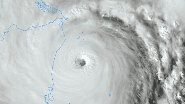
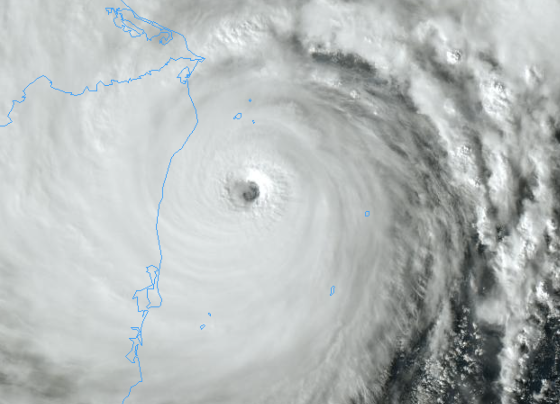
IOTA NEARING LANDFALL: Extremely dangerous Hurricane Iota is now at Category 5 strength with sustained winds of 160 mph. Iota is expected to remain a catastrophic Category 5 hurricane when it approaches the coast of Nicaragua tonight. Extreme winds and a life-threatening storm surge are expected along portions of the coast of northeastern Nicaragua, where a Hurricane Warning is in effect. Through Thursday, heavy rainfall from Iota will likely lead to life-threatening flash flooding and river flooding across portions of Central America. Flooding and mudslides in Honduras and Nicaragua could be exacerbated by Hurricane Eta’s recent effects there, resulting in significant to potentially catastrophic impacts.
Also, a new area of low pressure could form in a couple of days over the central or southwestern Caribbean Sea. Environmental conditions should favor some subsequent development, and a tropical depression could form by the end of the week while the system moves slowly westward or west-southwestward across the southwestern Caribbean Sea. For now this looks like it will not be a threat to the Gulf of Mexico or the U.S.
ON THIS DATE IN 1989: Snow squalls were moving through north Alabama the day following an F4 tornado that killed 21 people in Huntsville.
ON THIS DATE IN 2006: An early morning F3 tornado killed eight people, injured 20 others and left 100 people homeless in Riegelwood, North Carolina. This storm was the second-deadliest tornado in the state in the past 50 years.
BEACH FORECAST: Click here to see the AlabamaWx Beach Forecast Center page.
WEATHER BRAINS: You can listen to our weekly 90-minute show anytime on your favorite podcast app. This is the show all about weather featuring many familiar voices, including the meteorologists at ABC 33/40.
CONNECT: You can find me on the major social networks:
For more weather news and information from James Spann and his team, visit AlabamaWx.


