James Spann: Pleasant days, cold nights, dry weather for Alabama through Saturday
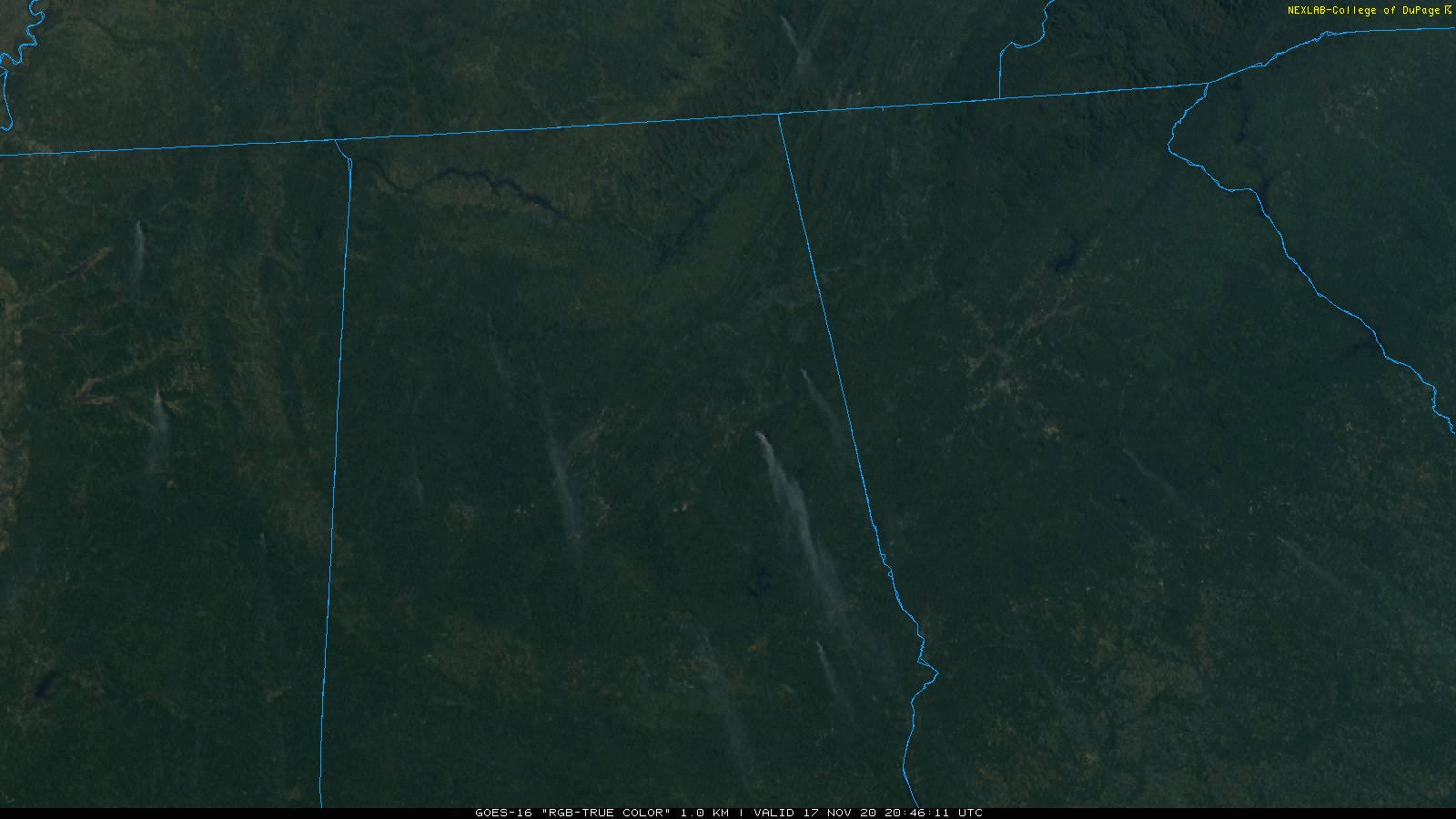
SEVERE CLEAR: Another day with a cloudless sky across Alabama. All you can see on weather satellite images are a few prescribed burns with smoke plumes running from north to south. Temperatures are in the 60s over the northern half of the state and the low 70s over far south Alabama. A picture-perfect fall day.
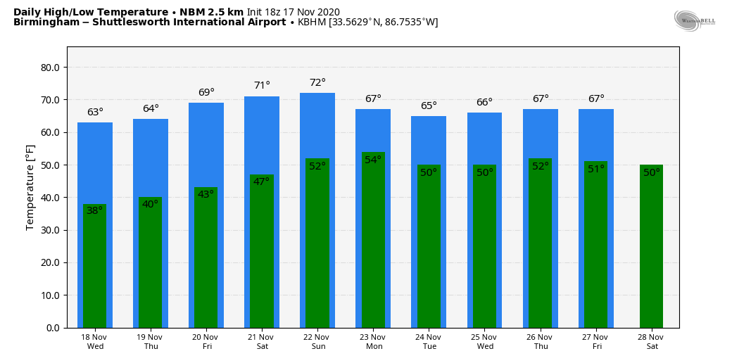
Tonight will be clear and cold; a freeze is possible across north Alabama, with frost down into the southern counties of the state. Lows will range from 25 to 35 for most communities early Wednesday morning.
We stay dry for the rest of the week; look for a high in the low to mid 60s Wednesday and Thursday, followed by upper 60s Friday.
THE ALABAMA WEEKEND: Saturday will be dry with a good supply of sunshine; the high will be in the low 70s. Moisture levels will begin to rise Sunday, and a few isolated showers are possible. Otherwise, the day will be partly sunny with a high between 70 and 74 degrees.
THANKSGIVING WEEK: A front will stall out near north Alabama early in the week. We will mention a chance of isolated showers Monday; new model guidance suggests showers become more widespread Tuesday through Thanksgiving with the stalled boundary nearby, followed by drier air Friday. Highs during the week should be mostly in the 60s.
TROPICS: Iota is now a tropical storm, weakening inland over Central America after making landfall last night on the coast of Nicaragua as a Category 4 hurricane. Elsewhere, A broad area of low pressure could form in a day or so over the southwestern Caribbean Sea. Environmental conditions do not appear to be as conducive for development as once thought, but slow development is possible over the next several days while the system moves slowly westward or west-southwestward across the southwestern Caribbean Sea. Regardless of tropical cyclone formation, areas of heavy rain are possible during the next several days from Nicaragua southward across Central America and into Colombia. These rains could cause new flooding concerns, especially across previously inundated areas.
The Gulf of Mexico will stay quiet for the next seven to 10 days.
ON THIS DAY IN 1957: Just after noon, tornadoes started touching down in eastern Mississippi. Two people were killed by a strong tornado that cut a 15-mile path from near Macon. Mississippi. Then, a little after 3 p.m., a violent tornado touched down 6 miles northwest of Jasper. Mr. and Mrs. Wilford Bradford had just built a new home there. The ranch home was blown 150 feet and smashed to bits. The couple and their 14-year-old daughter were killed. One other person was killed along the 5-mile path that carried the tornado near Saragossa and Manchester. An amateur photographer snapped a dramatic picture of the tornado that ran on front pages of newspapers all over the country.
BEACH FORECAST: Click here to see the AlabamaWx Beach Forecast Center page.
WEATHER BRAINS: You can listen to our weekly 90-minute show anytime on your favorite podcast app. This is the show all about weather featuring many familiar voices, including the meteorologists at ABC 33/40.
CONNECT: You can find me on the major social networks:
For more weather news and information from James Spann and his team, visit AlabamaWx.


