James Spann: Brighter days for Alabama Thursday, Friday
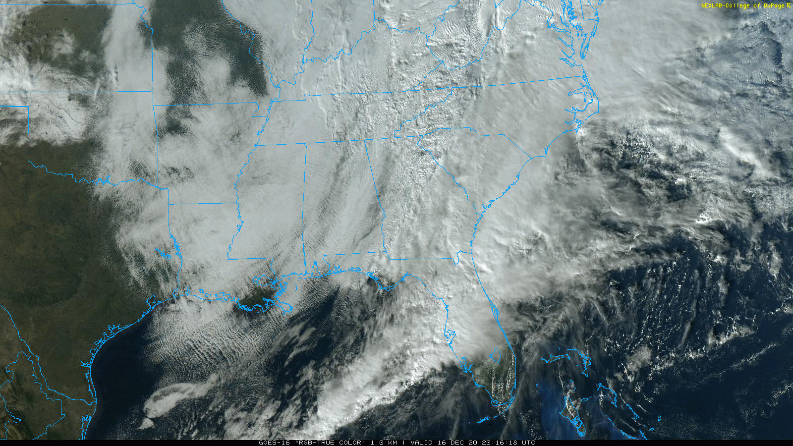
CLOUDY, COLD AFTERNOON: Most of the significant rain has moved out of Alabama this afternoon, but clouds linger. Temperatures remain well below average for mid-December in Alabama, between 38 and 45 degrees over the northern half of the state. Clouds will hang tough through the night for most places, and we expect a low in the upper 20s early Thursday as cold air spills southward.
TO THE NORTHEAST: The major winter storm is unfolding as forecast; heavy snow will continue tonight into Pennsylvania and the Northeast. Amounts exceeding 1 foot are likely for New York City, and around 10 inches for Boston. This is a high-impact winter storm that will be very disruptive.
THURSDAY THROUGH THE WEEKEND: The sky becomes mostly sunny across Alabama Thursday, but the weather stays fairly cold, with a high in the mid to upper 40s. We drop well down in the 20s early Friday morning, but then we warm into the mid 50s Friday afternoon with a strong December sun. Clouds return Saturday, and we will deal with some light rain at times Saturday afternoon and Saturday night. Moisture will be very limited, and rain amounts should be a quarter of an inch or less. Sunday will be mostly cloudy but generally dry. Highs will be in the 50s over the weekend.
CHRISTMAS WEEK: The weather looks dry Monday through Wednesday; the high will be in the upper 50s Monday, then close to 60 degrees Tuesday and Wednesday. A cold front will pass through Thursday with a chance of showers, followed by sharply colder air for Christmas Day. We are expecting highs in the 40s and lows in the 20s. For now we are not expecting any significant chance of snow with the frontal passage Thursday or Thursday night, but we are more than a week away from that and things could always change.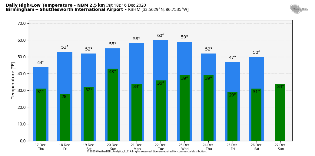
TWENTY YEARS AGO TODAY: An F4 tornado tore through southern Tuscaloosa, killing 11 people and injuring more than 100. Nine of the fatalities occurred in mobile homes, one in a vehicle and one in a commercial building converted to residential use. Six of those killed were females and five were males. Ages ranged from 16 months to 83 years. The tornado was on the ground for 18 miles, all within Tuscaloosa County. The tornado path was estimated to be 750 yards wide at its maximum intensity.
An excellent warning for the tornado was issued at 12:40 p.m. on that deadly Saturday, 14 minutes before the twister first touched down in a rural area southwest of Tuscaloosa near the Black Warrior River. The tornado crossed Alabama 69 near Shelton State Community College and Hillcrest High School, destroying a shopping center and many homes. The Bear Creek Trailer Park was hit, where many of the deaths occurred. The tornado moved to the east/northeast, south of Skyland Boulevard, and finally crossed I-59/20 near the Cottondale exit.
We caught the tornado live on our tower camera in Tuscaloosa; we were able to show live video of the twister on ABC 33/40 for almost 10 minutes as it rolled through the southern part of the city.
Later in the day, the same parent storm dropped an F3 tornado that struck the Coats Bend region of Etowah County, near Gadsden, destroying 250 homes and injuring 14 people.
BEACH FORECAST: Click here to see the AlabamaWx Beach Forecast Center page.
WEATHER BRAINS: You can listen to our weekly 90-minute show any time on your favorite podcast app. This is the show all about weather featuring many familiar voices, including the meteorologists at ABC 33/40.
CONNECT: You can find me on the major social networks:
For more weather news and information from James Spann and his team, visit AlabamaWx.