Scott Martin: Showers possible in Alabama tonight into Sunday
THE ALABAMA WEEKEND: We’ll start off today with mainly sunny skies, but clouds with an approaching cold front will move in and build throughout the daytime hours. Light shower activity will start to move in this evening and will keep rain chances in the forecast for the late night through the overnight hours. Highs will be in the 50s.
For Sunday, we’ll continue to have a small chance of a few light showers through the daylight hours, especially over the eastern half of the state. All shower activity will be out of Alabama by Sunday night. Highs will be in the lower 50s to the lower 60s.
THE WORK WEEK: We’ll start off dry with mostly sunny skies and highs in the mid-50s to the lower 60s on Monday. Tuesday will feature near-maximum sunshine with highs in the upper 50s to the lower 60s.
Wednesday will be mostly sunny with highs in the upper 50s to the mid-60s. A strong low will be near the Great Lakes over Minnesota and Wisconsin and an associated cold front will be moving in our direction. Rain chances will move into western Alabama during the evening, continuing through the night.

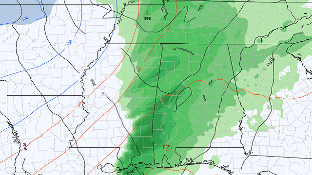
CHRISTMAS EVE AND CHRISTMAS DAY: Christmas Eve will be eventful as this cold front moves through the state. The Global Forecast System shows rain in the early hours with temperatures initially staying above freezing. Just a few hours later, temperatures begin to plummet across the area and snow showers look possible north and west of I-59. The front continues to push rather quickly across the state, and by daybreak the western portions will be drying out with much colder air moving in. By 9 a.m., much of the activity will be out of Alabama, with flurries possible over the extreme eastern parts of the state. By midday nearly all of it will be gone, other than a few flurries possible in the northeast corner of the state.
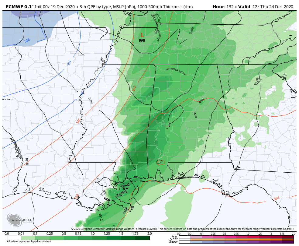
However, the European model is having none of that and is keeping all precipitation as rain throughout the entire event, so we still have some inconsistencies in the forecast. No matter the case, temperatures will be very cold behind the front, with highs at midnight in the mid-40s to the lower 50s, likely dropping into the upper 30s to the lower 50s by daybreak and eventually into the lower 20s to the lower 30s early Christmas morning. If any wet spots remain once we lose the sunshine, slick spots will be likely to develop. We’ll keep you updated.
At this point, Christmas Day is trending not as cold, as we’ll have plenty of sunshine with only a few clouds. Highs will be in the 40s across the state.
For more weather news and information from James Spann, Scott Martin and other members of the James Spann team, visit AlabamaWx.


