James Spann: Much colder tonight, freezing mornings ahead for Alabama
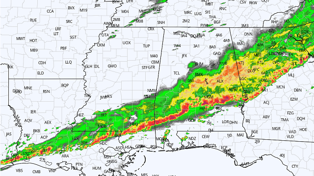
RADAR CHECK: At mid-afternoon rain has ended over north Alabama. Storms continue to push into the southern counties of the state with gusty winds and heavy rain. It has been a very active morning for the state. Some highlights:
- Storm damage in the Nesmith community near the Winston-Cullman county line around 4 a.m. possibly was caused by a brief spin-up tornado.
- Tree damage near Hayden, in Blount County, and Valley Head, in DeKalb County, also possibly was caused by isolated, brief tornadoes.
- Major flooding occurred this morning over parts of Marion and Winston counties, and around Smith Lake. Our Skywatcher at Arley reports 5 inches of rain.
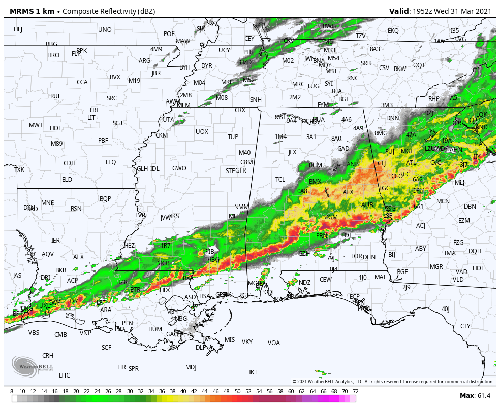
Rain and storms will move out of south Alabama tonight. Much colder air is rolling into the northern counties following the rain; temperatures have dropped into the upper 40s over the northwest part of the state with a brisk northwest wind. The sky will clear tonight and temperatures will drop into the 30- to 36-degree range early Thursday morning.
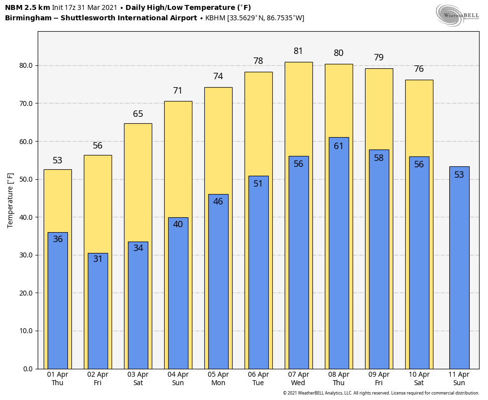
FREEZE WARNING: Thursday will be sunny, windy and very cool, with a high between 55 and 59 degrees. Winds will drop off Thursday night, and by Friday morning we are projecting a low between 22 and 29 degrees over the northern half of the state with a clear sky. Friday will be sunny and cool, with a high in the upper 50s. Another freeze is likely Saturday morning; most places will see a low ranging from 27 to 33 degrees.
The weekend will feature a warming trend. The sky will stay sunny both days; the high will be in the mid 60s Saturday, followed by low 70s Sunday.
NEXT WEEK: The first half of the week looks dry as the warm-up continues. Afternoon temperatures will be close to 80 degrees by Tuesday and Wednesday. A few showers are possible Thursday or Friday, but for now we are not expecting any risk of severe thunderstorms.
ON THIS DATE IN 1973: A devastating tornado took a nearly continuous 75-mile path through north-central Georgia, causing more than $104 million damage. The tornado first touched down near Jonesboro around 5:30 p.m. and carved a 75-mile-long path through Clayton, Henry, Dekalb, Rockdale, Walton, Oconee, Clarke and Oglethorpe counties before finally dissipating 10 miles east-northeast of Athens. Two were killed, one near Conyers and one in Athens. An even stronger tornado (F-4) was spawned from the parent supercell and killed seven along a path from Calhoun Falls to Abbeville, South Carolina.
ON THIS DATE ONE YEAR AGO: Four tornadoes touched down across the Southeast, including an EF-2 that moved through southern Eufaula. The most significant damage occurred in the Country Club of Alabama neighborhood along the south side of Pebble Beach Drive. The tornado crossed the Walter F. George Reservoir along the Chattahoochee River and continued into Quitman County in Georgia.
BEACH FORECAST: Click here to see the AlabamaWx Beach Forecast Center page.
WEATHER BRAINS: You can listen to our weekly 90-minute show any time on your favorite podcast app. This is the show all about weather featuring many familiar voices, including the meteorologists at ABC 33/40.
CONNECT: You can find me on the major social networks:
For more weather news and information from James Spann and his team, visit AlabamaWx.


