James Spann: Scattered storms for Alabama Friday, severe storms likely early Saturday
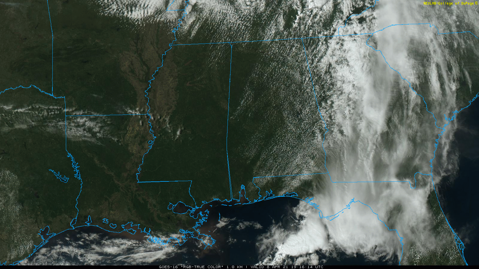
NICE AFTERNOON: The sky has become partly to mostly sunny across most of Alabama this afternoon with temperatures at or over 80 degrees in most places. The sky will be mostly fair tonight, with some low clouds forming after midnight.
FRIDAY: While a few showers could form Friday morning, most of the showers and storms will come during the afternoon and evening, when the air mass becomes very unstable across the Deep South. It will be much like a summer day; the storms will be hit and miss, but where they form they could produce strong winds and possibly some hail. There is no tornado threat Friday afternoon; the high will be in the mid to upper 70s.
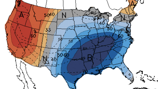
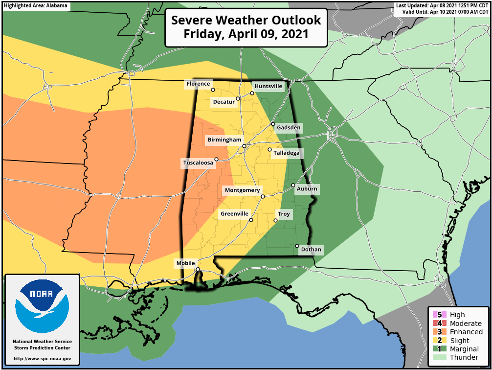
FRIDAY NIGHT/SATURDAY: A nasty line of severe storms is forecast to roll into Alabama after midnight Friday night into Saturday morning. The Storm Prediction Center has defined an enhanced risk (level 3 of 5) as far east as Hamilton, Brent and Grove Hill. There is a slight risk (level 2 of 5) to Huntsville, Anniston, Troy and Foley, and a marginal risk (level 1 of 5) covers the rest of the state. This SPC outlook runs through 7 a.m. Saturday. There will be higher risk over east Alabama after 7 a.m. Saturday.
TIMING: Storms will likely enter northwest Alabama around 3-4 a.m. Saturday and will move out of southeast Alabama by 3 p.m. For the northern half of the state, the rain will be over by mid to late morning and the afternoon will be dry with a clearing sky.
THREATS: This line of storms will be capable of producing damaging winds, maybe even widespread wind damage. A few tornadoes are possible in the line, and some hail as well.
If you have an outdoor event planned for Saturday morning, be aware of this threat and pay attention to radar trends and warnings. Saturday afternoon will be mostly sunny over north and central Alabama with a high in the mid 70s.
SUNDAY AND NEXT WEEK: Look for mostly sunny, mild days and fair nights Sunday through Tuesday. The high will be in the mid 70s Sunday, upper 70s Monday and close to 80 Tuesday. Showers are possible Wednesday, followed by another shot of drier air Thursday and Friday.
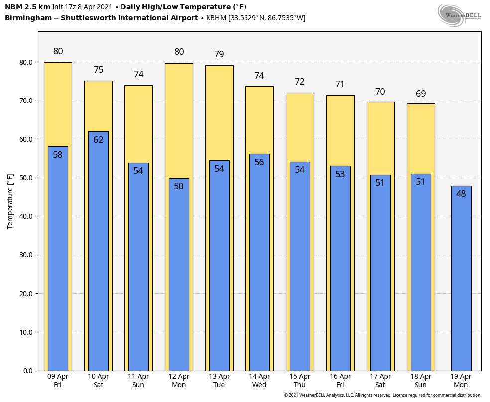
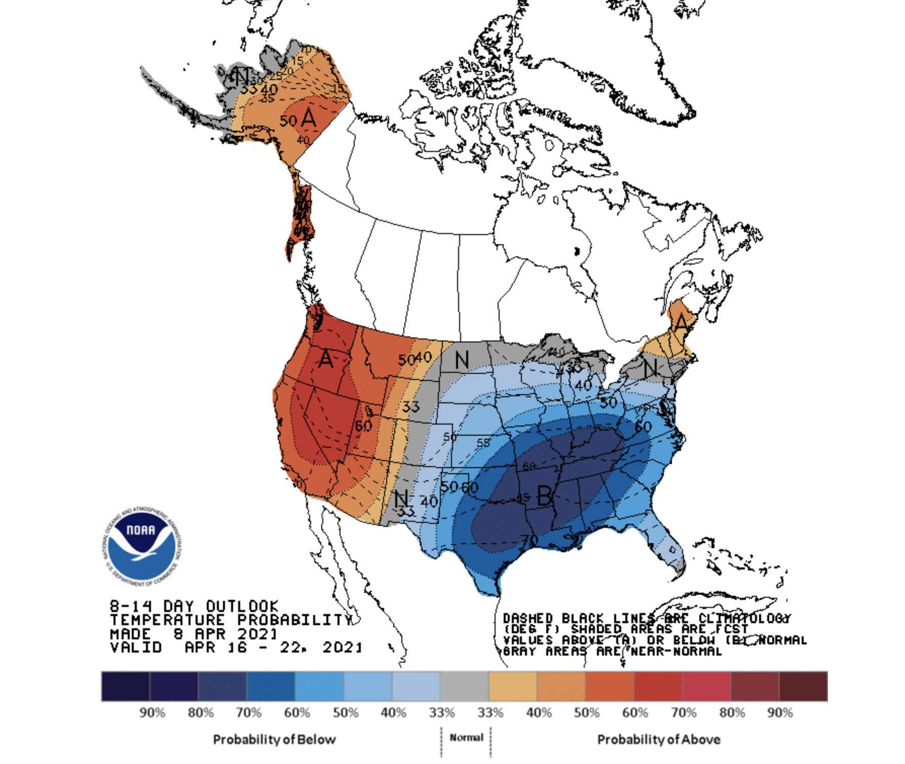
LONG RANGE: The latest Climate Prediction Center guidance continues to suggest below-average temperatures across the Deep South April 16-22. This pattern could bring a few frosty mornings to Alabama. Odds of a major, killing freeze are low, but there could be a few mornings with temperatures well down in the 30s — “blackberry winter,” as some call it.
ON THIS DATE IN 1998: A violent EF-5 tornado cut a 31-mile long, three-quarter-mile wide swath through nine Birmingham suburbs including Oak Grove, Sylvan Springs, Rock Creek, Pleasant Grove, Concord, Pratt City and Edgewater before lifting in the western limits of Birmingham. The worst of the destruction occurred across the Oak Grove, Rock Creek, McDonald Chapel and Pratt City communities.
Thirty-two people were killed in this tornado: three in Oak Grove, 11 near Rock Creek, four in Sylvan Springs, two in Wylam Heights, nine in Edgewater, two in McDonald Chapel and one in West Ensley.
The same parent storm would drop another tornado that killed two more people in St. Clair County near Wattsville.
BEACH FORECAST: Click here to see the AlabamaWx Beach Forecast Center page.
WEATHER BRAINS: You can listen to our weekly 90-minute show any time on your favorite podcast app. This is the show all about weather featuring many familiar voices, including the meteorologists at ABC 33/40.
CONNECT: You can find me on the major social networks:
For more weather news and information from James Spann and his team, visit AlabamaWx.


