James Spann: Mostly dry week ahead for Alabama; frost possible early Thursday
James Spann forecasts dry weather for Alabama from Alabama NewsCenter on Vimeo.
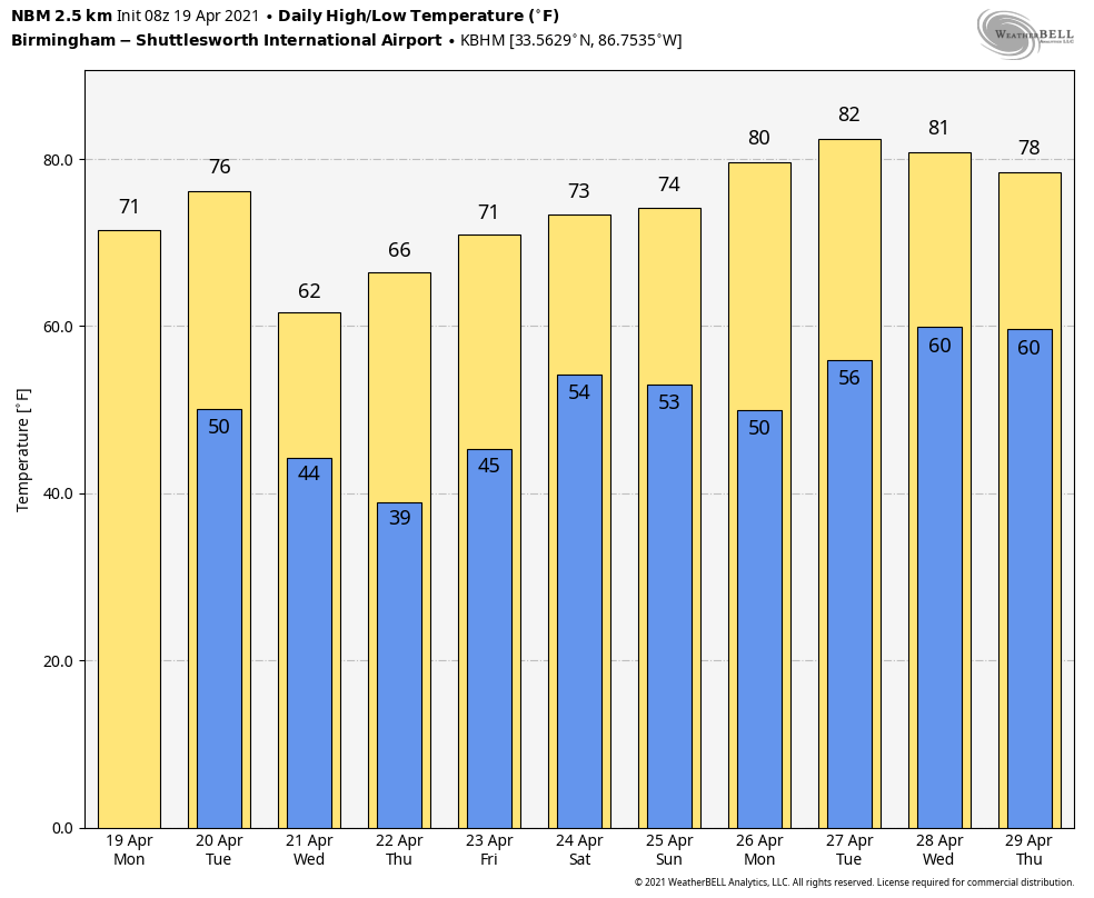
PLEASANT SPRING WEATHER CONTINUES: Dry air covers Alabama this morning. We expect a good supply of sunshine today with a high in the low 70s. Tuesday will be partly to mostly sunny with a high between 72 and 75 degrees, still a little below average for mid-April.
A significant cold front will pass through the state late Tuesday night and early Wednesday. A sprinkle or two is possible over the Tennessee Valley of north Alabama, but this will be a mostly dry frontal passage with very little moisture to work with. Wednesday will be breezy and noticeably cooler; areas north of Birmingham won’t get out of the 50s despite a clearing sky.
FROST EARLY THURSDAY: With a clear sky and light wind, radiational cooling will bring temperatures down into the 30s over much of north and central Alabama early Thursday morning. This kind of setup always brings a big temperature range, with variations mostly due to elevation. Most places will stay above freezing with a low between 33 and 42 degrees, but a few colder spots (like Valley Head and Black Creek) could hit 32 degrees or lower. Frost is likely, even down into a few pockets over south Alabama.
Thursday will be sunny with a high in the low 60s, and we stay dry Friday with a partly sunny sky and a high in the low 70s.
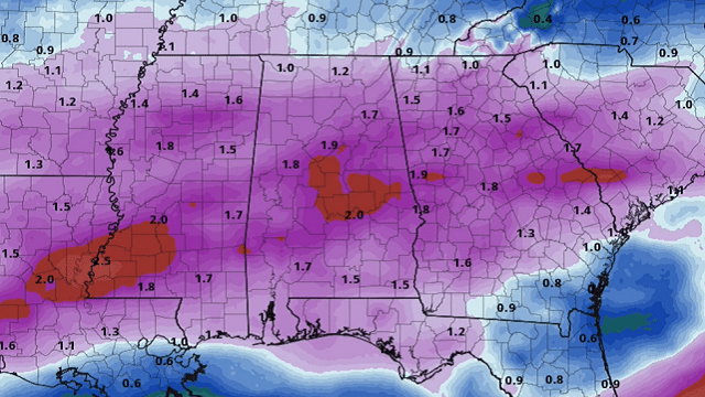
THE ALABAMA WEEKEND: A potent storm system will bring rain and thunderstorms Saturday. A good soaking is likely, with amounts of 1-2 inches. There could be some potential for strong thunderstorms, but the thermodynamic environment is questionable at this point. Dry air returns Sunday with a good supply of sunshine and a high in the 70s.
NEXT WEEK: An upper ridge builds over the region early in the week, which should help temperatures reach the low 80s. Much of the week looks dry, but a cold front will bring some risk of showers late Thursday or Friday.
ON THIS DATE IN 1986: A major storm system produced 10 tornadoes in Texas. One of these virtually annihilated the town of Sweetwater. The tornado struck at the unlikely time of 7:17 a.m. One person was killed and 100 were injured.
ON THIS DATE IN 2020: An early-morning severe thunderstorm produced extensive wind damage across parts of central Alabama. It began in Chilton County (just west of Thorsby and Jemison), where maximum winds were estimated in the range of 80 to 90 mph. The wind damage continued eastward through Coosa County and Tallapoosa County, where maximum winds were estimated in the range of 70 to 80 mph. The damage was the result of straight-line wind, consisting of numerous snapped and uprooted hardwood and softwood trees, trees falling onto structures and trees falling onto campers, especially notable in Wind Creek State Park, where several were crushed.
BEACH FORECAST: Click here to see the AlabamaWx Beach Forecast Center page.
WEATHER BRAINS: You can listen to our weekly 90-minute show any time on your favorite podcast app. This is the show all about weather featuring many familiar voices, including the meteorologists at ABC 33/40.
CONNECT: You can find me on the major social networks:
For more weather news and information from James Spann and his team, visit AlabamaWx.