James Spann: Showers, storms increasing across Alabama this afternoon
RADAR CHECK: Showers and storms are increasing, especially over central and southern Alabama, this afternoon in a moist, unstable air mass. The storms are advancing northward, and many places will see a few passing showers or thunderstorms over the next eight hours. Stronger storms will be capable of producing small hail and strong, gusty winds; the main threat will come from heavy rain and some flooding. All of the thunderstorms will be very efficient rain producers in this tropical air mass.
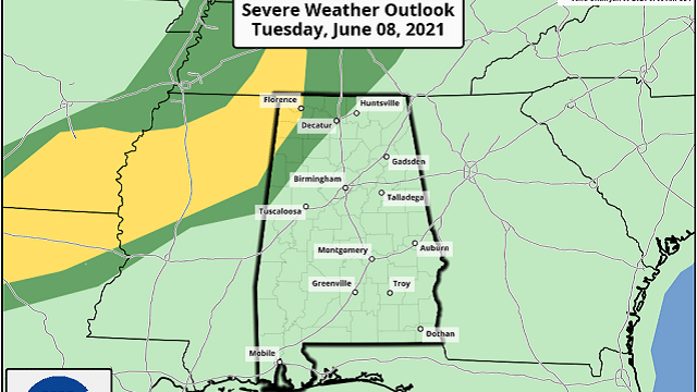
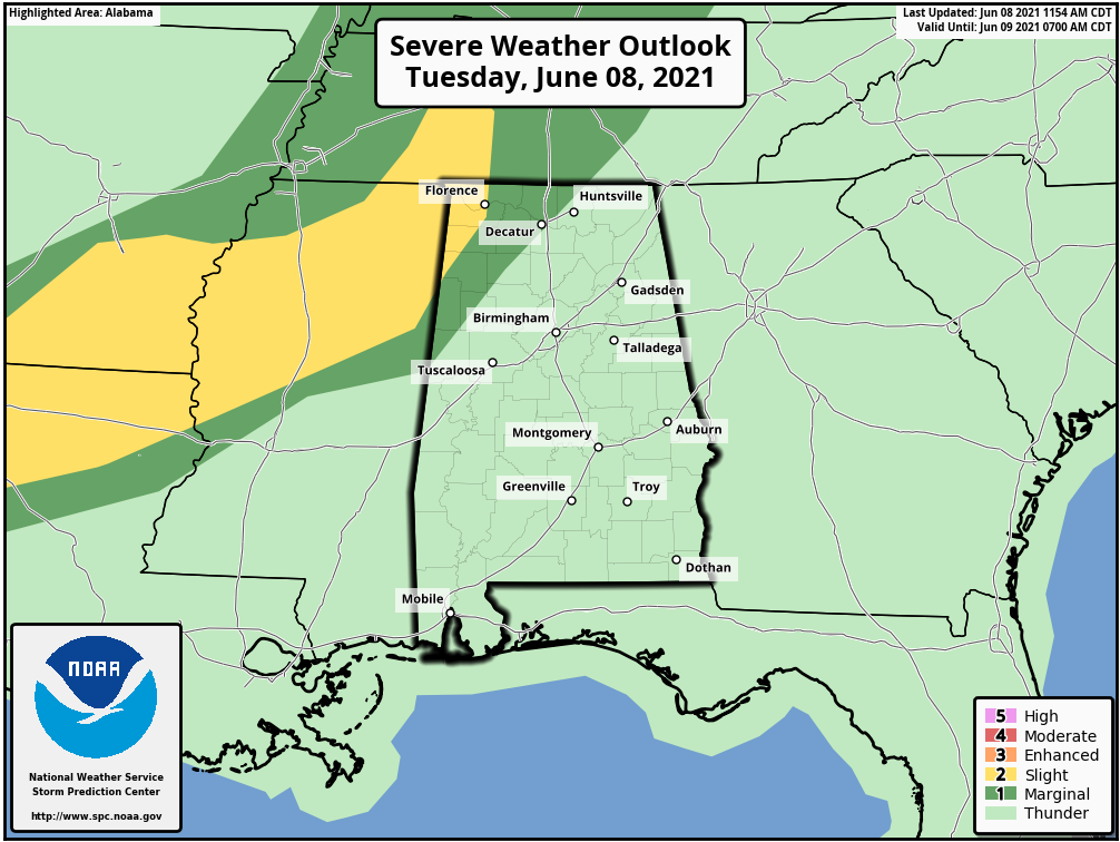
The Storm Prediction Center has introduced a slight risk (level 2 out of 5) of severe thunderstorms for the northwest corner of the state, with a marginal risk (level 1 of 5) as far east as Athens, Double Springs and Reform.
Showers and storms will fade late tonight.
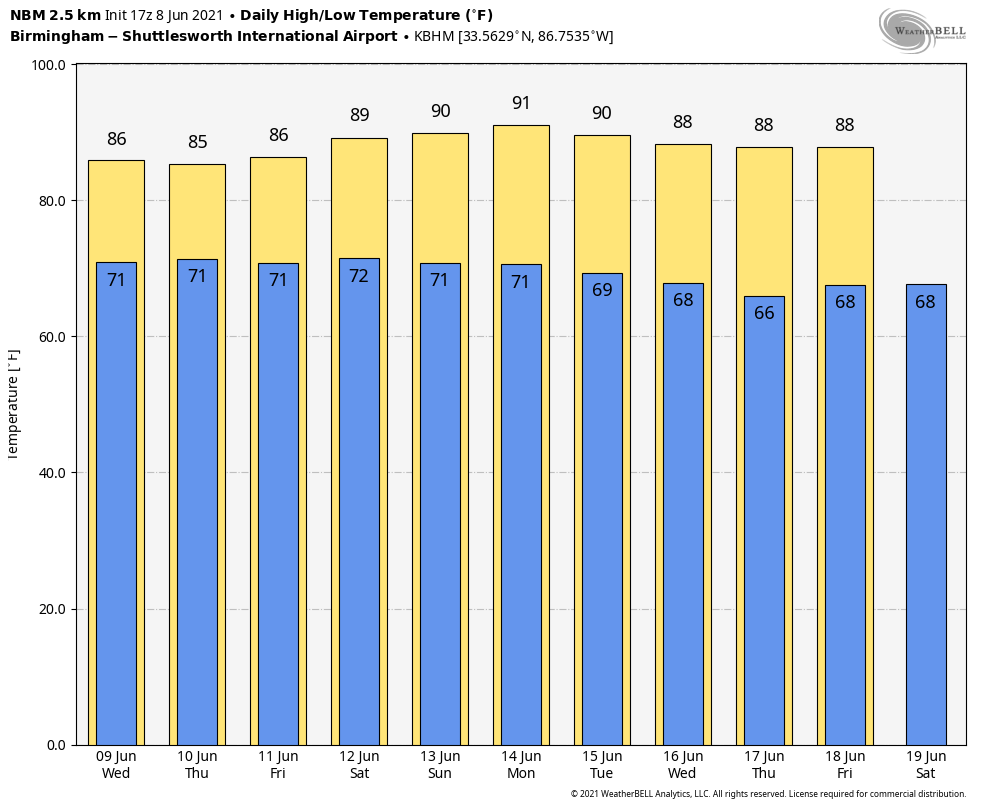
WEDNESDAY THROUGH THE WEEKEND: We aren’t expecting much change Wednesday through Saturday. Look for warm, humid days with scattered to numerous showers and thunderstorms, most active from about 1 until 11 p.m. (but we can’t rule out a few late-night or morning showers as well). Away from the storms, expect a mix of sun and clouds with highs mostly in the mid 80s. Showers will be fewer in number Sunday as precipitable water values decrease. Sunday will feature a partly sunny sky with a high around 90 degrees. Odds of any one spot getting wet Wednesday through Saturday will be 60-70%, dropping to near 30% Sunday.
NEXT WEEK: Global models continue so suggest the weather will trend a little drier and hotter next week. Afternoon showers are still possible each day, but they should be widely scattered, with afternoon highs between 87 and 90 degrees.
TROPICS: An area of low pressure is expected to develop over the southwestern Caribbean Sea by Wednesday or Thursday. Some gradual development will be possible thereafter while the system moves slowly northwest toward Central America. Regardless of development, this system could produce heavy rainfall across northern Colombia and portions of Central America from Honduras southward later this week and into the weekend.
We continue to see some signs from global models about potential development in the Gulf of Mexico next week, but it’s way too early to be specific. Just something to watch for now.
ON THIS DATE IN 2001: Tropical Storm Allison hit Houston for the second time in three days. Louisiana and southern Texas were inundated with rain. Baton Rouge received 18 inches over just a couple of days. Some portions of Texas racked up 36 inches by June 11.
BEACH FORECAST: Click here to see the AlabamaWx Beach Forecast Center page.
WEATHER BRAINS: You can listen to our weekly 90-minute show any time on your favorite podcast app. This is the show all about weather featuring many familiar voices, including the meteorologists at ABC 33/40.
CONNECT: You can find me on the major social networks:
For more weather news and information from James Spann and his team, visit AlabamaWx.


