James Spann: Warm, muggy weather continues for Alabama with showers, storms
James Spann forecasts more of the same for Alabama’s weather from Alabama NewsCenter on Vimeo.
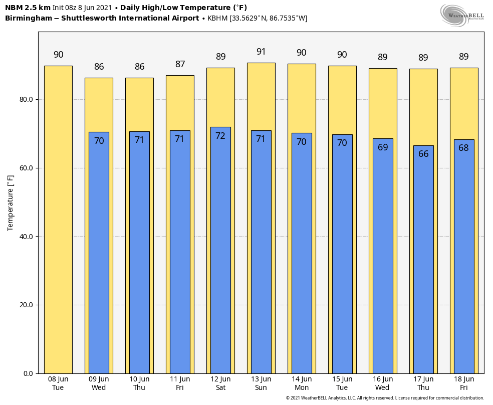
RADAR CHECK: At sunrise we have a few showers over the northern third of Alabama; otherwise the sky is mostly cloudy with temperatures between 68 and 72 degrees for most places. The weather won’t change much today — warm and humid with some sun at times, and scattered showers and storms firing up again during the afternoon and evening. Like Monday, where storms form they will be very efficient rain producers as we continue to have high precipitable water values in place. Odds of any one spot getting wet today will be 55-65%. Look for a high in the mid 80s for most communities; the average high at Birmingham on June 8 is 87.
REST OF THE WEEK AND THE WEEKEND: The weather will be pretty much the same each day through the weekend — warm and humid with a mix of sun and clouds daily, along with scattered showers and thunderstorms. Most of them will come from roughly 1 until 11 p.m., but a late-night or morning shower can’t be ruled out. For those trying to plan outdoor events, unfortunately, with summer storms there just isn’t a way of knowing in advance exactly when and where they form; you simply have to watch radar trends. The chance of any one spot getting wet will remain around 60% Wednesday through Friday, dropping to 40% over the weekend as the air will be slightly drier. Highs will remain in the 84- to 88-degree range most days.
NEXT WEEK: Global models suggest precipitable water values will be a bit lower next week, meaning showers and storms will be fewer in number. Still, we will keep the usual risk of scattered, mostly afternoon and evening showers and thunderstorms in the forecast through the week with partly sunny days and highs between 86 and 90 degrees.
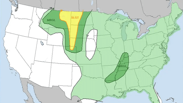
TROPICS: The Atlantic basin remains quiet this morning, but an area of low pressure is expected to develop over the southwestern Caribbean Sea by Wednesday or Thursday. Some gradual development will be possible thereafter while the system moves slowly northwest toward Central America. Regardless of development, this system could produce heavy rainfall across northern Colombia and portions of Central America from Honduras southward later this week and into the weekend.
We continue to see some signs from global models about potential development in the Gulf of Mexico next week, but it’s way too early to be specific. Just something to watch for now.
MONDAY’S RAIN: Here are some of the heavier rain totals Monday from the ABC 33/40 Skywatcher team:
- Mountain Brook — 1.91 inches
- Rainbow City — 1.46
- Crestwood — 1.27
- Jemison — 0.86
- Cottondale — 0.78
- Leeds — 0.64
ON THIS DATE IN 2001: Tropical Storm Allison hit Houston for the second time in three days. Louisiana and southern Texas were inundated with rain. Baton Rouge received 18 inches over just a couple of days. Some portions of Texas racked up 36 inches by June 11.
BEACH FORECAST: Click here to see the AlabamaWx Beach Forecast Center page.
WEATHER BRAINS: You can listen to our weekly 90-minute show any time on your favorite podcast app. This is the show all about weather featuring many familiar voices, including the meteorologists at ABC 33/40.
CONNECT: You can find me on the major social networks:
For more weather news and information from James Spann and his team, visit AlabamaWx.


