Scott Martin: Alabama stays mainly dry Friday, Saturday; scattered showers on Sunday
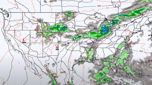
DRY DAY: Friday will be mainly dry with only a small chance of a few isolated showers roughly west and south of a line from Hamilton to Tuscaloosa to Montgomery. Skies will be mostly sunny with highs reaching the mid-80s to right around 90 degrees.
THE ALABAMA WEEKEND: Saturday will be another mostly sunny day with a very small chance of a few afternoon showers. The best chances for any showers will be over northern and extreme southern Alabama. Highs will be in the upper 80s to the lower 90s. On Sunday, there will be a slightly higher risk for scattered afternoon showers and storms; otherwise, it will be just a typical summer day in Alabama with highs will be in the mid-80s to the lower 90s.
NEXT WEEK: A few isolated afternoon showers will be possible Monday, but much of the state will stay dry with a mix of sun and clouds. Highs will be in the mid to upper 80s. The coverage of showers and thunderstorms will begin to pick up on Tuesday. Higher chances will be over the southern half of the state, but a good portion of central Alabama may see a shower. Highs will be in the mid-80s to right around 90 degrees. On Wednesday much of the state may see a scattered shower or storm, mainly during the afternoon to early evening. Highs will be in the mid to upper 80s.
On Thursday, showers and storms will become likely by the afternoon. Highs will be in the 80s. Friday won’t bring much change. Showers and storms will be likely by the afternoon, but a few locations will stay dry. Highs will be in the 80s.
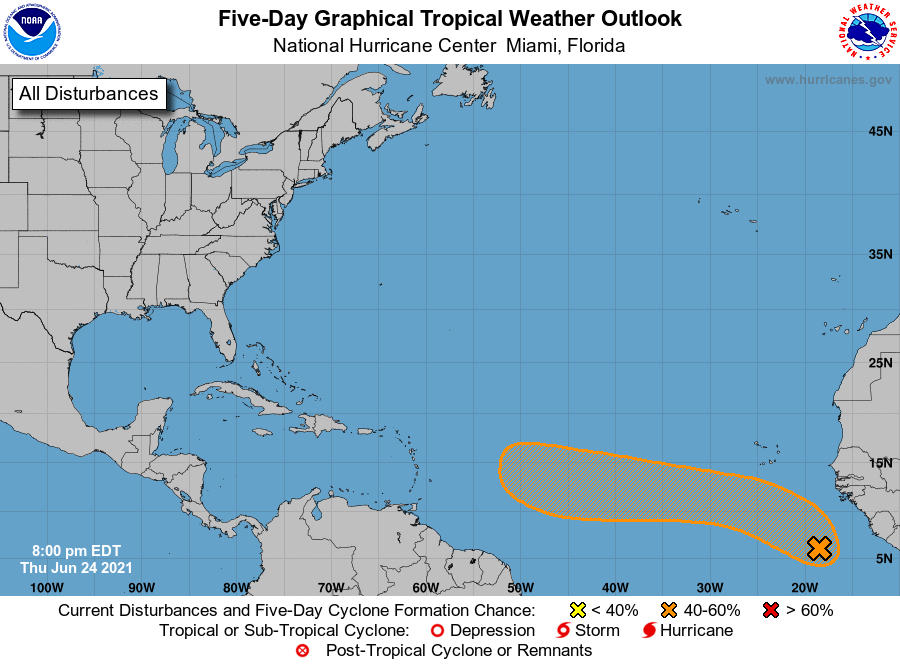
TROPICS: We have a strong tropical wave, now classified as Invest 95L by the National Hurricane Center, over the far eastern Atlantic off the African coast and producing a broad area of showers and a few thunderstorms. As the system moves west-northwestward into the central Atlantic Ocean during the next few days, conditions appear only marginally conducive for development due to relatively cool ocean temperatures. However, some development of this system is still possible by early next week. The NHC gives it a 40% chance of developing into a depression or storm within the next five days.
The latest model guidance shows the potential of 95L to continue westward for a good while, possibly moving into the Caribbean Sea. Intensity guidance has this ramping up throughout the next five days or so, potentially becoming a Category 1 hurricane. It is way too early to know exactly what will happen with 95L and if it will gain the name of Danny. We’ll keep our eyes on it.
For more weather news and information from James Spann, Scott Martin and other members of the James Spann team, visit AlabamaWx.


