James Spann: Scattered storms for Alabama over the weekend; Fred heads for the Gulf
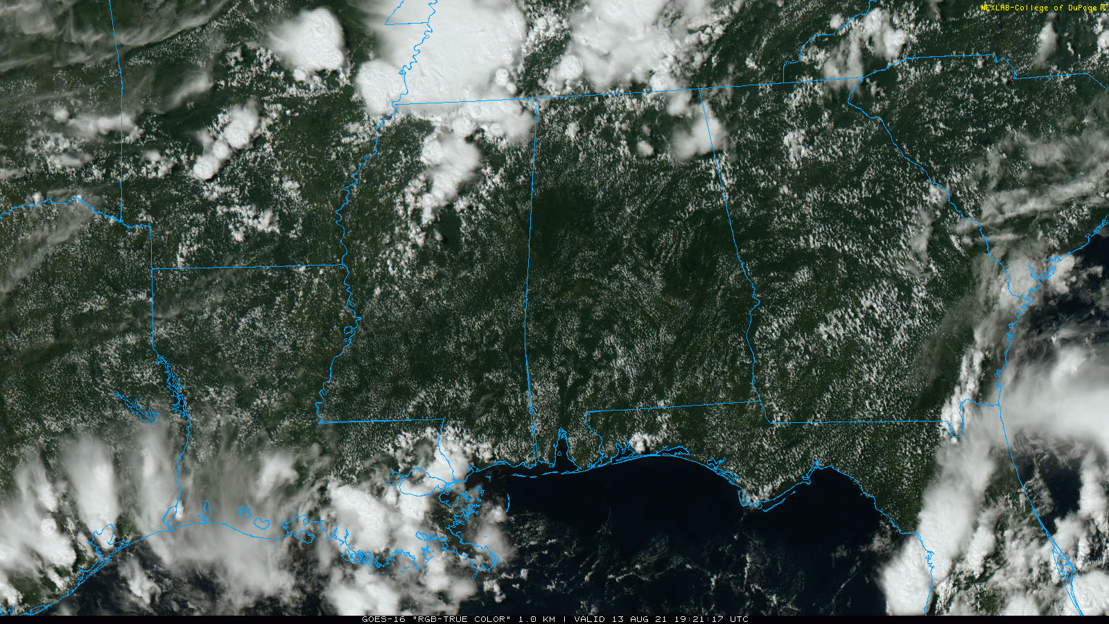
RADAR CHECK: Most of the showers and thunderstorms across Alabama today so far have been over the Tennessee Valley; otherwise the sky is partly to mostly sunny with temperatures mostly between 88 and 92 degrees. We will maintain the chance of scattered storms through the evening.
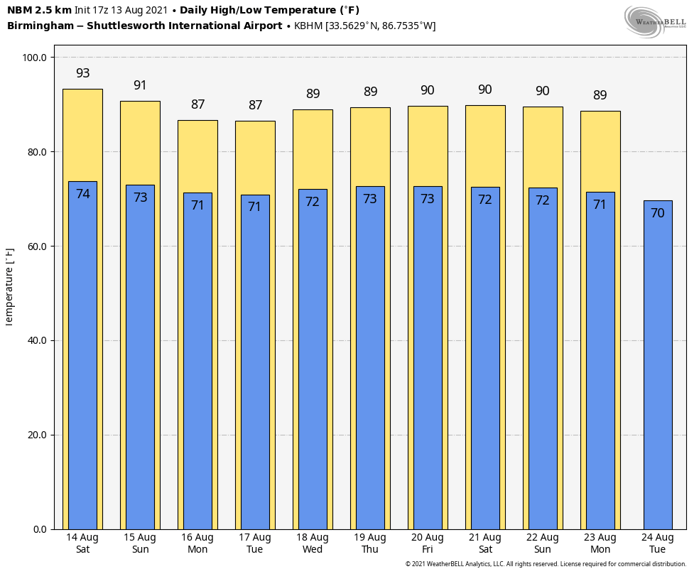
THE ALABAMA WEEKEND: Look for a mix of sun and clouds Saturday and Sunday with scattered showers and thunderstorms both days, mostly between noon and 10 p.m. The chance of any given location getting wet both days is 45-55%. The high will be around 90 Saturday and in the upper 80s Sunday for most communities.
NEXT WEEK: The National Hurricane Center has adjusted the forecast track of what should be Tropical Storm Fred to the west, meaning rain will be more widespread across Alabama, especially the eastern half of the state, Monday and Tuesday. Initially it looks like 1 to 2 inches are likely both days along and east of I-65, but that could change depending on how Fred evolves over the next few days. A deep layer of tropical moisture will be left behind, and we expect scattered to numerous showers and storms Wednesday through Friday with a mix of sun and clouds each day. Highs will be mostly in the mid to upper 80s.
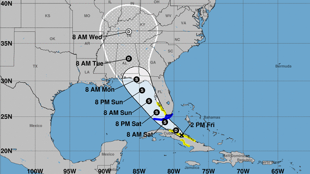
FRED: Fred remains a disorganized tropical depression this afternoon near the northern coast of Cuba. The NHC expects the system to regain tropical storm strength Saturday and move to a landfall near Panama City Beach Monday morning (under hurricane strength).
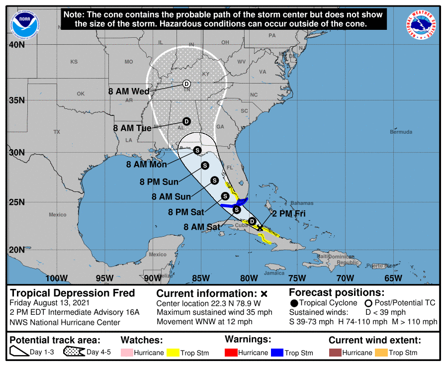
Some notes on Fred:
- The NHC forecast track has been adjusted a little to the left based on new model guidance. This will increase the amount of rain expected across the eastern half of Alabama Monday and Tuesday. Rain amounts of 1-2 inches seem likely at this point.
- Fred is not expected to become a hurricane due to shear; rain and rip currents are the main threats. Tropical-storm-force winds (39-73 mph) are likely, however, on the coast along and east of the point of landfall.
- The rip current danger all along the central Gulf Coast will be high Sunday and Monday.
- The heaviest rain and stronger wind gusts will be along and east of the circulation center.
- A few isolated tornadoes are possible across the northern Florida peninsula Sunday.
- As you look at the forecast map, Fred isn’t a dot on a map; it will be a broad area of rain, with the heavier rain to the east of the center.
- I can’t give specific advice on a beach trip since different people go to the beach for different reasons. If you are headed to the Florida Panhandle beaches (Pensacola to Panama City Beach), pay attention to updates over the weekend.
- This forecast can change; always work with current information.
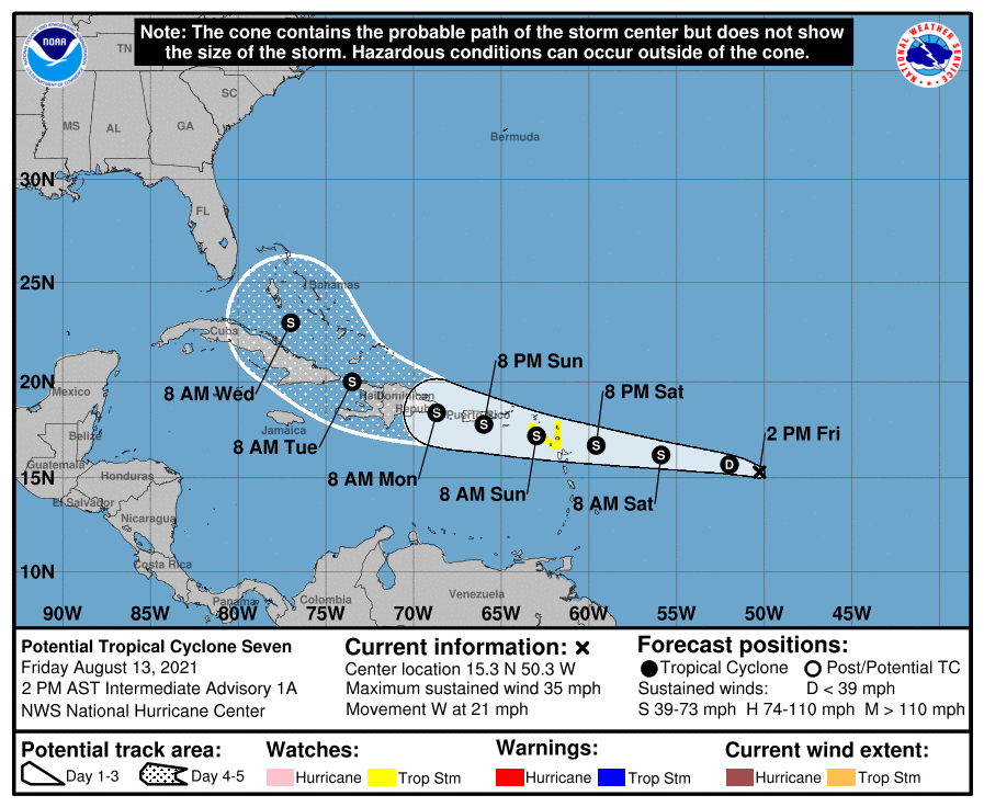
PTC 7: Potential Tropical Cyclone Seven is forecast to become Tropical Storm Grace tonight or Saturday. The NHC track has it in the vicinity of the Bahamas early next week. It’s too early to determine whether this will bring an impact to the U.S.
ON THIS DATE IN 2004: Hurricane Charley made landfall on the southwest coast of Florida near Cayo Costa, just west of Fort Myers, around 3:45 p.m. Eastern Time with maximum sustained surface winds near 150 mph. Charley was initially expected to hit farther north in Tampa, and caught many Floridians off guard with a sudden change in the storm’s track as it approached the state. Along its path, Charley caused 10 deaths and $16.9 billion in damage to insured residential property, making it the second-costliest hurricane in United States history at the time. Charley was a compact, fast-moving storm, which limited the scope and severity of the damage.
BEACH FORECAST: Click here to see the AlabamaWx Beach Forecast Center page.
WEATHER BRAINS: You can listen to our weekly 90-minute show any time on your favorite podcast app. This is the show all about weather featuring many familiar voices, including the meteorologists at ABC 33/40.
CONNECT: You can find me on the major social networks:
For more weather news and information from James Spann and his team, visit AlabamaWx.


