James Spann: Scattered to numerous showers, storms in Alabama through Saturday
James Spann forecasts an uptick in showers, storms for Alabama from Alabama NewsCenter on Vimeo.
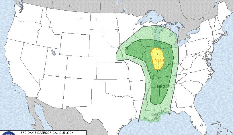
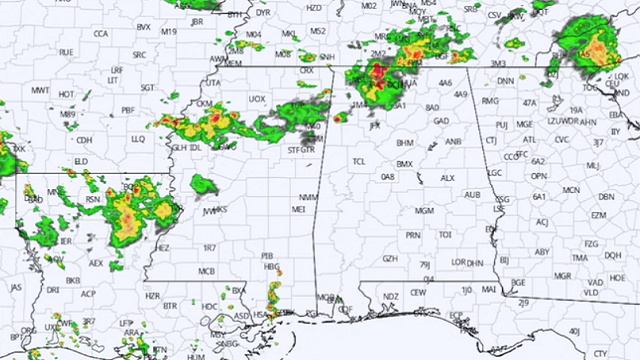
UNSETTLED PATTERN: The air has become unstable across Alabama thanks to a weak upper trough nearby, and that will bring an increase in the number of showers and storms statewide through the beginning of the weekend. There will be good breaks in the rain, but we expect scattered to numerous showers and thunderstorms each day. Most, but not all, of the rain will come from noon to midnight. We note a few strong storms early this morning over the northern quarter of the state.
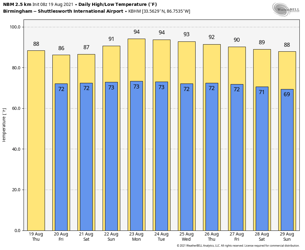
We aren’t expecting any organized severe weather, but stronger storms over the next few days will produce very heavy rain, gusty winds and lots of lightning. With only a limited amount of sun, temperatures will be below average, with highs mostly between 84 and 88 degrees through Saturday.
SUNDAY AND NEXT WEEK: An upper ridge will begin to rebuild over the region Sunday, and showers will become few and far between with an increasing amount of sun and rising heat levels; Sunday’s high will be close to 90. Then, we expect highs between 92 and 95 degrees Monday and Tuesday under the ridge; the sky will be partly to mostly sunny both days with only isolated showers and storms during the afternoon and evening hours. The ridge weakens later in the week, and scattered showers and storms will increase again Wednesday through Friday.
FOOTBALL WEATHER: For the high school football games across Alabama tonight and Friday night, a passing shower or thunderstorm is possible in a few scattered places. Unfortunately, with summer storms there is no way of knowing in advance exactly when and where they form; you just have to watch radar trends. When you hear thunder, get out of the stands and indoors or into a vehicle. Temperatures at kickoff time will be in the low 80s at most stadiums.
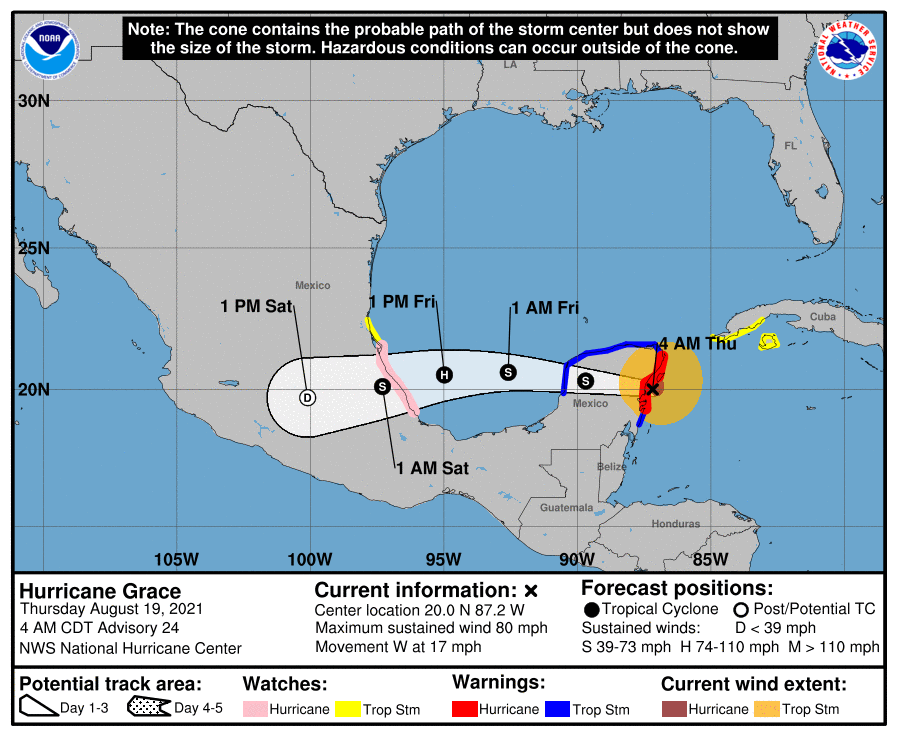
TROPICS: Hurricane Grace made landfall on Yucatan peninsula this morning south of Cozumel with winds of 80 mph. The system will emerge over the Bay of Campeche tonight, and the second landfall comes on the Mexican coast, far south of Brownsville, Texas, Friday night, most likely as a Category 1 hurricane. This track is far south of the U.S., but Grace will stir the pot and bring the risk of rip currents to the central Gulf Coast tonight and Friday.
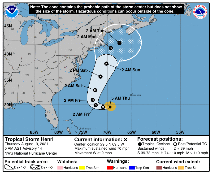
Over in the Atlantic, Tropical Storm Henri is expected to become a hurricane Friday; it will turn north and then northeast, passing between the U.S. East Coast and Bermuda. The latest National Hurricane Center forecast track has Henri a little east of Cape Cod as a tropical storm Sunday night; the center is forecast to remain offshore.
The rest of the Atlantic basin is quiet.
ON THIS DATE IN 1991: Hurricane Bob made landfall in Rhode Island as a Category 2 hurricane. Eighteen fatalities were reported in association with Bob; the loss of life and most of the damage occurred as a result of high winds and rough seas. There were six confirmed tornadoes during its passage. Bob is the last hurricane to hit the New England states directly as a hurricane. It was the only hurricane to make landfall in the contiguous United States during the 1991 season.
BEACH FORECAST: Click here to see the AlabamaWx Beach Forecast Center page.
WEATHER BRAINS: You can listen to our weekly 90-minute show any time on your favorite podcast app. This is the show all about weather featuring many familiar voices, including the meteorologists at ABC 33/40.
CONNECT: You can find me on the major social networks:
For more weather news and information from James Spann and his team, visit AlabamaWx.