James Spann: Sizzling summer day ahead for Alabama
James Spann forecasts one of Alabama’s hottest days this year from Alabama NewsCenter on Vimeo.
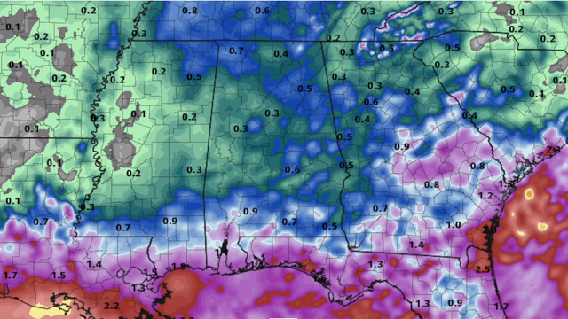
HOT: A strong upper ridge will keep Alabama hot and mostly dry today; we project a high between 93 and 96 degrees for most communities. So far Birmingham’s hottest temperature this summer is 95, recorded on July 28; we will be close to that level today. The average high for Aug. 24 is 90. Any showers or storms later today will be over the southern part of the state, and even there they will be scarce.
REST OF THE WEEK: Wednesday won’t bring much change; afternoon showers will be few and far between with a high in the low to mid 90s. Then the upper ridge weakens and we expect an increase in the number of scattered showers and thunderstorms Thursday and Friday with lower heat levels; the highs both days will range from 88 to 91 degrees.
THE ALABAMA WEEKEND: We are forecasting a mix of sun and clouds Saturday and Sunday with scattered showers and storms both days, mostly during the afternoon and evening hours. Odds of any one spot getting wet are 50-60%, and highs over the weekend will be between 87 and 90 degrees for most places.
NEXT WEEK: We will roll with a persistence forecast — partly sunny days with the usual round of scattered showers and thunderstorms daily, mostly between noon and midnight. Highs next week will be generally in the upper 80s.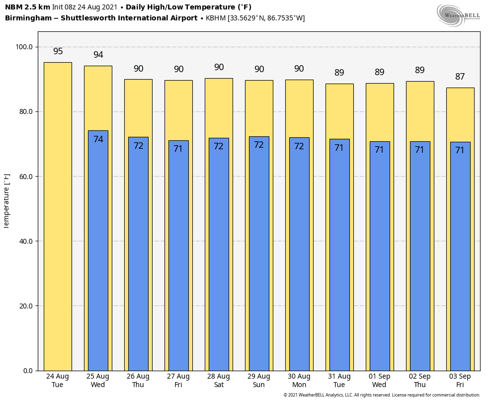
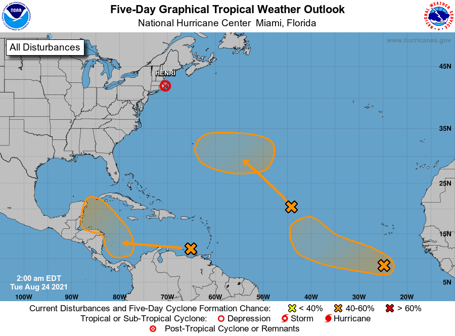
TROPICS: The National Hurricane Center is monitoring a trio of systems across the Atlantic basin. Two of them are over the central and eastern Atlantic with a medium chance of development; they most likely will not affect the U.S. if they get their act together.
The one of greatest interest is a wave over the eastern Caribbean Sea; it is expected to form a broad area of low pressure over the southwestern Caribbean later this week. Thereafter, environmental conditions are forecast to be favorable for gradual development, and a tropical depression could form by the end of the week while the system moves west-northwestward to northwestward over the northwestern Caribbean Sea. Long-range models suggest this one will cross the Yucatan peninsula, finally moving into either the coast of Mexico or maybe south Texas early next week.
There’s still no sign of any tropical systems threatening the central Gulf Coast for the next seven to 10 days.
ON THIS DATE IN 1992: Hurricane Andrew made landfall in southern Florida at 4:30 a.m. Andrew is one of only four hurricanes to make landfall in the United States as a Category 5, alongside the 1935 Labor Day hurricane, 1969’s Camille and 2018’s Michael.
The high winds caused catastrophic damage in Florida, with the Miami-Dade County cities of Florida City, Homestead and Cutler Ridge receiving the brunt of the storm. About 63,000 homes were destroyed and more than 101,000 others were damaged. This storm left roughly 175,000 people homeless. As many as 1.4 million people were left without electricity at the height of the storm. In the Everglades, 70,000 acres of trees were knocked down. Rainfall in Florida was substantial, peaking at 13.98 inches in western Miami-Dade County. About $25 billion in damage and 44 fatalities were reported in Florida.
After moving across southern Florida, the hurricane emerged over the Gulf of Mexico at Category 4 strength, with the Gulf Coast of the United States in its dangerous path. After turning northwestward and weakening further, Andrew moved ashore near Morgan City, Louisiana, as a low-end Category 3 storm.
BEACH FORECAST: Click here to see the AlabamaWx Beach Forecast Center page.
WEATHER BRAINS: You can listen to our weekly 90-minute show any time on your favorite podcast app. This is the show all about weather featuring many familiar voices, including the meteorologists at ABC 33/40.
CONNECT: You can find me on the major social networks:
For more weather news and information from James Spann and his team, visit AlabamaWx.


