James Spann: Only isolated showers for Alabama Tuesday
James Spann forecasts showers for some, dry weather for most in Alabama from Alabama NewsCenter on Vimeo.
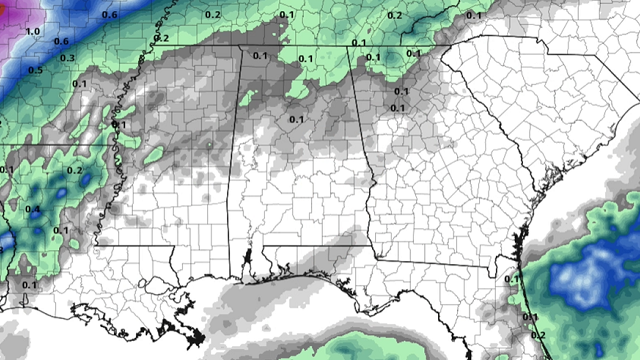
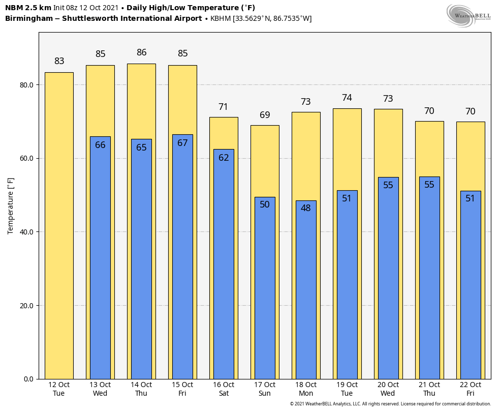
RADAR CHECK: We have a few small, isolated showers over northwest Alabama early this morning ahead of a surface front that will stall out northwest of Alabama. We will mention the chance of small, spotty showers today over the northern half of the state, but the chance of any one place seeing rain is only 10-20%. Otherwise, today will be warm again with a mix of sun and clouds; the high will be in the mid 80s. The average high for Birmingham on Oct. 12 is 78.
The weather will be warm and dry Wednesday and Thursday; with a good supply of sunshine both days, afternoon temperatures will reach the mid 80s.
FRIDAY AND THE WEEKEND: Most of the day Friday will be dry, and we stay warm with mid 80s likely again. But clouds will increase during the day, and we will mention a chance of showers generally from 6 p.m. Friday through 9 a.m. Saturday. These showers are ahead of a sharp cold front that will bring a big change to cooler weather for the weekend. The sky becomes partly sunny Saturday afternoon, but the high will be between 68 and 72 degrees with a fresh north breeze.
Temperatures will fall into the 40s over most of north and central Alabama early Sunday, and the day Sunday will be a picture-perfect autumn day with ample sunshine and highs in the upper 60s and low 70s.
NEXT WEEK: For now the week looks mostly dry and very pleasant, with highs mostly in the 70s and lows in the 50s.
 TROPICS: The Atlantic basin is generally quiet this morning. Weak disturbances near Hispaniola and the Windward Islands are not expected to develop. Over in the eastern Pacific, Pamela is now a hurricane, and the center is about 260 miles south/southeast of the southern tip of Baja California. Sustained winds are 75 mph and landfall is expected on the Pacific Coast of Mexico late tonight or early Wednesday morning.
While the system will rapidly weaken over Mexico Wednesday, moisture from Pamela will move into Texas Thursday, with potential for heavy rain in a broad zone from Del Rio to Dallas/Fort Worth.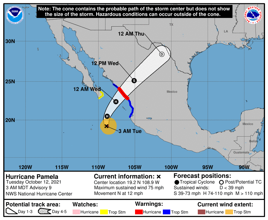 GEOMAGNETIC STORM: A G2 moderate geomagnetic storm affected the high latitudes last night and early this morning. A vivid display of the Northern Lights was seen over most of Canada and the far northern U.S. The storm was sparked by a coronal mass ejection. This is a large expulsion of plasma and magnetic field from the Sun’s corona.
ON THIS DATE IN 1979: The lowest barometric pressure ever recorded occurs in the center of Typhoon Tip on this day. A fly reconnaissance mission recorded the low pressure of 870 hPa or 25.69 inHg. Typhoon Tip was the most extensive tropical cyclone on record, with a wind diameter of 1,380 miles at its peak.
BEACH FORECAST: Click here to see the AlabamaWx Beach Forecast Center page.
WEATHER BRAINS: You can listen to our weekly 90-minute show any time on your favorite podcast app. This is the show all about weather featuring many familiar voices, including the meteorologists at ABC 33/40.
CONNECT: You can find me on the major social networks:
For more weather news and information from James Spann and his team, visit AlabamaWx.


