James Spann: Dry, pleasant weather continues for Alabama through Thursday
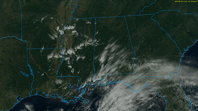
FINE FALL WEATHER: Again today we have a sunny sky statewide with just a few cirrus streaks around; temperatures are mostly in the low to mid 70s. Tonight will be clear and cool, with a low in the 40s for most communities early Tuesday morning.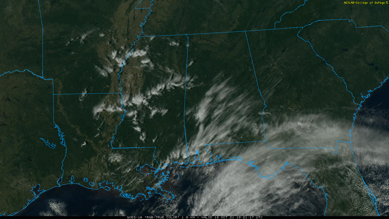 Dry weather continues Tuesday and most of the day Wednesday; expect a good supply of sunshine both days with highs in the 70s. Moisture will begin to increase late in the day Wednesday, and a few showers could show up by afternoon near the Gulf Coast. We will mention a chance of showers statewide Thursday as a cold front approaches. Moisture will be limited, and we expect rain amounts to be generally less than a quarter-inch. There could be a rumble of thunder in spots, but there is no risk of severe storms.
FRIDAY AND THE WEEKEND: We’re still seeing conflicting output in the main global models this afternoon. The American GFS keeps the surface front stalled over the region with some risk of scattered showers daily, while the European ECMWF brings a new surge of dry air into the state with rain-free conditions Friday and over the weekend. We will continue to use the dry Euro solution in our forecast for now; look for mostly sunny days and fair nights Friday through Sunday with highs in the 70s and lows in the 50s.
NEXT WEEK: A generally quiet weather pattern continues, but a front could bring some risk of showers by Wednesday or Thursday. Highs will remain in the 70s.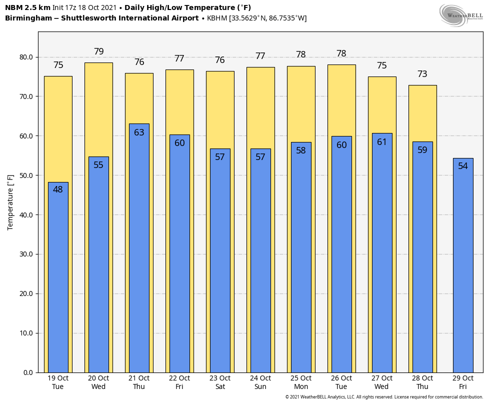 TROPICS: All remains quiet across the Atlantic basin, and tropical storm formation is not expected through the week.
ON THIS DATE IN 1916: A Category 3 hurricane made landfall at Pensacola. The maximum wind velocity at Mobile was 115 mph from the east at 8:25 a.m. Pensacola had winds of 120 mph at 10:13 a.m. when the wind instrument tower was blown down.
ON THIS DATE IN 2007: A destructive fall tornado hit Nappanee, Indiana, causing extensive damage along its 20-mile path across northeast Marshall, northwest Kosciusko and southwest Elkhart counties. High-end EF3-intensity winds near 165 mph were estimated based on the most severe damage over southeast Nappanee.
BEACH FORECAST: Click here to see the AlabamaWx Beach Forecast Center page.
WEATHER BRAINS: You can listen to our weekly 90-minute show any time on your favorite podcast app. This is the show all about weather featuring many familiar voices, including the meteorologists at ABC 33/40.
CONNECT: You can find me on the major social networks:
For more weather news and information from James Spann and his team, visit AlabamaWx.


