Scott Martin: Severe threats for Alabama through Saturday night
TODAY: Strong to severe storms will be possible today, as we’ll have a shortwave slowly move through the state starting this afternoon. The threats continue through the night and will not end until the mid to late afternoon Thursday. With dewpoints well up into the 60s and even reaching 70 degrees or more later this evening, mixed with a good bit of instability and shear up in the 50- to 60-knot range, the ingredients will be there for severe storm formation. Highs will be in the lower 70s to the lower 80s.
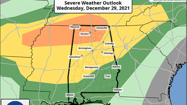
An enhanced risk is up for the northwest corner of the state, roughly along and west of a line from Hackleburg to Decatur to just west of Hazel Green. A slight risk is up south and east of that to a line stretching from Livingston to Clanton to Alexander City. A marginal risk is up for the rest of Alabama.
The main threat today will be damaging winds up to 60 mph, with a smaller threat for a few tornadoes and large hail. The threats will be greater in the enhanced risk locations, especially the tornado threat.
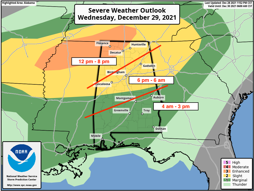
Timing for the threat of severe storms will start around noon in northwestern Alabama and will slowly progress southeastward throughout the day, not starting for much of the I-59 corridor until around or just after 6 p.m. The threat will continue overnight and will not start for southern and southeastern Alabama until around 4 a.m. Thursday morning. The threat will finally end around 3 p.m. Thursday afternoon.
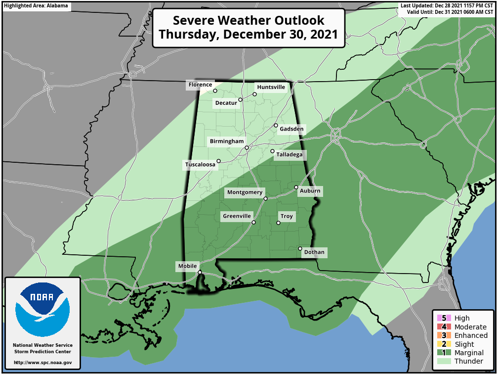
THURSDAY: A marginal risk of severe storms is up Thursday for the southern and southeastern portions of Alabama, mainly along and south of a line from Marion to Talladega Springs to Heflin.
Showers and storms may end for a while for most locations after the severe threat ends Thursday afternoon; locations in the southern and southeastern parts of the state may continue to see showers with a few rumbles of thunder through the evening and night. Temperatures will remain elevated as there is no cold front involved with this system. Highs will be in the 70s.
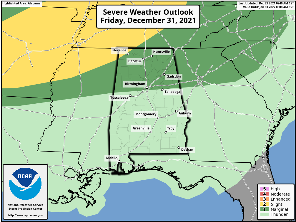
FRIDAY: A marginal risk of severe storms has been introduced for northern Alabama on Friday. Showers and storms will increase throughout the day as a warm front moves northward, and a few isolated damaging wind gusts up to 60 mph may be possible in the risk area. Highs will be in the lower 70s to the lower 80s.
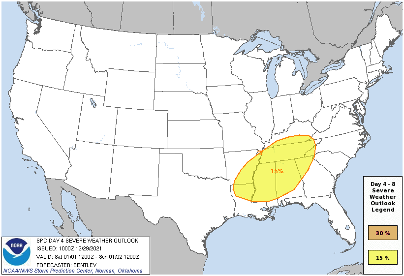
SATURDAY: Our next threat for severe storms will come Saturday as a strong cold front approaches and eventually enters Alabama. We could see a threat of damaging winds up to 60 mph, large hail and a tornado or two. The Storm Prediction Center continues the equivalent of a slight risk for most of Alabama, except for the extreme southern and southeastern parts of the state. Timing for the threat of strong to severe storms looks to be during the afternoon through the late night. Highs will be in the 70s.
SUNDAY: The system should be out of the state by Sunday afternoon, but we could see some wrap-around moisture on the backside of the surface low that may invade north and northeastern Alabama. Temperatures will be falling, with highs occurring during the early parts of the day. Temperatures look to be in the upper 40s to the mid-60s at noon, dropping into the upper 30s to the upper 50s by 5 p.m. Overnight lows will be in the mid-20s to the lower 30s.
NEXT WEEK: High pressure will be in control on Monday and we’ll have sunny skies, but temperatures will remain very cool. Highs will be only in the lower 40s to the lower 50s. The story will be much the same on Tuesday, but it will be a little warmer. Highs will be in the 50s.
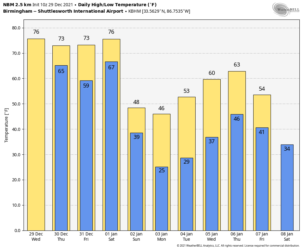
Looking at the National Blend of Models for the rest of next week, we will warm back up into the 60s by Thursday before another cold front moves through on Friday that will drop the highs back down into the 50s.
For more weather news and information from James Spann, Scott Martin and other members of the James Spann team, visit AlabamaWx.


