Scott Martin: Active weather continues for Alabama through the weekend
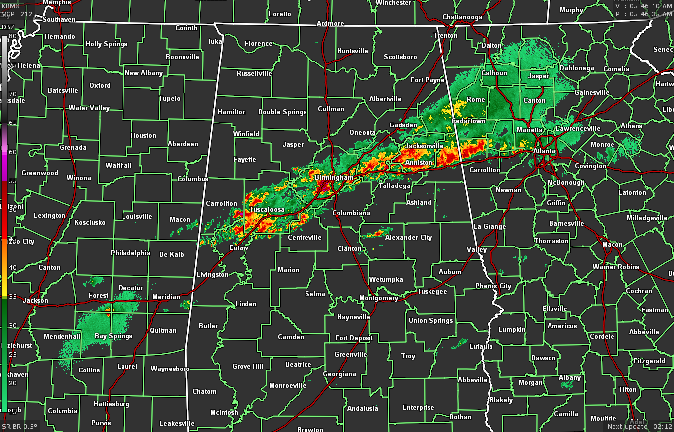
RADAR CHECK: At 5:47 a.m., we have a line of thunderstorms moving east-northeastward across the I-20 corridor, while nearly the rest of the state is dry for now. No severe weather watches or warnings are in effect, but we do have a couple of Areal Flood Advisories in effect for portions of Greene, Pickens, Sumter and Jefferson counties.
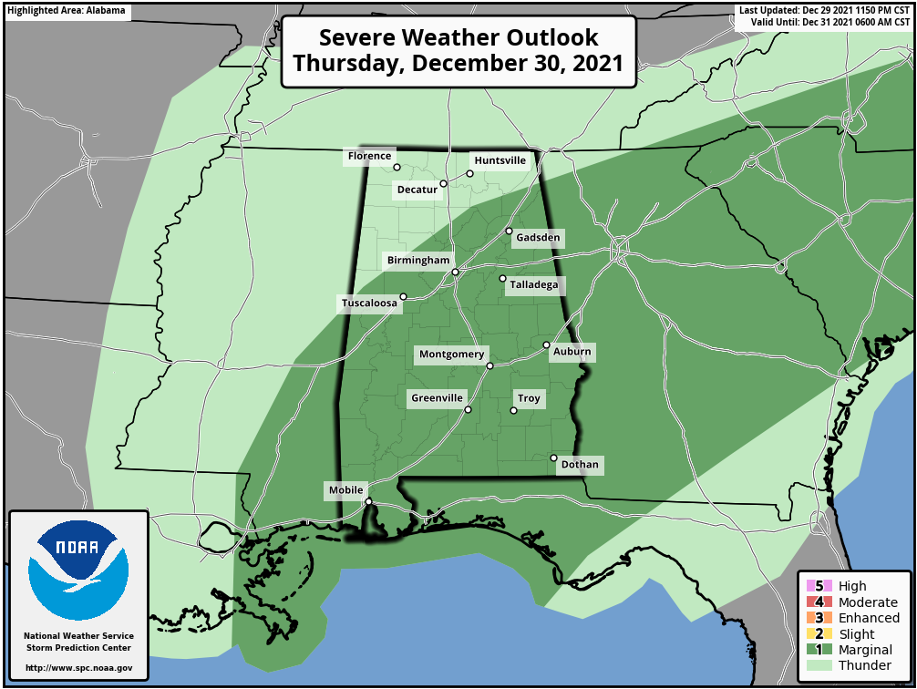
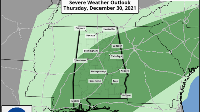
TODAY: Rain and thunderstorms will continue to be likely at times throughout the day, especially south of a line from Fayette to Oneonta to Gadsden. A few of these storms may be strong, with the potential of one or two becoming briefly severe. Most of Alabama, except for the northwest and extreme northeast, has been placed in a marginal risk for severe storms roughly through 6 p.m. The main threats will be isolated damaging wind gusts up to 60 mph and quarter-sized hail. Highs will be in the lower 70s to the lower 80s.
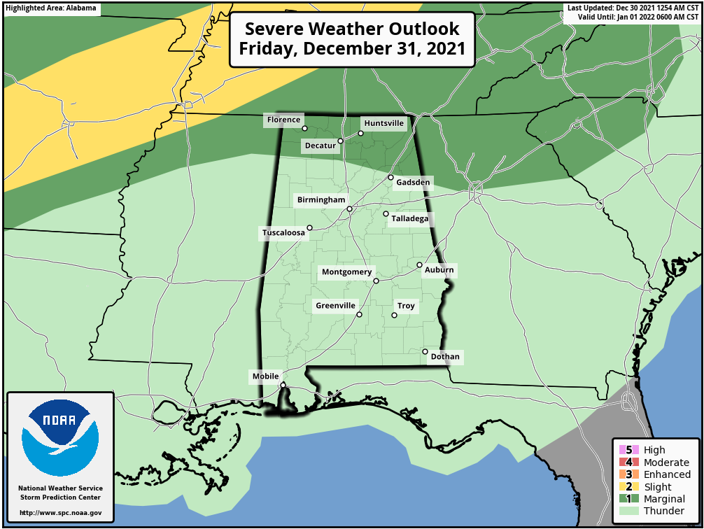
FRIDAY: Showers and thunderstorms will continue to be possible Friday throughout the day as a warm front moves northward through Alabama. The highest concentration of the activity will be across the central and southern parts of the state. A few storms may become strong in extreme northern Alabama, and a marginal risk is up for those locations for the threat of damaging winds. Highs will be in the lower 70s to the lower 80s.
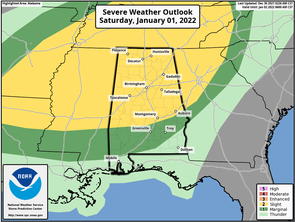
THIS WEEKEND: A strong cold front will sweep through Alabama this weekend that will bring us another round of strong to severe storms, mainly from Saturday afternoon through early Sunday morning. All of northern and most of central Alabama have been placed in a slight risk of severe storms for Saturday. All modes of severe weather will be possible, along with the threat of locally heavy rainfall that may lead to some flash flooding. Winds will be gusty at times outside of thunderstorm activity throughout the day Saturday. The system will push out of the area Sunday afternoon, but much colder air will filter in behind the cold front. Saturday’s highs will be in the mid-70s to the lower 80s. Sunday’s highs will be only in the upper 30s to the mid-50s from northwest to southeast.
NEXT WEEK: Skies will be sunny Monday as high pressure will control our weather, but it will be a chilly day. Highs will be only in the 40s. Tuesday will be similar, but highs will be a little warmer, reaching the 50s. Some moisture will try to sneak into the state on Wednesday, so we may have some clouds at times, but we will stay dry. Highs will be in the mid-50s to the lower 60s.
Our next rain chance will arrive Thursday as another front moves into the area, bringing us some showers, but that front looks to stall out in the southern parts of the state and will keep showers in the forecast on Friday. Highs will be in the mid-50s to the mid-60s Thursday, dropping back into the upper 40s to the lower 60s Friday.
For more weather news and information from James Spann, Scott Martin and other members of the James Spann team, visit AlabamaWx.


