James Spann: Winter Weather Advisory for far north Alabama; rain elsewhere
James Spann forecasts rain for Alabama, possible ice for the north from Alabama NewsCenter on Vimeo.
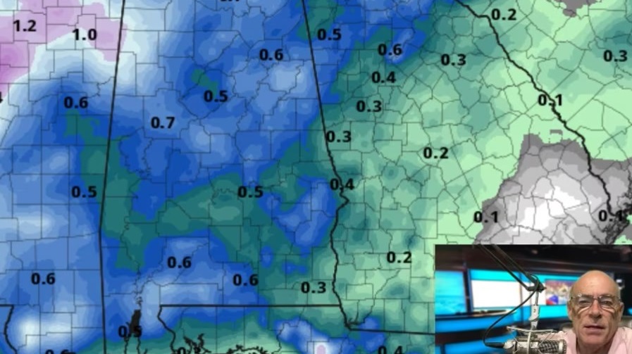
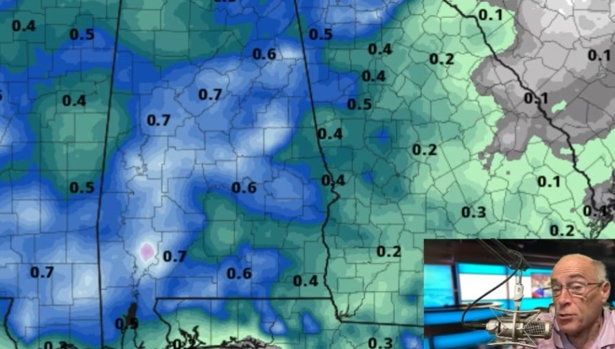
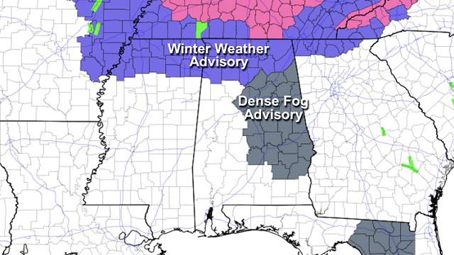
RADAR CHECK: Rain is moving into west Alabama early this morning; temperatures are above freezing statewide and there is no wintry precipitation anywhere in the state just before daybreak. Thick fog has formed over the eastern and central counties, where a Dense Fog Advisory has been issued.
For most places, today will be cloudy with occasional rain. However, as temperatures fall over the northern quarter of the state, there is still potential for a chance of some sleet, freezing rain and a few snow flakes later today. A Winter Weather Advisory remains in effect for areas north of a line from Hamilton to Cullman to Fort Payne.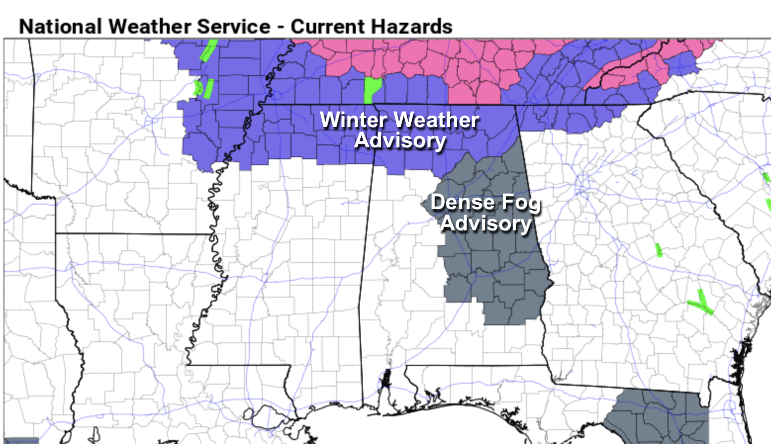
The highest risk of icy travel in Alabama later today is along and north of the Tennessee River, although a few isolated icy patches can’t be ruled out as far south as Hamilton, Cullman and Fort Payne. The best chance of accumulating snow is over Tennessee, where places like Nashville could see 3-5 inches by mid-afternoon; a Winter Storm Warning is in effect there.
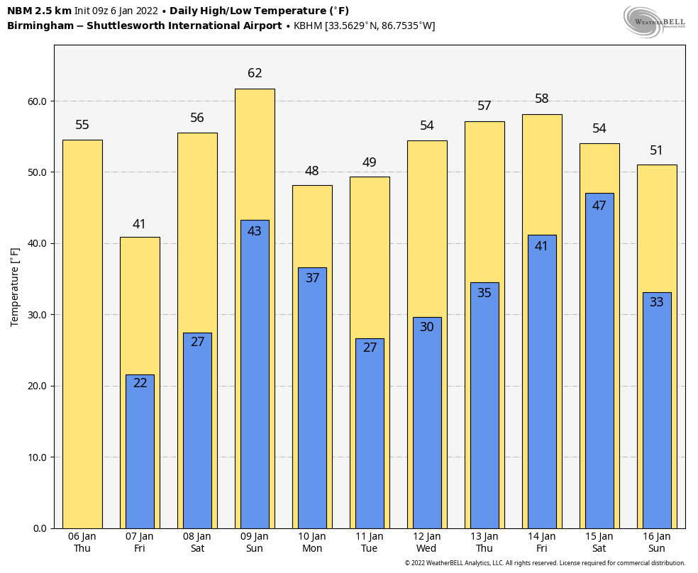
For most communities over the northern half of Alabama south of the advisory, temperatures will fall through the 30s this afternoon, but the precipitation will be long gone before we reach freezing. The big story is that this will be the coldest air so far this season. The sky will clear tonight, and we project a low between 18 and 24 degrees early Friday morning, with a wind chill index around 10 degrees. Friday will be sunny with a high between 37 and 41 degrees.
THE ALABAMA WEEKEND: After a low in the 20s, we expect a high in the mid 50s Saturday with a sunny sky. Clouds return Saturday night, and rain is likely statewide Sunday ahead of the next cold front. Some thunder is possible, but severe storms are not expected. The high Sunday will be between 57 and 62 degrees.
NEXT WEEK: Another shot of colder air arrives Monday; with a clearing sky, the high will be back in the 40s. The rest of the week looks dry for now with mostly seasonal temperatures.
ON THIS DATE IN 1886: The “Great Blizzard of 1886” struck the Midwest with high winds, subzero temperatures and heavy snowfall. These conditions caused as many as 100 deaths, and 80% of the cattle in Kansas perished.
ON THIS DATE IN 1996: A severe nor’easter paralyzed the East Coast from Jan. 6 to Jan. 8. In Washington D.C., this storm is also known as the “Great Furlough Storm” because it occurred during the 1996 federal government shutdown. Snowfall amounts from this event include 47 inches in Big Meadows, Virginia; 30.7 inches in Philadelphia; 27.8 inches in Newark; 24.6 inches at the Dulles International Airport; 24.2 inches in Trenton; 24 inches in Providence; 22.5 inches in Baltimore; 18.2 inches in Boston; 17.1 inches in D.C.; and 9.6 inches in Pittsburgh.
BEACH FORECAST: Click here to see the AlabamaWx Beach Forecast Center page.
WEATHER BRAINS: You can listen to our weekly 90-minute show any time on your favorite podcast app. This is the show all about weather featuring many familiar voices, including the meteorologists at ABC 33/40.
CONNECT: You can find me on the major social networks:
For more weather news and information from James Spann and his team, visit AlabamaWx.