James Spann: Occasional rain for Alabama through Wednesday, with some thunder
James Spann forecasts wet weather for Alabama from Alabama NewsCenter on Vimeo.
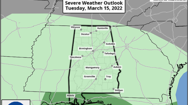
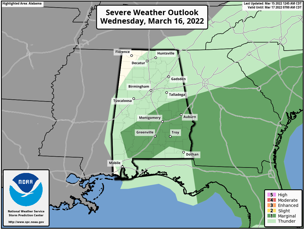
WET: An approaching upper trough will bring rain back to Alabama today. Showers are lined up near the Mississippi border early this morning, but the rain will become widespread later today, and periods of rain will continue tonight and Wednesday as the upper air system slowly moves through. A few strong storms are possible near the Gulf Coast today, and over roughly the southern half of the state Wednesday. The Storm Prediction Center has defined a marginal risk of severe storms for these areas; the main threat will come from strong, gusty winds.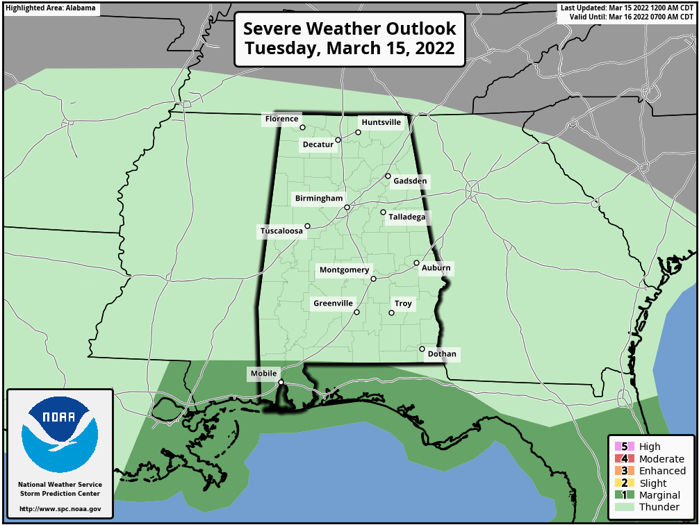
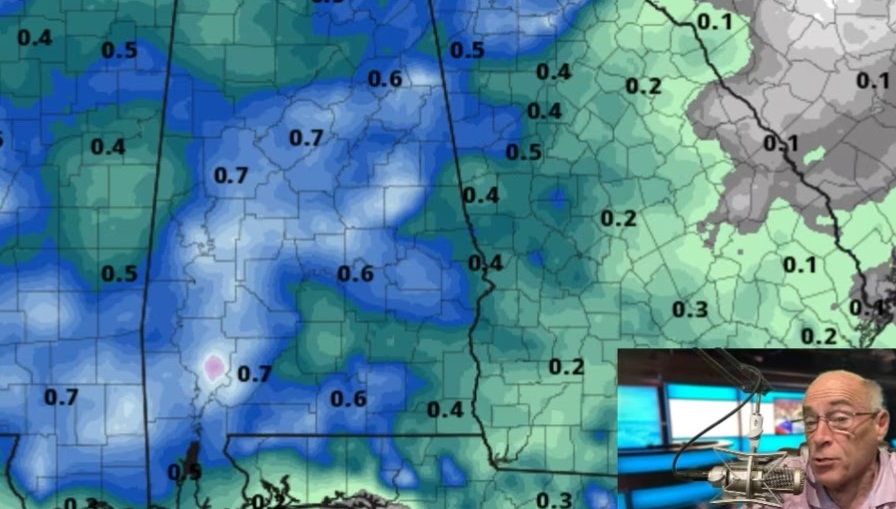
 Rain amounts over the next 48 hours will be one-half inch to 1 inch for most of the state, and highs will be in the 60s. Drier air returns Thursday. With ample sunshine we are forecasting a high in the mid 70s; it will be the warmest day of the week.
FRIDAY: A cold front will bring a band of showers and thunderstorms to the state. The SPC has much of south Alabama, where instability values will be highest, in a severe weather risk Friday; storms there could produce strong winds and possibly a brief tornado or two. For now the severe weather potential for the northern half of the state doesn’t look especially high. The high Friday will be between 67 and 70 degrees.
THE ALABAMA WEEKEND: Dry air returns, and the weekend will feature some delightful spring weather with sunny, mild days and fair, cool nights. The high will be in the upper 60s Saturday, followed by low 70s Sunday.
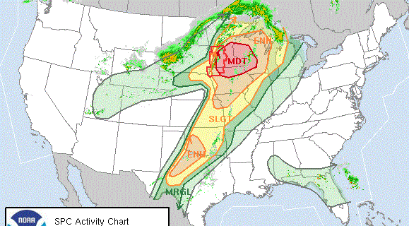
NEXT WEEK: Monday will be dry and mild, with a high in the 70s, but rain and storms will return by Tuesday night into Wednesday. There could be some severe thunderstorm potential with this system; the SPC has defined a severe weather risk for much of the state on its outlook that includes Tuesday night and early Wednesday. Dry air returns by Thursday and Friday.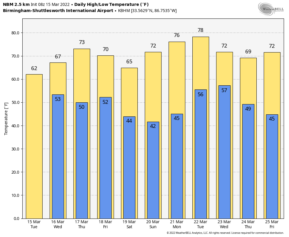 ON THIS DATE IN 1938: A tornado hit McPaul, Iowa, while moving from southeast to northwest. Another tornado raced through Batesville, Illinois, at 60 to 65 mph. A tornado causing F4 damage killed 10 and injured 12 in St. Clair County, Missouri. This tornado was part of an outbreak that produced four tornadoes and was responsible for 11 deaths and 42 injuries.
BEACH FORECAST: Click here to see the AlabamaWx Beach Forecast Center page.
WEATHER BRAINS: You can listen to our weekly 90-minute show any time on your favorite podcast app. This is the show all about weather featuring many familiar voices, including the meteorologists at ABC 33/40.
CONNECT: You can find me on all of the major social networks:
For more weather news and information from James Spann and his team, visit AlabamaWx.