James Spann: Strong to severe storms roll through Alabama tonight
ACTIVE NIGHT AHEAD: The weather is quiet across Alabama this afternoon; we have a mix of sun and clouds with only spotty, isolated showers. Temperatures are around 80 degrees in most places. To the west, storms continue to increase across parts of Arkansas, Louisiana and west Mississippi, and those storms will roll through Alabama tonight.
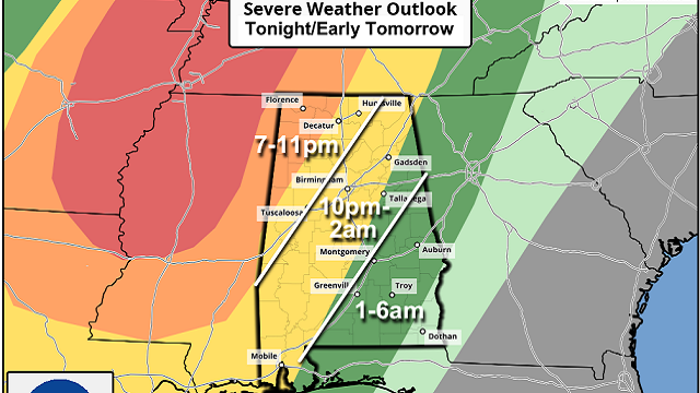
The Storm Prediction Center maintains an enhanced risk (level 3 out of 5) of severe thunderstorms for northwest Alabama — areas west of a line from Athens to Haleyville to Reform. A slight risk (level 2) extends as far east as Fort Payne, Sylacauga and Bay Minette. A marginal risk (level 1) covers most of the rest of the state, parts of east and south Alabama.
TIMING: Models now suggest the storms will move through Alabama faster than earlier expected. The main batch of storms will move into the northwest corner of the state around 7 p.m.; they reach the Birmingham metro, Tuscaloosa and Gadsden around 11 p.m. and then east and south Alabama after midnight.
THREATS: The main concern is strong, potentially damaging straight-line winds, but an isolated tornado or two is certainly possible. Higher tornado probabilities are over northwest Alabama between 7 p.m. and 10 p.m. Large hail is possible as well. The storms should weaken after midnight as the dynamic support fades and instability values decrease.
RAIN: Amounts tonight will be around 1 inch in most spots; for now major flooding is not expected.
While the higher severe weather probabilities are northwest of Alabama, still be weather aware tonight and have a reliable way of hearing severe weather warnings.
THURSDAY/FRIDAY: A few lingering showers or storms are possible across southeast Alabama during the morning. Otherwise the sky will be mostly sunny Thursday with a high in the mid 70s. Friday will be dry as well, with ample sunshine and a high in the upper 70s.
EASTER WEEKEND: A warm front will lift northward into Alabama Saturday, bringing clouds and rain back to the state. The front will stall across the central counties and keep the wet weather in place through Sunday. It won’t rain all weekend long, but occasional showers are likely both days. Some thunder is possible, but severe storms are not expected. Highs will be in the 70s.
NEXT WEEK: Showers will likely end early Monday morning, and the weather looks dry Tuesday and Wednesday. A cold front will bring a chance of showers Wednesday night and Thursday, followed by another shot of dry air Friday. Highs will be mostly in the 70s through the week.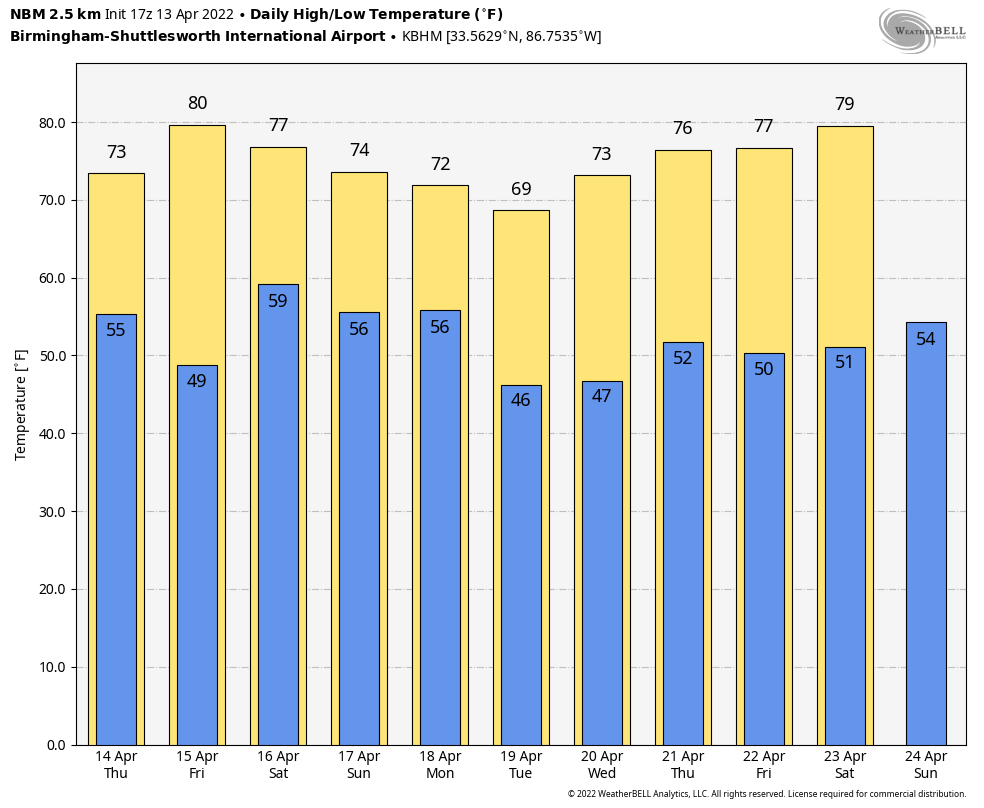
FOOTBALL WEATHER: For the Alabama A Day game in Tuscaloosa Saturday (2 p.m. kickoff), the sky will be cloudy with periods of rain likely. Temperatures will be between 70 and 74 degrees.
The Birmingham Stallions will host the New Jersey Generals Saturday evening at Protective Stadium (6:30 kickoff). Expect a cloudy sky with occasional showers; temperatures will fall from near 72 at kickoff into the upper 60s by the final whistle.
ON THIS DATE IN 1999: A two-mile-wide area of wind-driven hail pounded residences and farm equipment for about a 5-mile stretch in west Texas near Midland and Odessa. Hail grew to about golf-ball size and winds peaked at approximately 80 mph. The hail broke windows in houses and blasted paint off the wooden siding.
BEACH FORECAST: Click here to see the AlabamaWx Beach Forecast Center page.
WEATHER BRAINS: You can listen to our weekly 90-minute show any time on your favorite podcast app. This is the show all about weather featuring many familiar voices, including the meteorologists at ABC 33/40.
CONNECT: You can find me on the major social networks:
For more weather news and information from James Spann and his team, visit AlabamaWx.


