James Spann: Unsettled weather for Alabama through Thursday
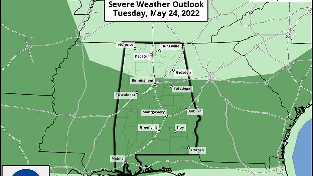
RADAR CHECK: We have scattered showers and thunderstorms across Alabama this afternoon with a mix of sun and clouds; temperatures are between 75 and 82 degrees in most places. Scattered showers will remain possible across the state tonight as a blanket of tropical moisture lingers. For Tuesday there will be intervals of sunshine, but scattered to numerous showers and storms will form again in this unstable air mass. Where storms do develop they could be strong. The Storm Prediction Center has introduced a low-end marginal risk (level 1 out of 5) of severe thunderstorms for about the southern two-thirds of the state. Stronger storms could produce small hail and gusty winds.
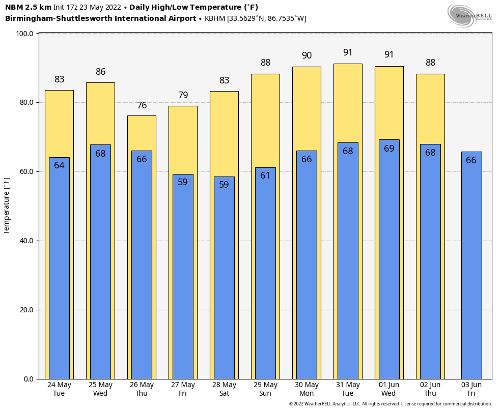
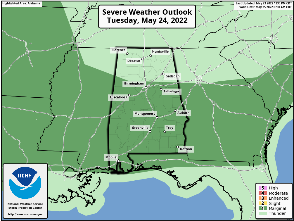 Unsettled weather continues Wednesday with a good chance of showers and storms, but it won’t rain all day. Heavier storms will again have the potential for hail and strong, gusty winds. On Thursday, rain and thunderstorms are likely as a cold front approaches. The rain should end Thursday night. Rain amounts between now and Thursday will be 1-3 inches, some beneficial rain as meteorological summer approaches in a week or so.
FRIDAY AND THE HOLIDAY WEEKEND: The sky becomes partly to mostly sunny Friday as drier air works into the state; the only chance of a shower will be near the Tennessee state line. Over the three-day holiday weekend, we expect mostly sunny, warm days and fair, pleasant nights. Highs will be in the 80s, with lows mostly in the 60s. Cooler spots will reach the 50s Saturday morning. About as nice as it gets on Memorial Day around here.
REST OF NEXT WEEK: The weather continues to look pretty quiet; a few spotty showers could show up over the latter half of the week, but nothing to suggest anything widespread. Highs will be close to 90 degrees on most days.
 TROPICS: The Atlantic basin remains quiet; tropical storm formation is not expected for the next five days, and most likely for the rest of May. The hurricane season officially begins June 1.
ON THIS DATE IN 1968: One of the costliest hailstorms in Oklahoma City history pummeled the city. Hail the size of baseballs fell over much of the city, resulting in more than 40,000 insurance claims over the 90,000-square-mile path of the storm. The final cost was more than $20 million. The parent thunderstorm also caused flash flooding that left 2 to 4 feet of water in some underpasses. A lightning strike started a fire that killed two people.
BEACH FORECAST: Click here to see the AlabamaWx Beach Forecast Center page.
WEATHER BRAINS: You can listen to our weekly show all about weather any time on your favorite podcast app. James Spann and a team of meteorologists from around the nation bring on interesting guests; it’s a great podcast for weather geeks.
CONNECT: You can find me on the major social networks:
For more weather news and information from James Spann and his team, visit AlabamaWx.


