James Spann: Occasional rain, storms to continue in Alabama through Thursday night
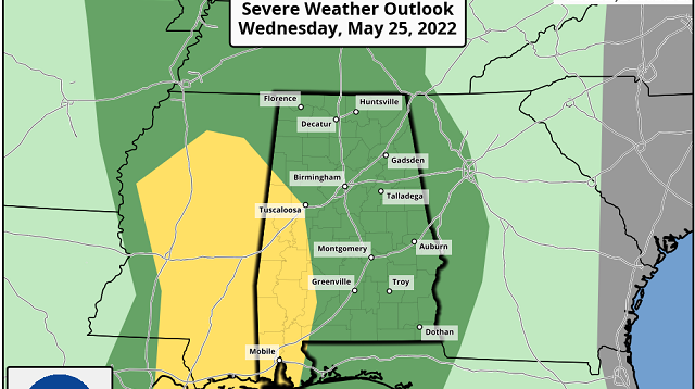
RADAR CHECK: Rain continues over far eastern Alabama, near the Georgia border, where some spots have seen more than 3 inches of rain today. Much of central Alabama is dry, but a new batch of rain and storms is moving into west Alabama, and this activity will push across the state this evening. Heavier storms will be capable of producing strong, gusty winds and hail. There is a low-end risk of a brief, isolated tornado as well. Storm intensity should slowly drop after sunset.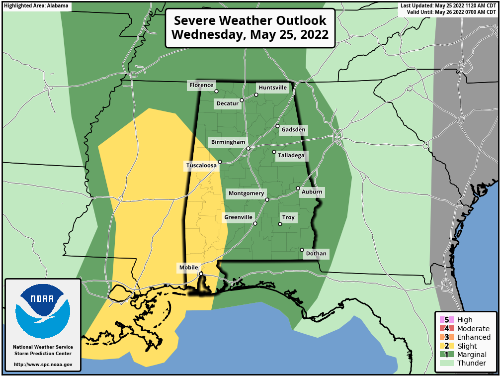 Thursday will be another wet day with occasional rain and a few strong thunderstorms. The Storm Prediction Center maintains a marginal risk (level 1 out of 5) of severe thunderstorms for all of Alabama due to the potential of hail and strong, gusty winds. Like this evening, a brief, isolated tornado can’t be totally ruled out. Rain and storms will end from west to east Thursday night.
Additional rain amounts of 2 inches are likely for most of Alabama as this beneficial rain event continues. Temperatures will hold in the 70s all day Thursday due to clouds and rain.
Dry air works into the state Friday, and the sky becomes partly sunny with a high between 75 and 79 degrees. Showers Friday will be confined to areas near the Tennessee state line under a cold-core upper low; most of the state will be dry.
MEMORIAL DAY WEEKEND: Look for mostly sunny, warm days and clear, pleasant nights over the three-day holiday weekend. The high will be in the low 80s Saturday and the upper 80s Sunday. Monday’s high will be close to 90 degrees. Lows will be mostly in the 60s, but cooler spots will be in the pleasant 50s early Saturday and Sunday morning. This is about as nice as it gets in late May in Alabama.
REST OF NEXT WEEK: Dry weather will continue Tuesday and Wednesday. A few spotty showers could show up Thursday and Friday, but nothing too widespread. Highs will be close to 90 degrees.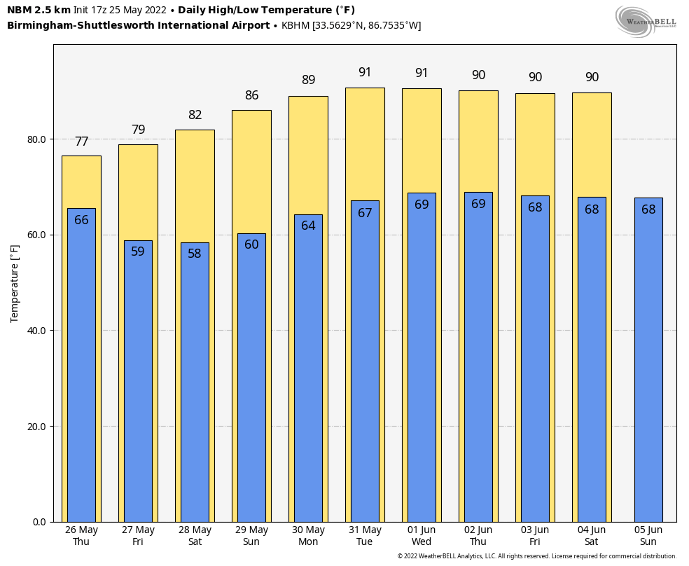 ON THIS DATE IN 1955: An estimated F5 tornado moved through the heart of Blackwell, Oklahoma. About 400 homes were destroyed, and many were leveled and swept away. About 500 other homes were damaged. The tornado dissipated just over the Kansas border as the Udall, Kansas, tornado was forming to the east. That tornado was estimated to be an F5 as well. More than half the population of Udall was killed or injured as the tornado completely devastated a large portion of town. Seventy-five people were killed, and many of the 270 injuries were serious.
ON THIS DATE IN 2008: A rare, large and destructive EF5 tornado created a 43-mile-long path across Butler and Black Hawk counties in Iowa. This tornado killed eight people, injured dozens and caused several million dollars in damage. The tornado was nearly three-quarters of a mile wide as it moved through the southern end of Parkersburg. A third of the town was affected by devastating damage, with nearly 200 homes destroyed.
BEACH FORECAST: Click here to see the AlabamaWx Beach Forecast Center page.
WEATHER BRAINS: You can listen to our weekly show all about weather any time on your favorite podcast app. James Spann and a team of meteorologists from around the nation bring on interesting guests; it’s a great podcast for weather geeks.
CONNECT: You can find me on the major social networks:
For more weather news and information from James Spann and his team, visit AlabamaWx.


