James Spann: Only isolated afternoon storms for Alabama through the weekend
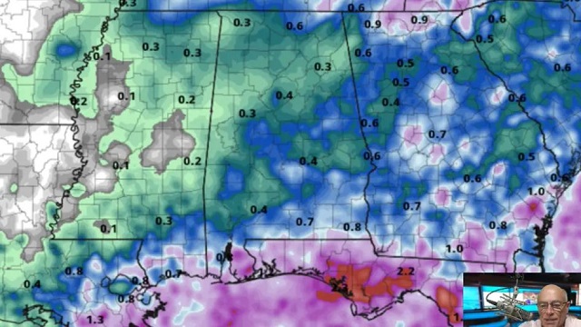
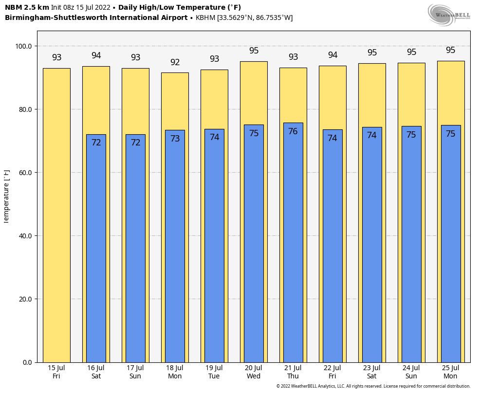
HOT SUMMER DAYS: The weather will trend drier across Alabama through the weekend. There is always the risk of a pop-up shower or storm during the heat of the day this time of the year, but they should be few and far between through Sunday. Better odds of seeing a shower are over the southern quarter of the state and near the Gulf Coast. Otherwise, expect partly to mostly sunny days and fair nights with highs between 90 and 94 degrees, right at seasonal averages.
NEXT WEEK: We expect routine summer weather next week — partly sunny, hot, humid days with a few random, scattered showers and storms during the afternoons and evenings, generally between 2 and 10 p.m. Highs will be in the 92- to 96-degree range. As is typically the case this time of the year, the main rain-producing systems will pass far to the north, near the Canadian border, where the jet stream is.
TROPICS: There’s still no sign of any tropical storms or hurricanes across the Atlantic basin through next week. Remember, the peak of the season is yet to come — August, September and early October. The season ends at the end of November.
RAIN UPDATE: Here are rain totals for the year so far, and the departure from average:
- Birmingham — 44.6 inches (9.7 inches above average)
- Tuscaloosa — 35.58 (5.01 above average)
- Huntsville — 34.83 (3.5 above average)
- Mobile — 32.86 (3.86 below average)
- Anniston — 32.65 (2.06 above average)
- Muscle Shoals — 32.62 (1.25 above average)
- Montgomery — 30.31 (1.25 above average)
- Dothan — 29.8 (0.05 below average)
ON THIS DATE IN 1901: The city of Marquette, Michigan, set its all-time record high temperature with 108 degrees.
BEACH FORECAST: Click here to see the AlabamaWx Beach Forecast Center page.
For more weather news and information from James Spann and his team, visit AlabamaWx.


