James Spann: Just a few isolated showers for Alabama today; mild week ahead
James Spann forecasts a dry Halloween for most of Alabama from Alabama NewsCenter on Vimeo.
FOGGY START: A dense fog advisory is in effect for central Alabama early this morning; visibility is very restricted in many places. Morning clouds and fog will give way to some sun this afternoon with temperatures rising into the low 70s. We will mention the chance of a few small, spotty showers this afternoon over the northern third of the state as an upper trough swings through, but odds of any one spot getting wet are generally less than 20%. Most places will be dry for the trick-or-treaters this evening.
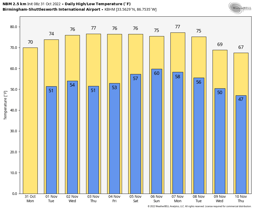
REST OF THE WEEK: For now, the weather looks dry Tuesday through Friday. A disturbance will swing through the state Tuesday night into Wednesday, but the air simply looks too dry for any rain. Under a building ridge aloft, highs will be in the mid to upper 70s, almost 10 degrees above average for early November.
THE ALABAMA WEEKEND: Severe storms are possible well to the west Saturday over parts of Texas and Oklahoma, but the upper ridge will keep most of Alabama rain-free with highs between 77 and 81 degrees. A few showers could reach the northwest corner of the state Sunday afternoon or night ahead of a cold front.
NEXT WEEK: A few scattered showers are possible Monday; otherwise much of the week looks dry at this point as the major rain producers will stay north and west of here. Temperatures will remain mild, with highs mostly in the 70s.
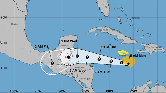
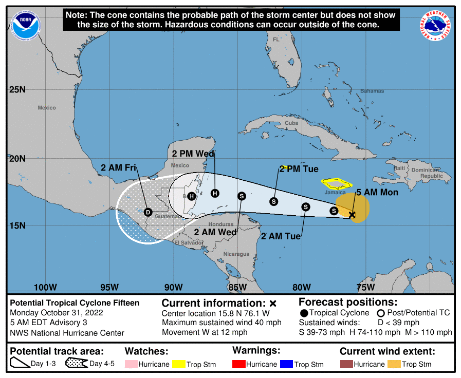
TROPICS: Potential Tropical Cyclone 15 is expected to become Tropical Storm Lisa during the next day or two as it moves westward; landfall is forecast on the coast of Belize Wednesday night as a hurricane. This system will remain far to the south of the Gulf of Mexico, and the rest of the Atlantic basin is quiet.
ON THIS DATE IN 1991: A severe winter storm, dubbed the Great Halloween Mega Storm, struck the upper Midwest. Minnesota bore the brunt of this storm. Blizzard conditions occurred with winds gusting frequently to 40 and 50 mph. By the time it was all over on Nov. 2, Duluth recorded 37 inches, Minneapolis 28 inches, International Falls 18 inches and Sioux Falls, South Dakota, 11.2 inches in 24 hours, its earliest heavy snowfall of 6 inches or more and snowiest October on record.
BEACH FORECAST: Click here to see the AlabamaWx Beach Forecast Center page.
For more weather news and information from James Spann and his team, visit AlabamaWx.


