Scott Martin: Cloudy, humid and mild in Alabama this weekend
THE WEEKEND: A stalled front will continue to be draped over northern Alabama that will keep higher humidity levels trapped in place today. Skies will stay partly to mostly cloudy through the day, but a short wave will move along the front and bring shower chances into the forecast for the northern half of Alabama by the afternoon, while the southern half stays dry. Highs will be in the lower 60s to the mid 70s.
Rain and a few rumbles of thunder will move southeastward across Alabama on Sunday with that shortwave. Rain will be likely at times, but none of the activity will be strong to severe. However, with the ongoing rainfall in the northern half of the state, we may see a brief flooding issue or two pop up. Highs will be in the lower 60s to the lower 70s.
NEXT WEEK: Other than the cloud cover, Monday will be really nice and mild. It won’t be quite as humid, with dewpoints back down in the 50s. Highs will be in the lower 60s to the lower 70s.
A large area of severe storms will be possible to our west on Tuesday, but it looks like Alabama will stay rather quiet for one more day. We may have a backdoor wedge develop and move into the northeastern parts of the state that will keep highs a little lower than the rest, but, other than that, clouds will be on the increase with highs in the upper 50s to the upper 60s.
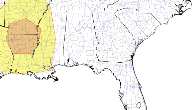
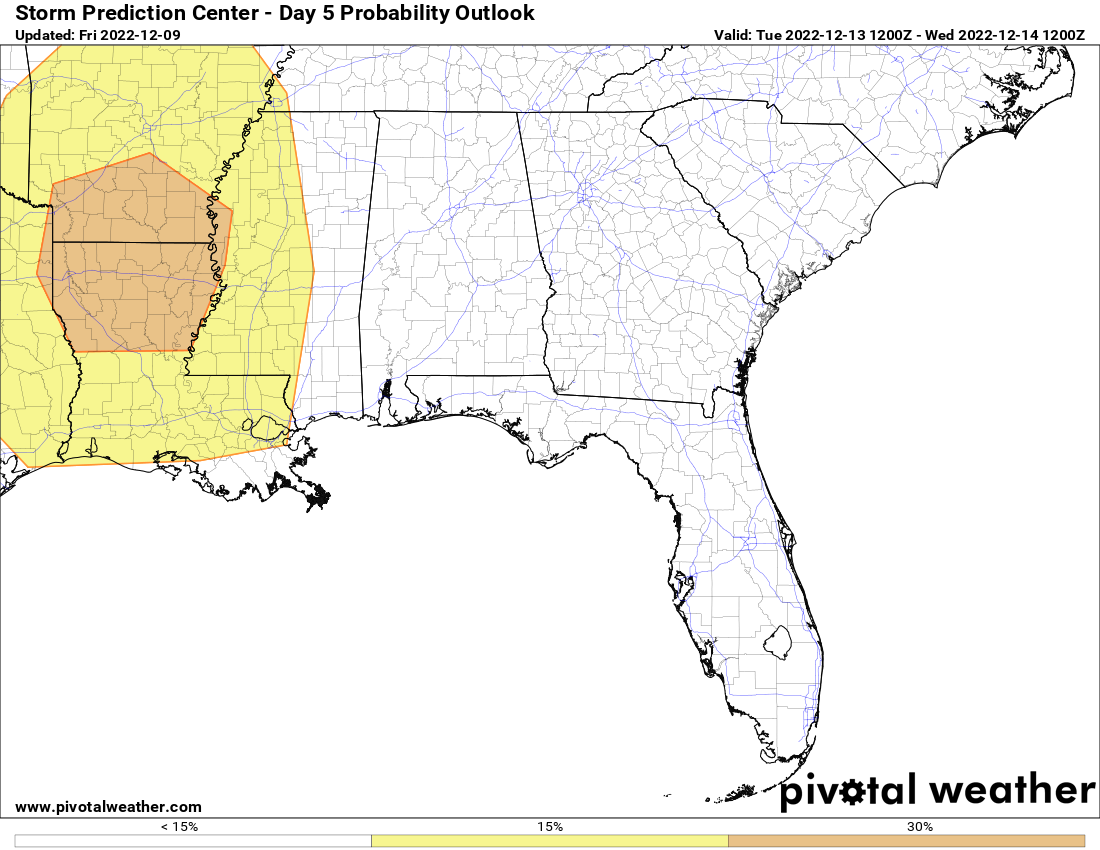
A weak surface low looks to form along the cold front over northeastern Mississippi before dawn Wednesday, which may keep storms going a little longer before everything weakens as the better dynamics pull farther northward. The Storm Prediction Center has the equivalent of a slight risk up for southwestern Alabama from Eutaw and Demopolis southward to the Gulf Coast. Rain and storms will be likely through much of the day, with the backside of the activity moving over the I-59 corridor during the evening. Highs will be in the lower 60s to the lower 70s.
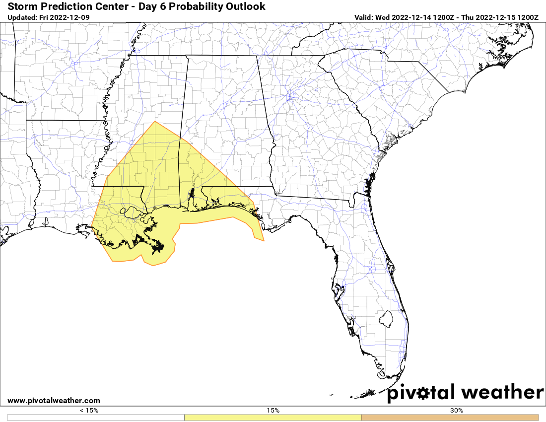
The cold front will struggle to make it out of Alabama on Thursday, and showers and some thunder will remain possible mainly along and south of I-85. Colder air will have moved into the north, but milder temperatures will remain in the south. Highs will be in the lower 50s to the lower 60s.
On Friday, colder air will continue to work into Alabama, and with a mix of sun and clouds, highs will make it only into the mid 40s to the mid 50s. While these temperatures will be colder than normal, it will make it feel more like Christmastime.
For more weather news and information from James Spann, Scott Martin and other members of the James Spann team, visit AlabamaWx.


