James Spann: Wet, stormy Wednesday for Alabama; very cold by Christmas
RADAR CHECK: Despite a mostly cloudy sky, most of Alabama is dry this afternoon with temperatures generally in the 50s over the northern counties of the state, with 60s to the south. The risk of a shower will remain low tonight as clouds linger.
WEDNESDAY: An active day is ahead with a dynamic storm system moving into the state. The Storm Prediction Center has forecast an enhanced risk (level 3 out of 5) of severe thunderstorms for southwest Alabama — areas south and west of a line from Demopolis to Greenville to Andalusia. A slight risk (level 2) is up as far north and east as Tuscaloosa, Wetumpka and Eufaula. A marginal risk (level 1) is defined as far north as Birmingham.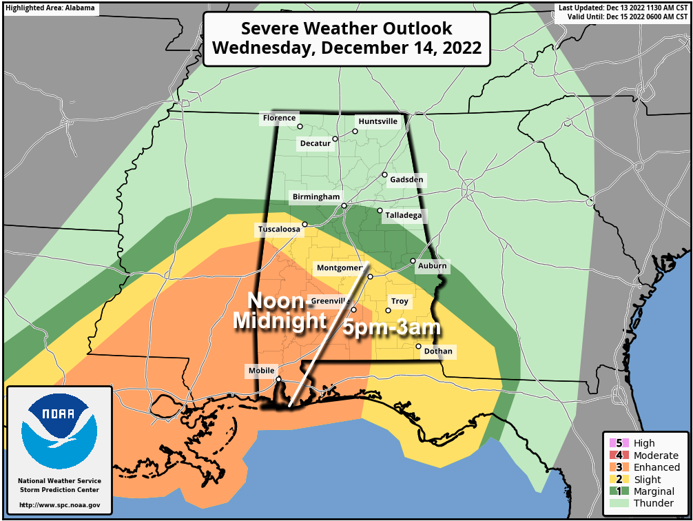 The greatest tornado threat will be in the enhanced risk area of southwest Alabama Wednesday evening and night, especially from 4 p.m. until midnight. A few isolated severe storms could form as early as noon. Be sure you have a reliable way of hearing severe weather warnings if they are needed (never an outdoor siren), and a plan of action if you are in the polygon. This is tornado season in Alabama; it runs from November through May.
North Alabama will be in a cool, stable air mass, but all of the state will get a big soaking, with rain amounts of 2-3 inches likely. A flash flood watch has been issued for areas along and north of I-20 (Tuscaloosa to Birmingham to Anniston). Some flooding could develop by Wednesday night.
The rain will end from west to east late Wednesday night and before dawn Thursday. The sky becomes mostly sunny Thursday with a high between 57 and 62 degrees.
FRIDAY AND THE WEEKEND: The weather looks dry for most of the state with a trend toward colder temperatures. A disturbance will bring some clouds into the state Saturday, and a sprinkle is possible a few spots, but the air will be dry and the best chance of rain with this feature will be over the northern Gulf of Mexico. Highs will be in the 40s and 50s, and we drop below freezing by early Sunday morning for the first time since Dec. 1.
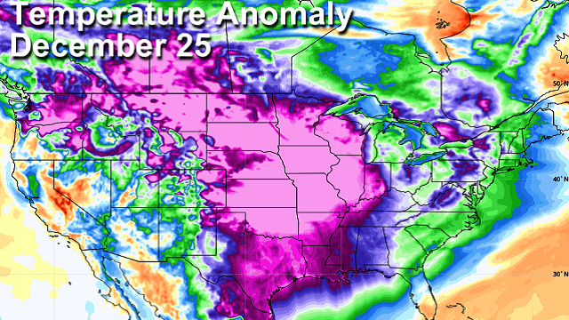
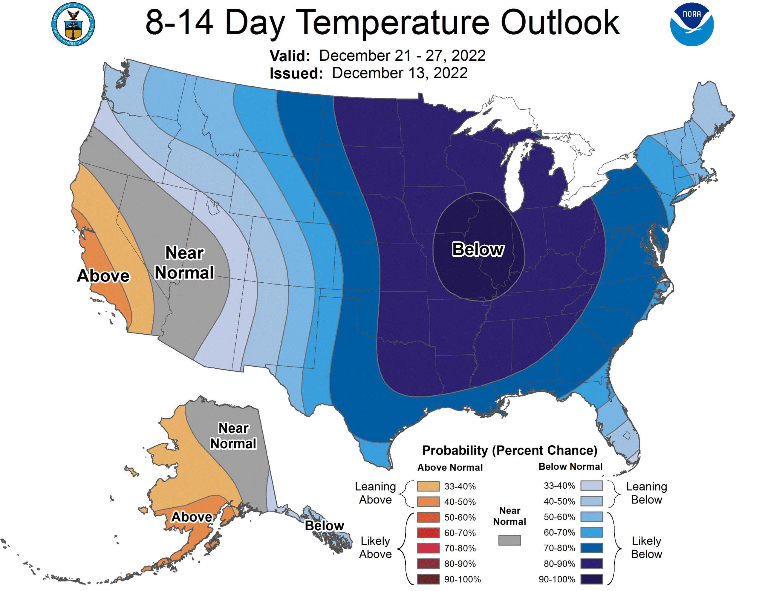
NEXT WEEK AND BEYOND: New model data suggests a mostly dry week with highs in the 40s and 50s, and lows mostly in the 20s and 30s. We continue to see strong signals in global models of bitterly cold air moving into the Deep South around Christmas. But Dec. 25 is still 12 days away and there is no skill in a specific forecast for now.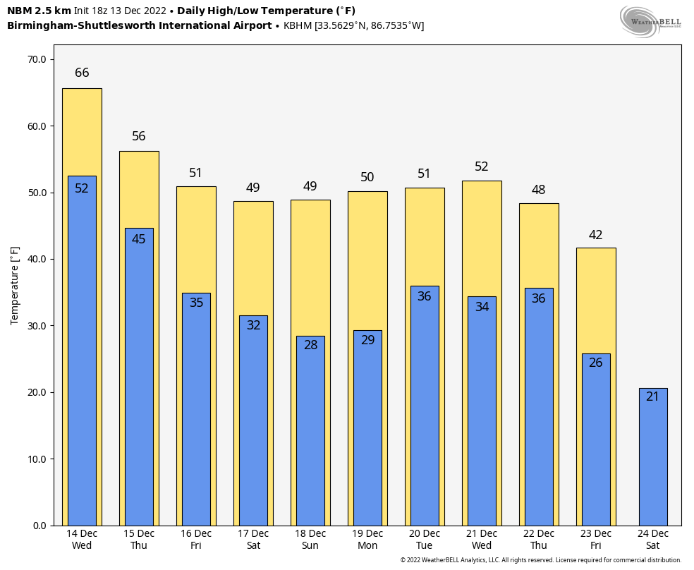
 ON THIS DATE IN 1997: A freak cold snap and snowstorm struck parts of northern Mexico, leaving 12 people dead and the area paralyzed. It snowed in the city of Guadalajara for the first time since 1881, leaving amazed residents to gawk at the stuff and make snowmen. The temperature plunged to 5 degrees in Chihuahua.
BEACH FORECAST: Click here to see the AlabamaWx Beach Forecast Center page.
For more weather news and information from James Spann and his team, visit AlabamaWx.


