James Spann: Dry Wednesday for Alabama; brutal cold arrives Friday
RADAR CHECK: This has been a cold, cloudy, wet day for Alabama, and rain continues to fall this afternoon mainly along and south of I-20. Rain will end this evening as a disturbance in the northern Gulf moves northeast. Temperatures are between 40 and 45 degrees for most communities this afternoon; the average high for Birmingham on Dec. 20 is 56.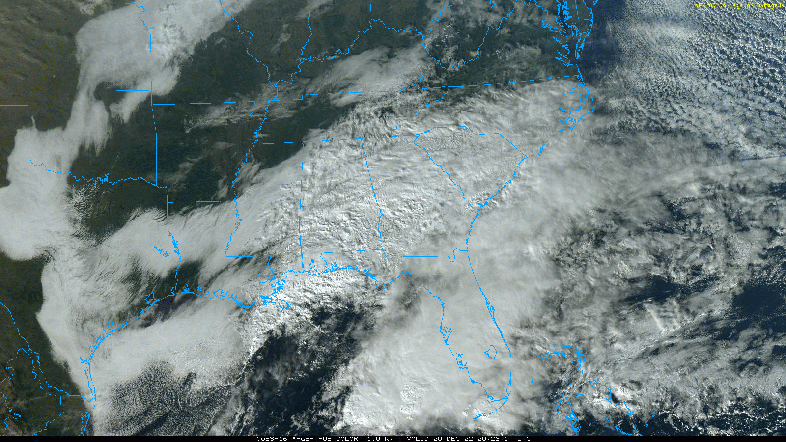
Wednesday will be dry with intervals of sun possible; the high will be in the mid 50s. The sky becomes cloudy Thursday, and some light rain is possible by mid to late afternoon.
ARCTIC BLAST: A brutally cold air mass will roll into Alabama Thursday night. Here are important notes:
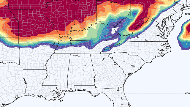
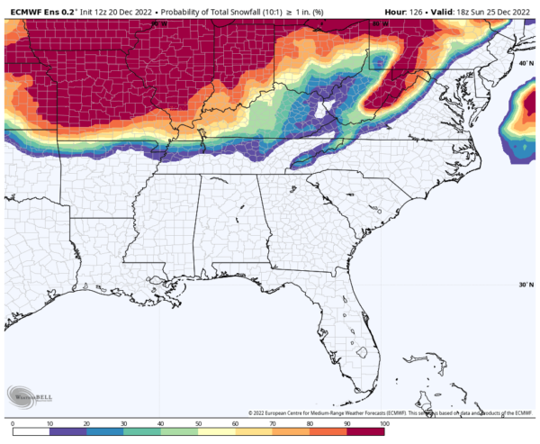
- After the light rain Thursday evening, snow flurries are likely over north and central Alabama after midnight Thursday night and Friday morning, but meaningful accumulation is not expected. It is a “cold air chasing the moisture” setup, which rarely produces any significant accumulation here; the best chance of seeing snow on the ground is north of I-40 (north of a line from Little Rock to Nashville).
- Temperatures will drop into the 5- to 12-degree range Friday morning across north and central Alabama, with a wind chill index as low as minus 15. The index will stay below zero most of the day Friday.
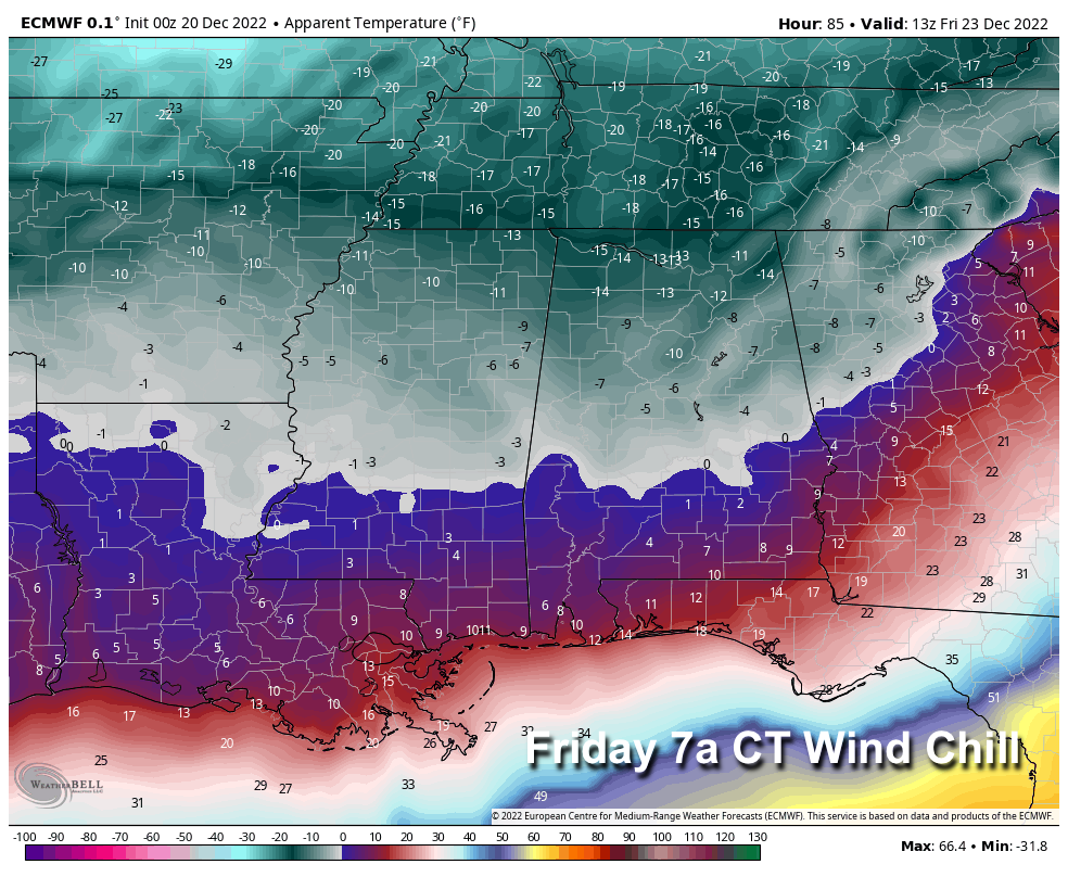
- Strong north winds of 12-25 mph will dry roads quickly, and major travel issues are not expected. But, where water is still standing, a few icy spots are possible Friday. Be careful if you are driving.
- Once we go below freezing before dawn Friday, it will be Monday, Dec. 26, before temperatures climb over 32 degrees for many communities across north Alabama. Be ready for more than 72 consecutive hours of subfreezing weather.
- For Alabama, this will be the coldest air mass since 2018, but the most prolonged Arctic outbreak since at least 2014. It is the coldest December air mass since 1989. This is a very significant and life-threatening Arctic outbreak for the state. This is due to potential impacts on infrastructure, such as burst pipes.
- Check on the elderly and those who might not have adequate heating. Hypothermia risk is a big concern.
- Alternative heat sources like space heaters need to be used safely; we always hear of disastrous home and business fires during cold waves like this. Carbon monoxide poisoning is also a concern.
- If you have pets or farm animals, make sure they have plenty of food and water, and are not overly exposed to extreme cold. Take precautions to ensure your water pipes do not freeze. Know the temperature thresholds of your plants and crops.
- For those driving, fill up the tank. Make sure your car or vehicle has at least a half-tank of gas during extreme cold situations so that you can stay warm if you become stranded.
NEXT WEEK: The weather looks generally dry through the week with a warming trend. Temperatures will rise into the low 60s by Friday, Dec. 30.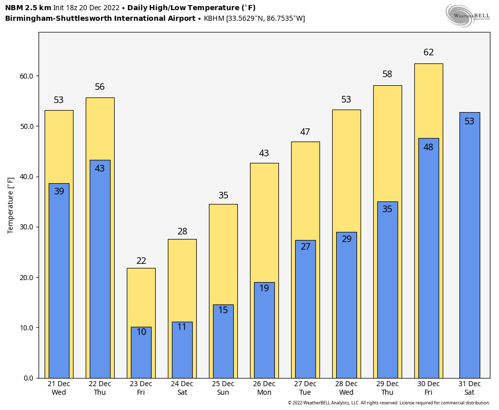
ON THIS DATE IN 1836: A famous sudden freeze occurred in central Illinois. A cold front with 70 mph winds swept through around noon, dropping the temperature from 40 degrees to near zero in a matter of minutes. Many settlers froze to death. Folklore told of chickens frozen in their tracks and men frozen to saddles. Ice in streams reportedly froze to 6 inches in a few hours.
ON THIS DATE IN 1984: Lili, a rare December hurricane, was officially declared a tropical system in the central Atlantic as a distinct eye-type feature was apparent on satellite imagery. The hurricane peaked at sustained 80 mph winds and a pressure of 980 millibars or 28.94 inches of mercury, a very respectable Category 1 hurricane in December.
BEACH FORECAST: Click here to see the AlabamaWx Beach Forecast Center page.
For more weather news and information from James Spann and his team, visit AlabamaWx.