James Spann: Alabama stays dry today; bitterly cold air arrives late Thursday night
James Spann forecasts Arctic air arriving late Thursday night from Alabama NewsCenter on Vimeo.
DRY DAY AHEAD: Look for a high in the mid 50s across most of Alabama today with intervals of sunshine as dry air returns to the state. Clouds thicken tonight and Thursday ahead of an Arctic front; some light rain is possible ahead of the front during the afternoon and evening, but amounts should be light (generally less than one-tenth of an inch).
Here are important notes on the bitterly cold air that will roll into Alabama Thursday night:
- The Arctic air will move into the northwest corner of the state around 10 Thursday night; temperatures fall rapidly after midnight, reaching the 5- to 15-degree range by daybreak Friday for the northern half of the state.
- Light snow showers and snow flurries are likely in the cold air Thursday night and Friday morning. Deeper moisture will exit the state rapidly as the cold air arrives; no meaningful accumulation is expected. There might be a few spots where the grass gets white, especially across higher terrain.
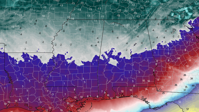
- Strong northwest winds of 15-30 mph will bring the wind chill index down to 10 to 15 degrees below zero early Friday over north Alabama. The index will remain below zero through much of the day.
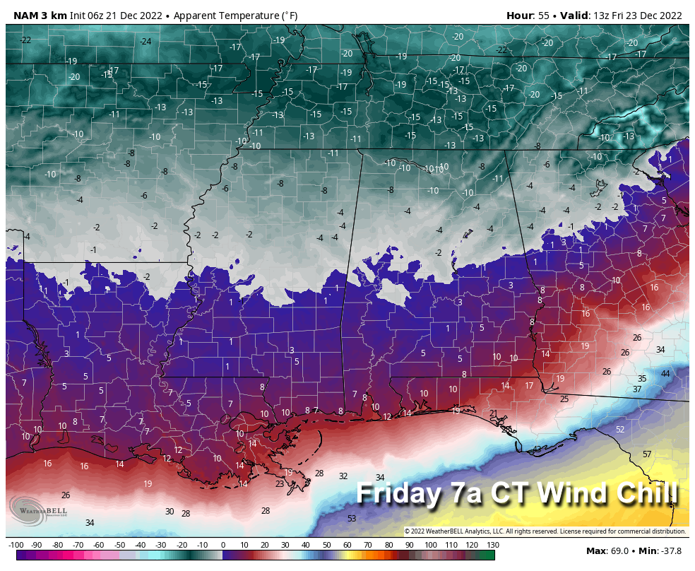
- Those strong winds will dry the roads quickly, and widespread travel problems are not expected. However, if there are any spots with standing water, it will turn to ice quickly, so watch for icy spots if you are driving Friday.
- Air temperatures will dip into the 5- to 12-degree range over the northern half of the state early Saturday morning; lows will be in the teens down to the Gulf Coast.
- It will likely be Monday, Dec. 26, before temperatures rise above freezing over the northern half of Alabama, meaning many communities will experience more than 72 consecutive hours of subfreezing temperatures. This will be the coldest Christmas for most of Alabama since 1989.
PEOPLE: It will be dangerously cold, especially for those without adequate shelter and safe sources of warmth.
- Wear layers and have extra blankets on hand.
- Check on neighbors.
- Ensure loved ones and neighbors have a safe and reliable heat source.
- Arrange for emergency heat in case of power failure.
- Practice home heating safety. Keep heating equipment at least 3 feet from anything that can burn; do not plug space heaters into an extension cord or power strip.
- If traveling, make sure you are ready to handle any surprises that may leave you stranded. Have supplies such as water and food, warm clothes and blankets, and a charged cellphone. Don’t let your gas tank get too low so you can periodically run the engine for heat.
PETS: Not all furry family members are equipped to handle the bitter cold. They can die if left exposed to extreme temperatures.
- Bring pets indoors with a source of food and water.
- Ensure pets will not be able to gain access to hazardous materials.
PIPES: They can burst, leaving you without water and resulting in damage to your home.
- Cover/insulate or drain exposed pipes before Thursday.
- Drip faucets.
NEXT WEEK: The week looks dry with a warming trend; temperatures reach the low 60s by Friday, Dec. 30.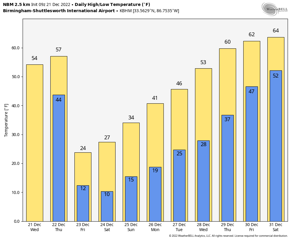
ON THIS DATE IN 1967: An F4 tornado traveled 33 miles across Iron and Washington counties in Missouri during an unusual time of day, 12:45 to 1:20 a.m. The tornado killed three and injured 52 others. Most of the intense damage occurred in the town of Potosi, about 55 miles southwest of St. Louis.
BEACH FORECAST: Click here to see the AlabamaWx Beach Forecast Center page.
For more weather news and information from James Spann and his team, visit AlabamaWx.


