James Spann: Active day ahead for Alabama; severe storms possible through tonight
James Spann forecasts a long period of active weather for Alabama today, tonight from Alabama NewsCenter on Vimeo.
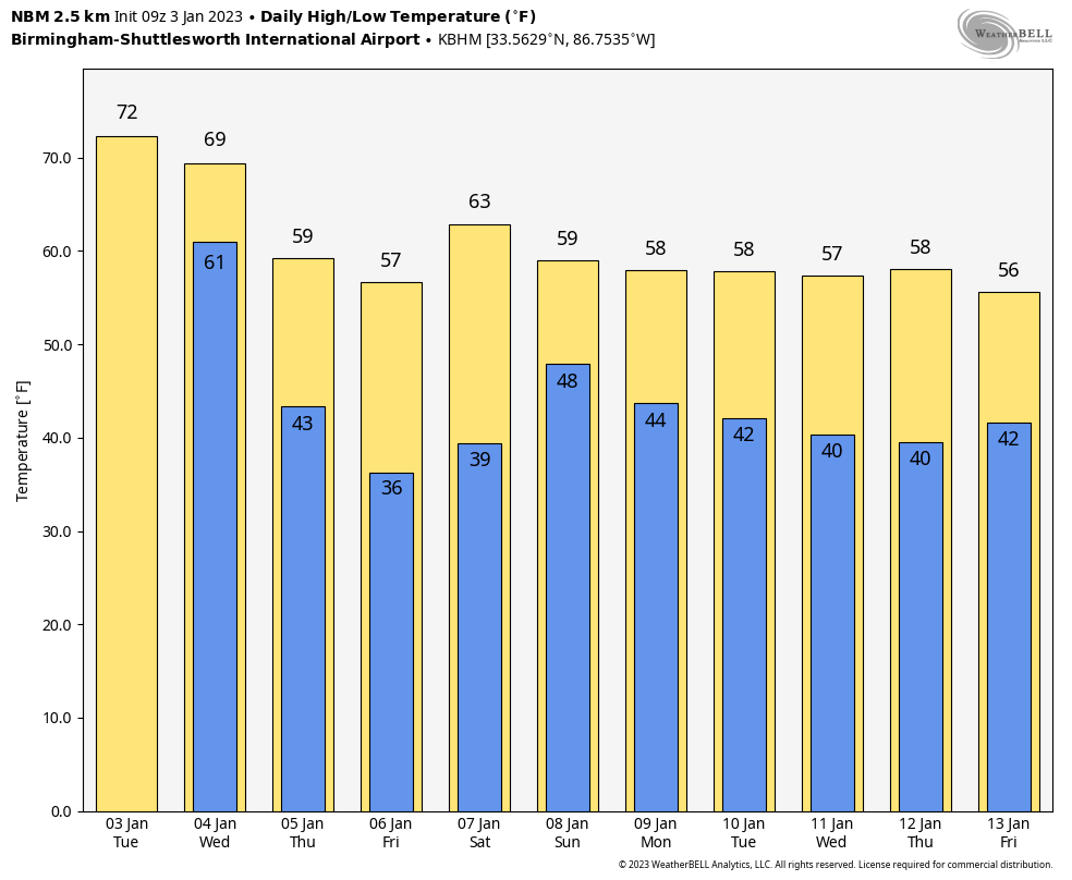
RADAR CHECK: Scattered showers continue over the eastern half of Alabama early this morning; otherwise it is a cloudy, very mild and humid morning with temperatures hovering between 65 and 72 degrees at daybreak, well above the average high of 54 for Jan. 3. A dynamic weather system will bring potential for severe thunderstorms to the state later today and tonight.
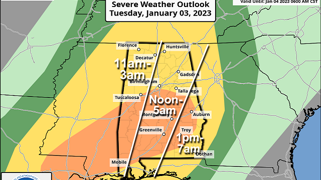
The Storm Prediction Center maintains an enhanced risk (level 3 out of 5) of severe thunderstorms for much of central and south Alabama; a slight risk (level 2) is defined for areas north of I-20.
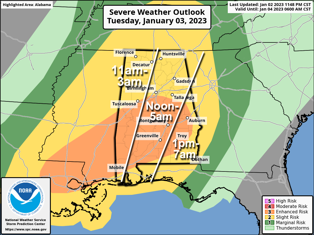 TIMING: We have potential for two rounds of severe storms: one this afternoon and this evening, and another one after midnight. That is why you see the large windows on our timing graphic, lasting around 15 hours. Severe storms could develop over far west Alabama as early as 11 a.m. and could linger across southeast Alabama as late as 8 a.m. Wednesday.
This doesn’t mean, of course, that you will have 15 hours of continuous rain and storms, but periods of rain are likely with potential for a few severe storms along the way.
THREATS: All modes of severe weather will be possible, including large hail, damaging winds and a few tornadoes. The highest tornado threat is in the enhanced risk over the southern two-thirds of the state, and one or two strong tornadoes (EF-2 or higher) are possible there.
RAIN/FLOODING: A flash flood watch has been issued for roughly the southern half of Alabama through Wednesday morning — for areas south of a line from Demopolis to Alexander City. Rain amounts could exceed 2 inches in that part of the state; amounts of 1-2 inches are likely over the northern counties.
PREPARE: Be sure you can hear severe weather warnings if they are needed. A NOAA Weather Radio is the baseline, and be sure Wireless Emergency Alerts are enabled on your phone (look under settings and notifications). Install the free ABC 33/40 weather app. Never rely on a siren.
Review your severe weather plan; know the safe place in your home, which is a small room on the lowest floor, near the center of the house, away from windows. If you live in a mobile home, be sure you know the location of the nearest shelter or site-built structure that is available, and the quickest way of getting there. Have transportation available.
No need to be anxious; these setups are common in Alabama in January. Our tornado season runs from November through May.
Rain and storms will be out of the state by mid-morning Wednesday, and the sky becomes partly sunny by afternoon with a high around 70 degrees.
THURSDAY THROUGH THE WEEKEND: Thursday and Friday will feature a mostly sunny sky with a cooling trend; the high will be in the low 60s Thursday, followed by mid to upper 50s Friday. Some spots across north Alabama will see a light freeze early Friday morning. Most of the day Saturday will be dry with a high in the low to mid 60s. Showers are possible Saturday night and Sunday, but this won’t be a big rain event, and Sunday won’t be a washout.
NEXT WEEK: At this point the week looks generally dry with seasonal temperatures — highs mostly in the 50s with lows in the 30s.
 ON THIS DATE IN 1949: During the late afternoon, an estimated F4 tornado destroyed Warren, Arkansas. The tornado killed 55 people and injured more than 250 others. The destruction of the Bradley mill displaced 1,000 employees.
ON THIS DATE IN 2018: For the first time in 28 years, there was measurable snow in Tallahassee, Florida. The National Weather Service Office in Tallahassee measured 0.1 inch of snow/sleet at 8:30 a.m.
BEACH FORECAST: Click here to see the AlabamaWx Beach Forecast Center page.
For more weather news and information from James Spann and his team, visit AlabamaWx.


